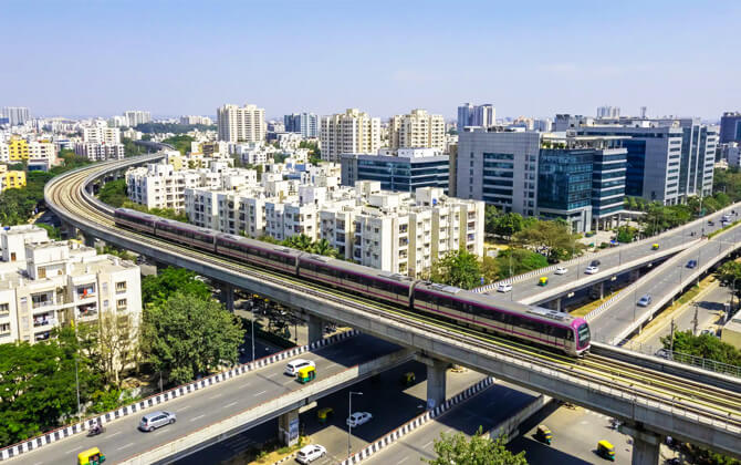
Namma Metro, also called Bengaluru Metro, is the rapid transit system serving Bengaluru, the capital of Karnataka, India. It opened in 2011 as South India’s first metro system and became the region’s first underground metro in 2016. As of April 2026, the network has 96.1 km (59.7 mi) in operation and, as of August 2025, 83 operational stations across elevated, underground, and at-grade sections. It is run by Bangalore Metro Rail Corporation Limited (BMRCL) and forms a major part of public transport and city transport in Bengaluru.
| Key | Information |
|---|---|
| System | Namma Metro (Bengaluru Metro) |
| City | Bengaluru, Karnataka, India |
| Operator | Bangalore Metro Rail Corporation Limited (BMRCL) |
| Opened | 2011 |
| Network length | 96.1 km (59.7 mi) |
| Operational stations | 83 |
| Line types | Elevated, underground, and at-grade |
| Power supply | 750V DC third rail |
| Train length | All rakes converted from three coaches to six coaches |
| Typical operating hours | Daily service, generally from 05:00 to 00:00 |
| Typical frequency | About 3 to 15 minutes |
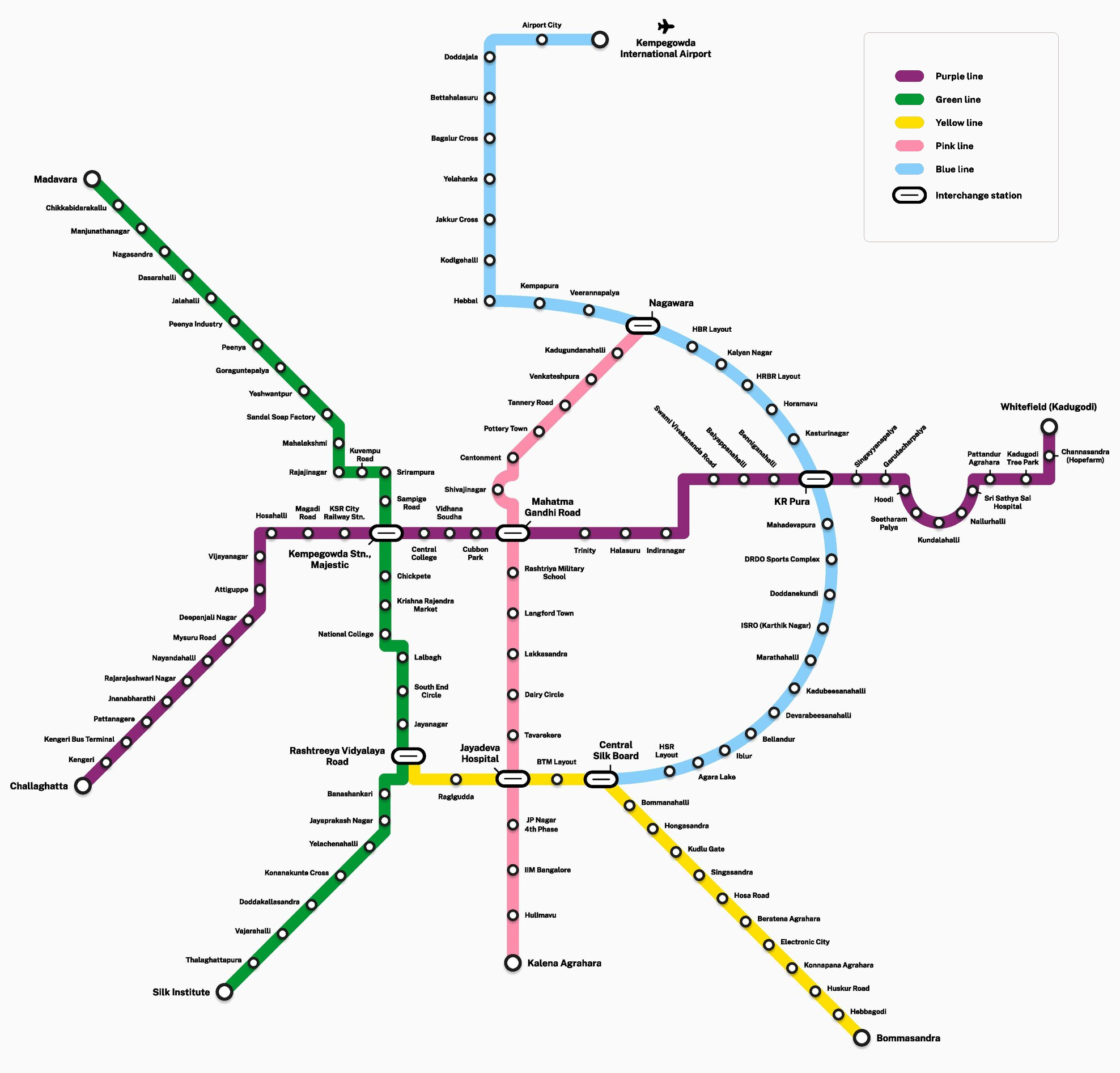
Namma Metro Map
Map of Bangalore Metro showing different lines and stations. Click on the map to enlarge it or download the Namma Metro map in PDF format.
Namma Metro Lines and Stations
Namma Metro currently operates three lines: the Purple Line, Green Line, and Yellow Line. Together they serve 83 stations across Bengaluru, with a route length of 96.1 km (59.7 mi). The system includes elevated sections, underground stretches, and one at-grade station.
The Purple Line runs from Challaghatta to Whitefield (Kadugodi) and has 37 stations. It includes a 4.8 km (3.0 mi) underground section through the city centre and connects major areas such as Whitefield, MG Road, Majestic, KSR Railway Station, Mysuru Road, and Kengeri.
The Green Line runs from Madavara to Silk Institute and has 32 stations. It links key parts of north and south Bengaluru, including Peenya, Yeshwanthpur, Majestic, Chickpete, Basavanagudi, Jayanagar, and Banashankari. Its underground section is 4.0 km (2.5 mi).
The Yellow Line connects Rashtreeya Vidyalaya Road to Delta Electronics Bommasandra. This fully elevated route has 16 stations and serves the Electronic City corridor. Important interchanges include Rashtreeya Vidyalaya Road, Jayadeva Hospital, and Central Silk Board.
Major interchange stations
| Station | Details |
|---|---|
| Nadaprabhu Kempegowda Station, Majestic | Interchange between the Purple Line and Green Line. |
| Rashtreeya Vidyalaya Road | Interchange between the Green Line and Yellow Line. |
| Jayadeva Hospital | Interchange between the Yellow Line and the Pink Line. |
| Central Silk Board | Interchange between the Yellow Line and the planned Blue Line. |
| Krishnarajapura | Planned interchange between the Purple Line and the Blue Line. |
| Nagawara | Planned interchange between the Pink Line and the Blue Line. |
The stations map will expand further as more corridors are built. Lines under construction or planned include the Pink Line, Blue Line, Orange Line, Grey Line, and Red Line, extending the system toward outer areas, technology hubs, and the airport corridor.
Namma Metro Operating Hours
Namma Metro operating hours vary slightly by line and day, but the published opening hours for the Purple and Green Lines are generally consistent. On most weekdays, trains start at 5:00 AM and the closing time is 11:00 PM. Sunday opening times are later, around 7:00 AM. Some source material also describes the wider system as running daily between 05:00 and 00:00, so timings today can differ depending on service updates.
The Yellow Line is described as operating daily from 5:00 AM to 11:00 PM. Because first departures, last train times, and station-specific timetable details may change, checking the latest train schedule before travel is a good idea.
| Service detail | Timings |
|---|---|
| Monday to Friday | 5:00 AM to 11:00 PM |
| 1st, 3rd, and 5th Saturdays | 5:00 AM to 11:00 PM |
| 2nd and 4th Saturdays & Public Holidays | 5:00 AM to 11:00 PM |
| Sundays | 7:00 AM to 11:00 PM |
| Yellow Line | 5:00 AM to 11:00 PM daily |
| Typical frequency | About every 3 to 15 minutes |
| Common weekday frequency on Purple and Green Lines | Every 5 to 6 minutes |
| Common Sunday frequency on Purple and Green Lines | Every 7 to 8 minutes |
If you need the exact starting time, last train, route timetable, or schedule today for a specific station, BMRCL advises checking its official website or app. That is the best way to confirm working hours, running time, and any short-notice changes.
Fares, Tokens and Smart Cards
Namma Metro uses a station-based fare system, so the ticket price increases with the approximate number of stations traveled. For many riders, a smart card or QR ticket is the easiest option because both get a 5% discount compared with the standard token fare.
| Stations Traveled (Approx Distance) | Token Fare | Smart Card / QR (5% Off) |
|---|---|---|
| 1 – 2 Stations (Up to 2 km / 1.2 mi) | ₹10 ($0.12) | ₹9.50 ($0.11) |
| 3 – 5 Stations (2 – 5 km / 1.2 – 3.1 mi) | ₹20 ($0.24) | ₹19.00 ($0.23) |
| 6 – 12 Stations (5 – 12 km / 3.1 – 7.5 mi) | ₹30 ($0.36) | ₹28.50 ($0.34) |
| 13 – 21 Stations (12 – 21 km / 7.5 – 13.0 mi) | ₹40 ($0.48) | ₹38.00 ($0.46) |
| 22 – 32 Stations (21 – 32 km / 13.0 – 19.9 mi) | ₹50 ($0.60) | ₹47.50 ($0.57) |
| 33+ Stations (More than 32 km / 19.9 mi) | ₹60 ($0.72) | ₹57.00 ($0.68) |
Children below 3 feet in height can travel without a ticket. Children taller than 3 feet must pay the full fare. If you need a card, a Namma Metro smart card costs ₹50 ($0.60) at station ticket counters. Commuters can also apply online for a National Common Mobility Card through partner bank websites such as RBL Bank.
Smart cards can be recharged on the official BMRCL website, in the Namma Metro-BMRCL app, or through third-party apps like Paytm. After an online recharge, the card must be tapped at an automatic gate to update the balance. QR ticketing is also supported through the official app and other approved platforms.
Passengers may carry one piece of baggage up to 60 cm x 45 cm x 25 cm. Extra or oversized luggage costs ₹30 per bag ($0.36), payable at the Customer Care center. If someone travels without a valid ticket, the penalty is ₹200 ($2.40) plus the maximum single-journey fare.
Monthly pass options for unlimited travel between specific stations are available on a smart card. A day pass is also available for tourists and occasional riders.
Parking near Metro
Namma Metro and BMRCL have been developing station parking near selected stations to meet growing demand and reduce congestion around metro access points. Parking solutions vary by location, depending on land availability and road conditions.
One of the biggest upcoming station parking projects is near KR Puram. BMRCL plans a large parking and commercial development on a 6,730-square metre site near Old Madras Road and the Outer Ring Road, about 50 metres from the future interchange station on the Purple and Blue lines.
The KR Puram project is expected to include an 11-storey building with a ground floor and two basements. The basements are planned for parking, while upper floors may be used for offices, retail, and shopping malls. The project is expected to be developed through a public-private partnership for 30 years and is planned for completion in 2027.
At present, some stations already have parking facilities. Majestic has space for 260 two-wheelers and 36 cars, while KR Pura has parking for 530 two-wheelers and no cars. BMRCL has also announced or studied parking options in other areas, including Cubbon Road near M G Road.
Exact parking charges, parking charges per day, and station parking cost are not provided in the available source material. For drivers, that means it is best to confirm the current price directly at the station before you park.
Connections to Other Systems
Namma Metro is being integrated with other public transport options to make local transport easier across Bengaluru. Key interchange points include Yeshwantpur, Kengeri, Hebbal, Kempegowda International Airport, and KR Puram, where metro links are planned or coordinated with rail and bus services.
Majestic is the clearest example of this approach. Here, the metro connects with the KSRTC bus terminal and KSR Bengaluru City railway station, making transfers much more practical. Similar integration work is planned or underway at KR Puram and Kengeri TTMC through foot overbridges or dedicated access paths.
The airport corridor also fits into this broader transportation in Bengaluru strategy. It is planned as a regular metro line with fewer halts, replacing an earlier high-speed rail proposal, and is expected to connect with the network at KR Pura, Nagawara, and Hebbal.
Within the metro system itself, interchange stations are central to the route plan. The Purple and Green Lines connect the main east-west and north-south corridors, while newer and planned lines add more transfer points at Jayadeva Hospital, Central Silk Board, MG Road, Nagawara, and Krishnarajapura.
BMTC feeder bus services have also been introduced at some stations to improve last-mile access. One example is KR Pura station, which has 37 feeder routes. BMRCL has said it aims to connect metro stations with bus terminals, railways, and suburban rail wherever possible.
Airport Connections
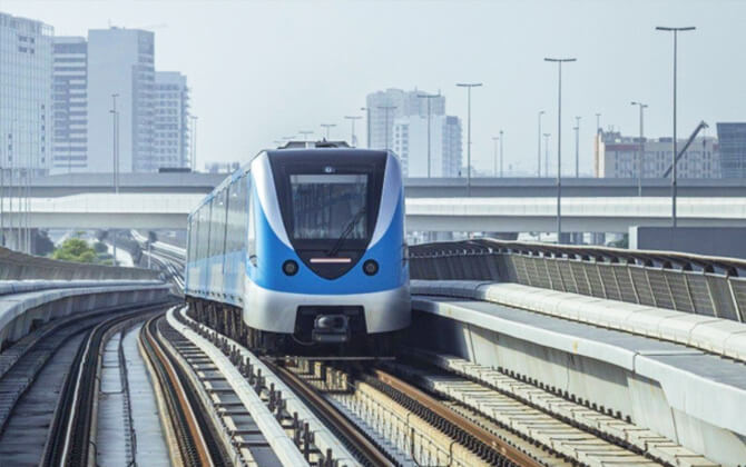
Namma Metro’s airport connection is being developed as the Blue Line under Phase 2B. The route will run from Central Silk Board to Krishnarajapura under Phase 2A, then continue from Krishnarajapura to Kempegowda International Airport.
This airport route is planned along the northern part of the Outer Ring Road before heading toward the airport via Airport Road. Key areas on the path include Nagawara, Hebbal, Jakkur, Yelahanka, Doddajala, Airport City, and KIAL Terminals.
The line is expected to improve airport access and create new interchange opportunities along the corridor. It is also intended to reduce travel time compared with the earlier high-speed rail proposal. According to available project details, airport stations were not included in tenders because they will likely be built by BIAL.
The planned airport section runs from Central Silk Board to Krishnarajapura, then from Krishnarajapura to KIAL Terminals. Planned airport-related stations mentioned in the available information include Krishnarajapura, Nagawara, Hebbal, and KIAL Terminals.
Namma Metro Rules and Tips
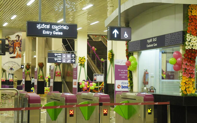
To travel safely on Namma Metro, always carry a valid ticket, token, smart card, or QR ticket and validate it at the entry and exit gates. Traveling without a valid ticket can lead to a penalty.
Children below 3 feet in height may travel free with an adult. Children taller than 3 feet need a valid ticket. Tickets, tokens, and cards should not be shared with another person for the same journey.
Namma Metro allows one piece of baggage per passenger up to 15 kg, with maximum dimensions of 60 cm x 45 cm x 25 cm. Overstaying in the paid area is not allowed, and passengers must exit within the permitted time limit to avoid extra charges.
For a smoother trip, a few simple habits help a lot:
- Queue properly at ticket counters, token machines, AFC gates, and while boarding.
- Stand on the left side of escalators and keep the right side clear.
- Let passengers get off before boarding and do not block the doors.
- Offer priority seats to senior citizens, differently-abled passengers, and pregnant women.
- Do not eat or drink inside the train.
- Do not smoke on metro premises.
- Do not carry pets, flammable items, or weapons without proper authorization.
- Use dustbins and help keep stations and trains clean.
Passengers should also avoid touching LCD screens, walking on the tracks, forcing train doors, or trying to board when the closing warning tone is sounding. If you need help, contact metro staff, security, or customer care.
History
The idea of a metro system for Bengaluru goes back to 1977, when the State Town Planning Department first recommended it. In 1981, Southern Railway was commissioned to study the project and proposed a two-corridor metro of about 80 km (49.7 mi), along with commuter rail lines and a ring railway.
In 1993, another committee reviewed mass rapid transit for the city and again supported the metro concept. The state then formed Bangalore Mass Rapid Transit Ltd in 1994 to explore a public-private partnership model. A feasibility study was commissioned for an elevated light rail network, but that project did not move ahead.
In 2003, the Government of Karnataka asked Delhi Metro Rail Corporation to prepare a detailed study based on the Delhi Metro model. The report recommended a cross-shaped two-line system with 60 km (37.3 mi) and 50 km (31.1 mi) corridors intersecting at the Central Railway Station. The government accepted this option, BMRTL was replaced by BMRCL, and the Union Cabinet approved Phase 1 on 25 April 2006.
Construction of Phase 1 began after the foundation stone was laid on 24 June 2006. Civil work on the first section of the east-west corridor, later named the Purple Line, started on 15 April 2007. The first stretch opened to the public on 20 October 2011.
The network then expanded in stages. The northern Green Line section opened on 1 March 2014, the underground Purple Line section opened on 30 April 2016, and the full Green Line opened on 19 June 2017, completing Phase 1. Phase 2 later added extensions and new corridors, including the ORR Metro line and the airport link plan.
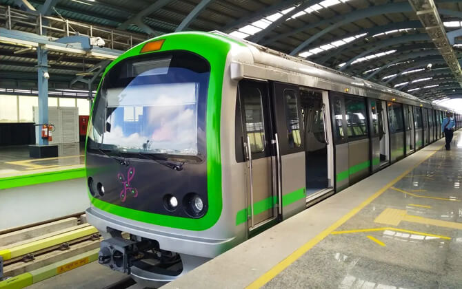
Further sections opened in the following years. The Purple Line extended west in 2021 and then to Challaghatta in 2023. The Green Line reached Madavara in 2024, and the Yellow Line opened in 2025. By the mid-2020s, Namma Metro had become the third-largest metro network in India by operational length, with all trains converted from three coaches to six as ridership grew.
Future Extensions
Namma Metro expansion is expected to continue beyond the current network. According to BMRCL plans and public announcements, Phase 3 and additional longer-term proposals are part of the future route plan.
Phase 3
Phase 3 has been approved and is set to add two new lines and 31 stations. Work has already begun on geotechnical investigation in some areas. Earlier announcements also described a 44.65 km (27.7 mi) elevated project and a separate 35 km (21.7 mi) corridor from Hebbal to Sarjapura as Phase 3A.
Further proposed corridors
BMRCL has also outlined more proposed corridors in different directions, including possible extensions toward Bidadi, Nelamangala, Devanahalli, Hoskote, and other outer areas. An Inner Ring Line Metro has also been mentioned in the Comprehensive Mobility Plan.
- Kalena Agrahara to Kadugodi Tree Park has been discussed as a major proposed corridor.
- Whitefield to Hoskote has been mentioned as a possible Purple Line extension.
- Kalena Agrahara to Jigani has been proposed as a Pink Line extension.
- MG Road to Hope Farm via Marathahalli has also appeared among future proposals.
- Inner Ring UG Metro is listed as another planned corridor.
These extensions are intended to improve transport links to suburban areas, employment hubs, and growing residential and industrial districts. The exact scope and schedule depend on approvals, feasibility studies, and detailed project reports.
Nearby Attractions
Namma Metro is one of the easiest ways to get around Bengaluru without dealing with long road delays. The Purple and Green Lines are especially useful for sightseeing because they connect parks, museums, shopping streets, landmarks, and busy commercial areas.
On the Purple Line, popular stops include MG Road, Cubbon Park, Vidhana Soudha, and Majestic. From these stations, you can reach Cubbon Park, the Visvesvaraya Industrial and Technological Museum, Jawaharlal Nehru Planetarium, Bengaluru Palace, Brigade Road, Commercial Street, and UB City. The line also serves activity hubs such as Whitefield, KR Puram, and Yeshwanthpur.
On the Green Line, useful stops include KR Market, Lalbagh, South End Circle, Jayanagar, and RV Road. This route gives access to Tipu Sultan’s Summer Palace, Bengaluru Fort, Lalbagh Botanical Garden, and ISKCON Temple, while also connecting major residential and commercial areas.
The Yellow Line adds another practical corridor along the Outer Ring Road and Hosur Road. It connects Electronic City to the metro system and includes interchange points at RV Road, Jayadeva Hospital, and Central Silk Board.
If you want a simple metro sightseeing plan, these stops stand out:
- Vidhana Soudha / Cubbon Park area for parks, museums, and the city’s administrative core
- MG Road for shopping, restaurants, and nightlife
- KR Market for nearby historic sites
- Lalbagh for gardens and quieter walks
- Majestic for easy line changes and quick access to central Bengaluru
With solid frequency, clear connections, and direct access to major parts of the city, Namma Metro makes exploring Bengaluru much simpler.