Namma Metro, also called Bengaluru Metro, is the rapid transit system serving Bengaluru, Karnataka. It opened in 2011 as the first metro system in South India and became the region’s first underground metro in 2016. As of April 2026, the system has 96.1 km (59.7 mi) in operation and 83 stations, including elevated, underground, and one at-grade station. Bangalore Metro Rail Corporation Limited (BMRCL) builds, operates, and expands the network. Regular operating hours run from 05:00 to 00:00, with train frequency typically ranging from 3 to 15 minutes depending on the line and time of day.
| Key | Information |
|---|---|
| System name | Namma Metro / Bengaluru Metro |
| City | Bengaluru, Karnataka, India |
| Opened | 2011 |
| Network length | 96.1 km (59.7 mi) |
| Operational stations | 83 |
| Station types | 74 elevated, 8 underground, 1 at-grade |
| Operator | Bangalore Metro Rail Corporation Limited (BMRCL) |
| Operating hours | 05:00 to 00:00 daily |
| Frequency | About 3 to 15 minutes |
| Power supply | 750V DC third rail |
Map of Namma Metro
Map of Namma Metro showing different lines. Click on the map to enlarge it or download the Namma Metro map in PDF format.

Namma Metro Lines
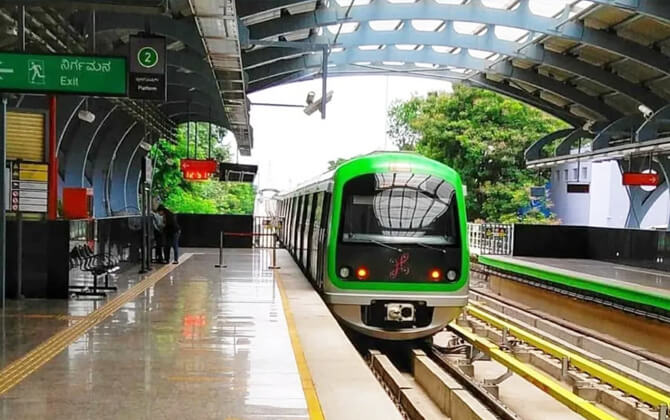
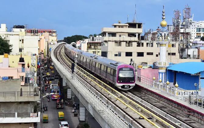
Namma Metro currently runs three lines: Purple, Green, and Yellow. Together, they form the core of Bengaluru public transport and connect residential districts, business areas, and major employment hubs across the city.
| Line | Terminals | Stations | Distance | Opening date | Last extension |
|---|---|---|---|---|---|
| Purple Line | Challaghatta to Whitefield (Kadugodi) | 37 | 43.49 km (27.02 mi) | 20 October 2011 | 9 October 2023 |
| Green Line | Silk Institute to Madavara | 32 | 33.46 km (20.79 mi) | 1 March 2014 | 7 November 2024 |
| Yellow Line | Rashtreeya Vidyalaya Road to Delta Electronics Bommasandra | 16 | 19.15 km (11.90 mi) | 11 August 2025 | 11 August 2025 |
| Total | 83 | 96.10 km (59.71 mi) |
The Purple Line runs west to east, from Challaghatta to Whitefield (Kadugodi). It includes elevated and underground sections, with a 4.8 km (3.0 mi) underground stretch through the city center.
The Green Line connects Madavara in the north-west with Silk Institute in the south-west. Like the Purple Line, it combines elevated and underground alignments, including a 4.0 km (2.5 mi) underground section.
The Yellow Line links Rashtreeya Vidyalaya Road and Delta Electronics Bommasandra. It is fully elevated and follows the Outer Ring Road and Hosur Road corridor.
Several more lines are part of the wider expansion plan. These include the Pink Line from Kalena Agrahara to Nagawara, the Blue Line from Central Silk Board to KIAL Airport, and Phase 3 corridors such as the Orange and Grey lines. A proposed Red Line from Hebbal to Sarjapura is also listed in current plans.
Operation Hours and Frequency
Namma Metro operating hours are generally 05:00 to 00:00 daily, though actual opening hours, opening times, and closing time can vary by day and station. Train frequency usually ranges from 3 to 15 minutes.
For the Purple and Green lines, the standard timetable and train schedule are as follows.
| Service detail | Timings |
|---|---|
| Monday to Friday | 5:00 AM to 11:00 PM, every 5 to 6 minutes |
| 1st, 3rd and 5th Saturdays | 5:00 AM to 11:00 PM, every 5 to 6 minutes |
| 2nd and 4th Saturdays and public holidays | 5:00 AM to 11:00 PM, every 7 to 8 minutes |
| Sundays | 7:00 AM to 11:00 PM, every 7 to 8 minutes |
On busy days, extra trains may be added from selected stations. If you need timings today, schedule today information, the first departure, or the last train, it is best to check the official BMRCL app or website, since route timetable details can change.
Ticket Fares and Types
Namma Metro uses contactless ticketing for both occasional riders and regular commuters. The main ticket options are single-journey tokens and rechargeable smart cards. There are also day pass and periodical pass products for unlimited or repeated travel.
The fare is based on distance. Ticket price starts at ₹10 ($0.12) and rises by distance slabs, with the highest listed fare capped at ₹90 ($1.08).
| Distance Slab | Fare |
|---|---|
| 0–2 km (0–1.2 mi) | ₹10 ($0.12) |
| 2–4 km (1.2–2.5 mi) | ₹20 ($0.24) |
| 4–6 km (2.5–3.7 mi) | ₹30 ($0.36) |
| 6–8 km (3.7–5.0 mi) | ₹40 ($0.48) |
| 8–10 km (5.0–6.2 mi) | ₹50 ($0.60) |
| 10–15 km (6.2–9.3 mi) | ₹60 ($0.72) |
| 15–20 km (9.3–12.4 mi) | ₹70 ($0.84) |
| 20–25 km (12.4–15.5 mi) | ₹80 ($0.96) |
| 25–30 km (15.5–18.6 mi) | ₹90 ($1.08) |
| Above 30 km (18.6 mi) | ₹90 ($1.08) |
Available ticket types include:
- Single Journey Token: valid for one trip.
- Smart Card: a rechargeable card for multiple journeys. Card users may get discounted fare depending on travel time.
- Day Pass: unlimited travel for 24 hours.
- Revised Tourist Passes: One-Day Pass at ₹300 ($3.60), Three-Day Pass at ₹600 ($7.20), and Five-Day Pass at ₹800 ($9.60).
- QR Code-Based Periodical Travel Passes: available through the Namma Metro app, with no security deposit.
Namma Metro also offers Varshik and Sanchar cards. The Varshik card can store credit up to ₹1,500 ($18.00). The Sanchar card is aimed at commuters traveling regularly between two fixed points.
Other options include group tickets for up to ten passengers traveling between the same stations, and the integrated Metro-Bus Ticket day pass for combined metro and bus travel.
Tickets can be bought at station counters and vending machines. Smart card recharge is available at stations, vending machines, Airtel retail outlets, the BMRCL website, select SBI channels, and through the Namma Metro, Paytm, and Amazon Pay apps. Payment methods include smart card, QR ticket, paper ticket, UPI, digital wallets, and cash. If you are looking for fare details, ticket cost, or a simple fare calculator reference, the slab-based structure above is the key pricing table.
Connections to Other Systems
Namma Metro is built as part of a broader city transport network. It connects, or is planned to connect, with railway stations, BMTC bus terminals, and other local transport hubs to make transfers easier across Bengaluru transportation.
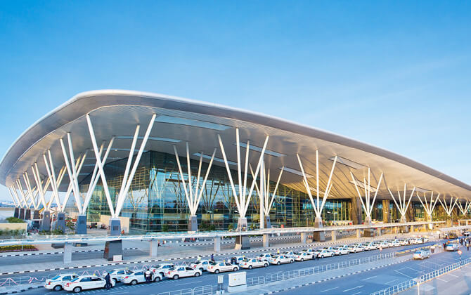
Majestic is the clearest example of this integration. Here, the metro connects with the KSRTC bus terminal and KSR Bengaluru City railway station. Other important interchange points identified by BMRCL include Yeshwantpur, Kengeri, Hebbal, Kempegowda International Airport, and KR Puram. At KR Puram, a foot overbridge already links the metro concourse to the railway station.
The network also includes line-to-line interchanges that strengthen the route plan for cross-city travel:
- Purple Line with the Green Line at Majestic, and with the Blue Line at K.R. Pura.
- Green Line with the Yellow Line at Rashtreeya Vidyalaya Road.
- Yellow Line with the Blue Line at Central Silk Board, and with the Pink Line at Jayadeva Hospital.
- Pink Line with the Purple Line at Mahatma Gandhi Road, and with the Blue Line at Nagawara.
- Blue Line with the Purple Line at Krishnarajapura, with the Pink Line at Nagawara, and with the Yellow Line at Central Silk Board.
Phase 3 plans continue this approach, with the Orange Line expected to connect with the Pink Line at JP Nagar 4th Phase, the Blue Line at Kempapura, and nearby rail or bus facilities at Bell Circle, Hebbal, and Kempapura. BMRCL has also said it wants metro stations to work more closely with suburban rail and bus services wherever possible.
Airport Connections
The airport connection for Namma Metro is the Blue Line. It is being developed in two parts: Phase 2A from Central Silk Board to Krishnarajapura, and Phase 2B from Krishnarajapura to Kempegowda International Airport.
The full Blue Line route is planned to cover 58.19 km (36.16 mi) with 32 stations. It follows the eastern and northern sections of the Outer Ring Road, then turns at Hebbal and continues along Airport Road to the airport.
The stations listed for the airport corridor are:
| Station | Details |
|---|---|
| Kasturi Nagar | Planned Blue Line station on the airport corridor |
| Horamavu | Planned Blue Line station on the airport corridor |
| HRBR Layout | Planned Blue Line station on the airport corridor |
| Kalyan Nagar | Planned Blue Line station on the airport corridor |
| HBR Layout | Planned Blue Line station on the airport corridor |
| Nagawara | Interchange point in future network plans |
| Veerannapalya | Planned Blue Line station on the airport corridor |
| Kempapura | Planned interchange in future expansion plans |
| Hebbal | Major interchange and transport node |
| Kodigehalli | Planned Blue Line station on the airport corridor |
| Jakkur Cross | Planned Blue Line station on the airport corridor |
| Yelahanka | Planned Blue Line station on the airport corridor |
| Bagalur Cross | Planned Blue Line station on the airport corridor |
| Bettahalasuru | Planned Blue Line station on the airport corridor |
| Doddajala | Planned Blue Line station on the airport corridor |
| Airport City | Listed as an at-grade station |
| KIAL Terminals | Direct connection to Kempegowda International Airport |
The airport route was approved as Phase 2B after earlier proposals were revised. The alignment was changed to avoid underground construction near the airport and instead run from Krishnarajapura via the Outer Ring Road, Hebbal, and Jakkur.
Once completed, the line is expected to improve airport access from eastern and northern Bengaluru, including Nagawara, Hebbal, Jakkur, Yelahanka, and surrounding areas.
Parking Facilities
Namma Metro offers station parking at many locations, though coverage is not uniform across the system. According to the available figures, parking is available at 66 of 83 stations, with space for about 12,700 two-wheelers and 2,300 cars.
On the Yellow Line, parking is arranged at 11 stations, with capacity for around 3,000 two-wheelers, 220 four-wheelers, and 10 light commercial vehicles across roughly 19,000 square feet. Four-wheeler parking is more limited than two-wheeler parking at several stations.
The stations mentioned with parking arrangements are:
| Station | Details |
|---|---|
| Ragigudda | Parking available |
| BTM Layout | Parking available |
| Central Silk Board | Parking available |
| Bommanahalli | Parking available |
| Hongasandra | Parking available |
| Kudlu Gate | Parking available |
| Hosa Road | Parking available |
| Electronic City | Parking available |
| Infosys Foundation Konappana Agrahara | Parking available |
| Biocon Hebbagodi | Parking available |
| Delta Electronics Bommasandra | Parking available |
Capacity varies a lot by station. Jayanagar has space for 330 two-wheelers and 10 cars. Near National College station, there is room for 450 two-wheelers and 15 cars. Mysore Road station has around 5,000 square feet for 300 two-wheelers, 70 cars, and 10 heavy vehicles. Near Attiguppe and Vijayanagar, parking is available at Hampinagar for 266 two-wheelers and 86 cars. Peenya Industrial Area provides space for 310 two-wheelers and 35 cars.
Parking charges per day are capped at ₹30 ($0.36) for bikes, ₹45 ($0.54) for autos, ₹60 ($0.72) for cars or jeeps, ₹150 ($1.80) for light commercial vehicles, and ₹300 ($3.60) for heavy vehicles. Bicycles can be parked free of charge.
Parking areas are monitored by CCTV 24 hours a day and staffed by security personnel. At the same time, some stations do not have parking at all. RV Road, for example, has no parking space. BMRCL has said that land constraints and acquisition costs have limited parking expansion in some places.
Interesting Facts
Namma Metro was the first metro system in South India when it opened in 2011. In 2016, it became the first underground metro in South India too.
The system uses standard-gauge tracks and 750V direct current through a third rail. Trains started with three coaches, but all rakes were later converted to six coaches as ridership increased.
As of August 2025, the network had 83 operational stations: 74 elevated, 8 underground, and 1 at-grade. That mix says a lot about the engineering needed to build rapid transit in a dense city like Bengaluru.
Phase 1 included the first metro tunnels in South India. These tunnels were bored about 60 feet below ground level using tunnel boring machines named Helen, Margarita, Kaveri, Krishna, and Godavari.
Passenger response was strong right from the start. In the first three days after opening in October 2011, 169,019 people used the metro, and by the end of the fourth day the total had reached about 200,000.
The Purple Line was the first section to open, on 20 October 2011. The Green Line followed in stages, and the underground sections later tied the network together more effectively.
Namma Metro also introduced features aimed at easier travel, including QR-based ticketing through the Namma Metro app and WhatsApp, along with real-time passenger information display boards.
History
The idea of a metro for Bengaluru goes back to 1977, when the State Town Planning Department recommended a study for a mass rapid transit project. In 1981, a Southern Railway team proposed a two-corridor metro of about 80 km (49.7 mi), along with commuter rail and a circular railway.
In 1993, another Karnataka government committee again backed the metro proposal. The state then created Bangalore Mass Rapid Transit Ltd (BMRTL) in 1994 to explore a public-private partnership model. A city cess was introduced, and a feasibility study proposed a 300 km (186.4 mi) elevated LRT network on six routes. A BOT proposal later followed, but it did not move ahead.
In 2003, the Government of Karnataka asked Delhi Metro Rail Corporation to prepare a detailed study using the Delhi Metro model. DMRC recommended a cross-shaped two-line system with a fully underground crossing at Bengaluru’s Central Railway Station. The proposal was accepted, BMRTL was dissolved, and BMRCL became the implementing agency.
DMRC submitted the detailed project report for Phase 1 in May 2003. The plan covered 33 km (20.5 mi) and 32 stations on standard gauge. The Union Cabinet approved the project on 25 April 2006. Prime Minister Dr. Manmohan Singh laid the foundation stone on 24 June 2006, and civil construction on the first Purple Line section began on 15 April 2007.
Phase 1 was later extended to improve links to the Outer Ring Road and industrial areas such as Peenya. The underground sections in the city center were the first metro tunnels in South India. Work on these tunnels started in late 2012 after delays linked to revised tenders and high bid prices. Tunnel boring for the Purple Line underground section finished on 17 March 2014, and the full underground stretch opened on 29 April 2016. The Green Line underground section was completed on 23 September 2016 and opened on 19 June 2017, marking the completion of Phase 1.
The first Namma Metro section opened to the public on 20 October 2011. The northern Green Line section followed on 1 March 2014, then the first underground Purple Line section on 30 April 2016. The remaining southern Purple Line reach and the second underground section opened on 18 June 2017, giving the network connectivity in all four directions.
Phase 2 received in-principle approval in 2012, with DMRC preparing the detailed project report earlier in 2011. This phase expanded the existing lines and added new corridors. The first Phase 2 section opened on 15 January 2021. Later openings included Purple Line extensions in 2021 and 2023, the Whitefield extension in 2023, and the Green Line extension to Madavara in 2024. Phase 2 also includes the Yellow, Pink, and Blue line projects.
On 20 April 2021, the Union Cabinet approved the delayed Phase 2A and Phase 2B corridors, including the Outer Ring Road-airport route. Phase 3 was then approved by the Union Cabinet on 16 August 2024.
The project has faced delays, difficult underground geology, and major cost increases, but it has continued to grow steadily since 2011.
- 1977: first official recommendation to study a metro for Bengaluru
- 1981: Southern Railway study recommended a two-corridor metro
- 1994: BMRTL was created
- 2003: DMRC prepared the detailed study for Bengaluru Metro
- 2006: Union Cabinet approved Phase 1
- 2011: first metro section opened to the public
- 2017: Phase 1 was completed
- 2021: Phase 2 began opening in stages
- 2024: Phase 3 was approved
Project Management and Phases
Bangalore Metro Rail Corporation Limited, a joint venture of the Government of India and the Government of Karnataka, is responsible for building, operating, and expanding Namma Metro. The project has been developed in phases to manage costs, land acquisition, and engineering complexity.
Phase 1 was the first major construction stage. Its detailed project report was prepared by DMRC and approved in 2006. Construction began in 2006, the first section opened in 2011, and the phase was completed in 2017 after the underground city-center sections came into service.
Phase 2 was approved in 2014 and extended the original network in both directions while adding new corridors. It included elevated, underground, and at-grade sections. Land acquisition, design changes, and repeated tendering affected the schedule.
Phase 2A added the Central Silk Board to K.R. Pura corridor along the Outer Ring Road as an elevated line.
Phase 2B covers the airport link from K.R. Pura to Kempegowda International Airport. The route was revised after several studies, and the work was split into three civil packages.
Phase 3 was approved later to add two more corridors and new stations, continuing the expansion of the metro system.
- Phase 1 established the first operational metro line in South India.
- Phase 2 expanded the original network and added new routes.
- Phase 2A focused on the Outer Ring Road corridor.
- Phase 2B created the airport connection.
- Phase 3 continues long-term network growth.
Across these phases, BMRCL has divided work into separate packages for civil construction, tunneling, stations, electrification, signaling, and depot facilities.
Future Extensions
Namma Metro expansion continues through new corridors and extensions that are already approved or under construction. The focus is clear: better access to job centers, outer neighborhoods, and the airport corridor.
Phase 2 extends the network in multiple directions. It includes the Green Line extensions to Silk Institute and Madavara, the Purple Line extensions to Whitefield and Challaghatta, and two new corridors: the Yellow Line from Rashtreeya Vidyalaya Road to Bommasandra and the Pink Line from Kalena Agrahara to Nagawara.
Phase 2A adds the Outer Ring Road corridor between Silk Board and KR Puram. Phase 2B continues from KR Puram to Kempegowda International Airport. Together, they are designed to improve transport along the ORR and strengthen airport access.
Phase 3 was first discussed as a 124 km (77.1 mi) expansion, though some parts were later shifted into Phase 2A and 2B. The approved Phase 3 plan adds two corridors and 31 stations, including links from JP Nagar Phase 4 to Kempapura and from Hosahalli to Kadabagere. This should improve connectivity on the western side of the city and along Magadi Road.
Later announcements also mentioned additional proposed corridors and a possible Inner Ring Line Metro. Feasibility studies and detailed project report work have been discussed for more routes, showing that long-term expansion remains central to the system’s route plan.
Future proposals also point beyond the main urban core, with directions toward Bidadi, Nelamangala, Devanahalli, Hoskote, Attibele, Harohalli, and other suburban areas. There have also been studies for links toward Tumakuru and for a metro connection to the upcoming international sports complex in the southeastern outskirts of Bengaluru.
Some proposals face technical hurdles. A direct link to Hosur, for example, is complicated by different power systems used in the Bengaluru and Chennai metro networks.
Nearby Attractions
Namma Metro makes it easier to reach many of Bengaluru’s well-known attractions. Depending on the line, you can use the system for shopping, dining, museums, parks, and places of worship without relying entirely on road transport.
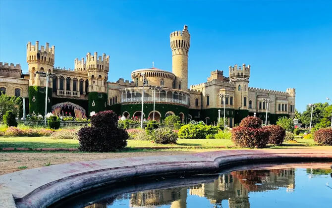
Along the Purple Line, nearby highlights include Phoenix Market City Mall, GT World Mall, Mantri Square Mall, Commercial Street, Russell Market, MG Road, Brigade Road, 1 MG-Lido Mall, and Garuda Mall. Museum and heritage options include Bengaluru Palace, Visvesvaraya Industrial & Technological Museum, and Jawaharlal Nehru Planetarium. The line also gives access to St Mark’s Cathedral, St Andrew’s Presbyterian Church, St Mary’s Basilica, St John’s Church, St Francis Xavier’s Cathedral, Cubbon Park, Indira Gandhi Musical Fountain Park, and Ulsoor Lake.
The Green Line is useful for reaching Orion Mall, Mantri Square Mall, Bobby’s Punjabi Dhaba, OG Variar and Sons, Variar Bakery, and Golden OAK. Near KR Market station, you can visit Tipu Sultan’s Summer Palace and Bengaluru Fort. ISKCON Temple is listed near Mahalakshmi station, while Lalbagh Botanical Garden and Lake is one of the closest green escapes on this line.
The Yellow Line connects to Market Square Mall, Gopalan Innovation Mall, The Bihari Rasoi, House Of Commons, Appu Thindi Adda, CuriosityCity Science Center, and NIMHANS Brain Museum. It also serves spots such as Shri Doddabasavanna Temple, Bull Temple, Ragigudda Anjaneya Temple, Huskur Lake View Point, Singasandra Lake, New BBMP Park Hosapalaya, BDA Park, National Poet Kuvempu Park, and Yediyur Lake.
For a quick city outing or a longer day plan, the metro is a practical way to move around Bengaluru.