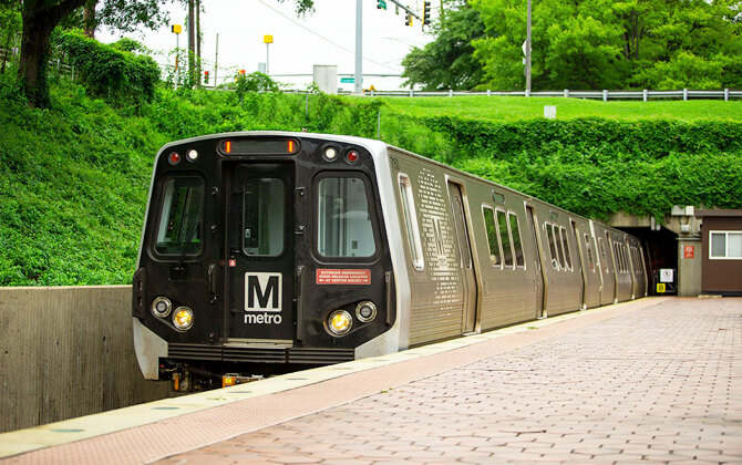
Washington Metro, formally known as Metrorail and often simply called Metro, is the rapid transit public transport system serving Washington, D.C., and nearby parts of Maryland and Virginia. Operated by the Washington Metropolitan Area Transit Authority, or WMATA, it opened in 1976 and now includes six color-coded lines, 98 stations, and 129 miles (208 km) of route. The system also connects with Metrobus, airport rail links, commuter rail, and other local transport across the region.
| Key | Information |
|---|---|
| Official name | Metrorail |
| Common name | Washington Metro or Metro |
| Operator | Washington Metropolitan Area Transit Authority, also known as WMATA |
| Opened | 1976 |
| Network size | Six lines, 98 stations, and 129 miles (208 km) of route |
| Service area | Washington, D.C.; Montgomery and Prince George’s counties in Maryland; Arlington, Fairfax, and Loudoun counties plus Alexandria in Virginia |
| Most recent expansion | Potomac Yard infill station, opened May 19, 2023 |
| Payment options | Contactless payment or SmarTrip card |
| Notable feature | Wheaton station has a 230-foot (70 m) single-tier escalator |
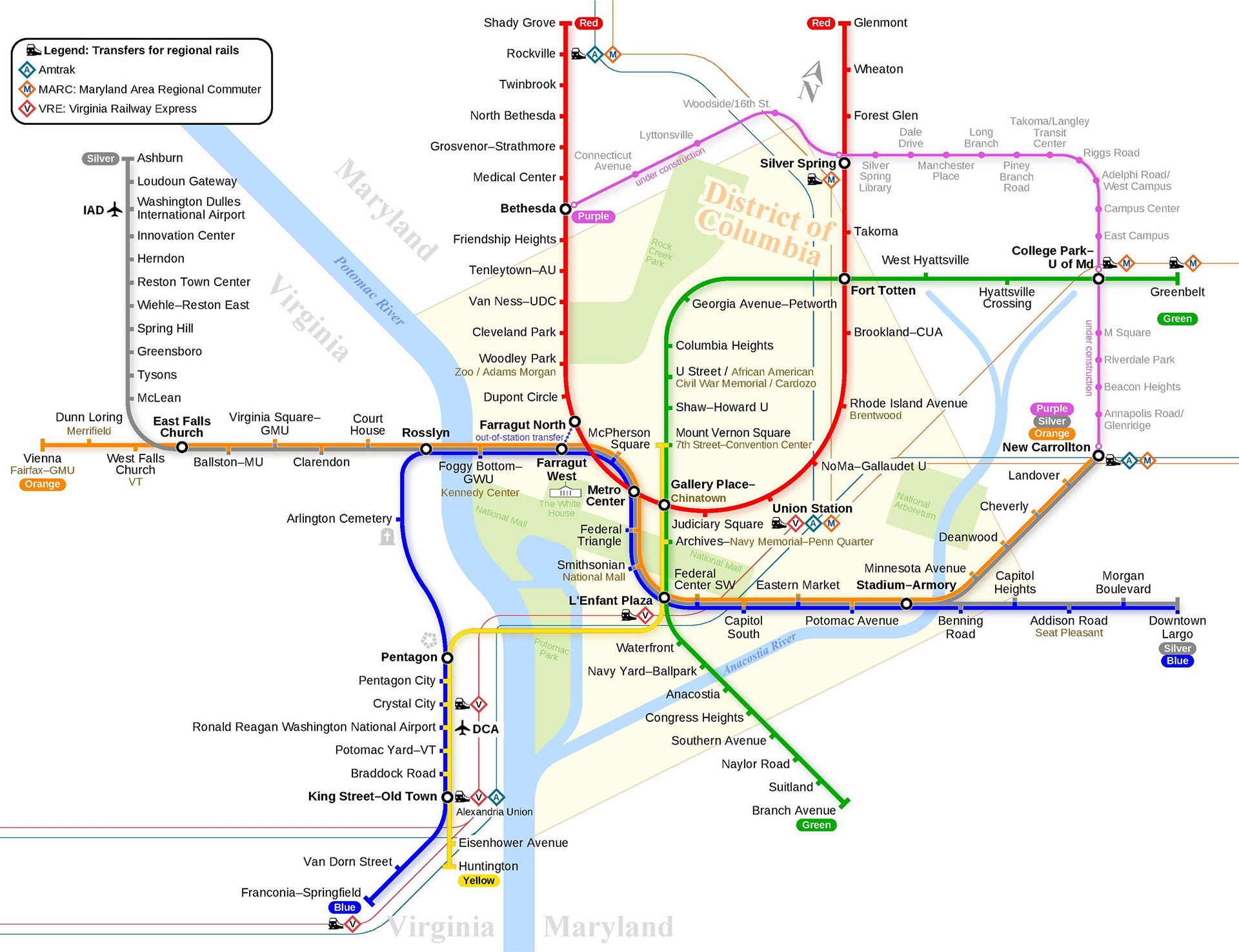
Washington Metro Map
Map of Washington Metro showing different lines and stations. Click on the map to enlarge it or download the Washington Metro map in PDF format.
Washington Metro Lines and Stations
The Washington Metro route plan is built around six color-coded lines: Red, Orange, Silver, Blue, Yellow, and Green. Most lines share tracks in some sections, which helps riders transfer between routes and continue across the region without always changing trains. The Red Line is the main exception, operating on its own alignment.
For trip planning, the stations map and stations list are especially useful because several downtown stations work as major interchange points. Metro Center, Gallery Place, L’Enfant Plaza, Fort Totten, Rosslyn, and Union Station are among the most important transfer stations in the system. Some stations have stacked or upper-and-lower platforms, including Fort Totten, Gallery Place, Metro Center, L’Enfant Plaza, and Rosslyn.
| Station | Details |
|---|---|
| Red Line | Runs between Shady Grove and Glenmont. |
| Orange Line | Runs between Vienna and New Carrollton. |
| Silver Line | Runs from Ashburn to Downtown Largo and New Carrollton. |
| Blue Line | Runs between Franconia-Springfield and Downtown Largo. |
| Yellow Line | Runs from Huntington to Mount Vernon Square and Greenbelt. |
| Green Line | Runs between Branch Avenue and Greenbelt. |
| Metro Center | Major transfer point for the Red, Orange, Blue, and Silver Lines. |
| Gallery Place | Major multi-line transfer station in central Washington. |
| L’Enfant Plaza | Major transfer station serving several lines and nearby federal and museum areas. |
| Fort Totten | Connects the Red, Green, and Yellow Lines. |
| Rosslyn | Key transfer station on the Virginia side of the Potomac River. |
| Union Station | Connects Metro with Amtrak, MARC, and Virginia Railway Express services. |
Union Station is the busiest station in the system, followed by Metro Center and Foggy Bottom-GWU. Other high-volume stations include Gallery Place, L’Enfant Plaza, Farragut North, NoMa-Gallaudet U, Dupont Circle, Farragut West, and Navy Yard-Ballpark. These stations show how strongly the network supports downtown jobs, government offices, universities, sports venues, and major visitor destinations.
Metro also serves important regional travel points. The Blue Line stops at Ronald Reagan Washington National Airport, and the Silver Line provides a direct path train connection to Washington Dulles International Airport. Amtrak and commuter rail links are available at Union Station, New Carrollton, King Street-Old Town, Rockville, Silver Spring, and other key stations.
Washington Metro Hours
Washington Metro operating hours run daily, but the closing time depends on the day of the week. These opening hours are the standard rail working hours, and each station opens 10 minutes before the first train arrives. First train and last train times vary by station, so station-specific timings today should be checked before travel.
| Service detail | Timings |
|---|---|
| Monday through Thursday opening times | 5:00 a.m. to 12:00 a.m. |
| Friday schedule | 5:00 a.m. to 2:00 a.m. |
| Saturday train schedule | 6:00 a.m. to 2:00 a.m. |
| Sunday schedule today | 6:00 a.m. to 12:00 a.m. |
| Station starting time | Stations open 10 minutes before the first train arrives. |
| Last train guidance | Last trains leave the end stations inbound about 30 minutes before the listed closing time. |
As of June 22, 2025, Metro’s route timetable follows the schedule above. During snowfall of up to about six inches, Metrorail can operate close to normal. If snow reaches about eight inches, above-ground service may be suspended.
Metro may also adjust the timetable during holidays and major events in Washington. If you are traveling late, check the exact last train and whether your station will close at the usual time.
Fares, Tickets and Cards
Washington Metro fare rules depend on the service, trip length, day, and time of travel. The Trip Planner is the easiest fare calculator for an exact ticket price, especially when your trip includes rail, bus, or a transfer.
| Service | Regular fare | Reduced fare |
|---|---|---|
| Metrorail | US$2.25-US$6.75 on weekdays; US$2.25-US$2.50 after 9:30 p.m. and on weekends | US$1.10-US$3.35 on weekdays; US$1.10-US$1.25 after 9:30 p.m. and on weekends |
| Metrobus Regular Routes | US$2.25 | US$1.10 |
| Metrobus Express Routes | US$4.80 | US$2.40 |
| MetroAccess Regular Routes | Up to US$4.50 |
Unlimited passes can lower the cost if you ride often or plan several trips in a short time.
| Pass | Regular price | Reduced price |
|---|---|---|
| 1-Day Unlimited Pass | US$13.50 | |
| 3-Day Unlimited Pass | US$33.75 | |
| 7-Day Unlimited Pass | US$60.75 | |
| 7-Day Short-Trip Pass | US$40.50 | |
| Monthly Unlimited Pass | US$72.00-US$216.00 | |
| Regional Bus Pass, 7-Day | US$13.50 | US$6.75 |
Reduced fares are available for people with disabilities, seniors, and customers enrolled in Metro Lift. Seniors and people with disabilities may also use the reduced-price 7-Day Regional Bus Pass.
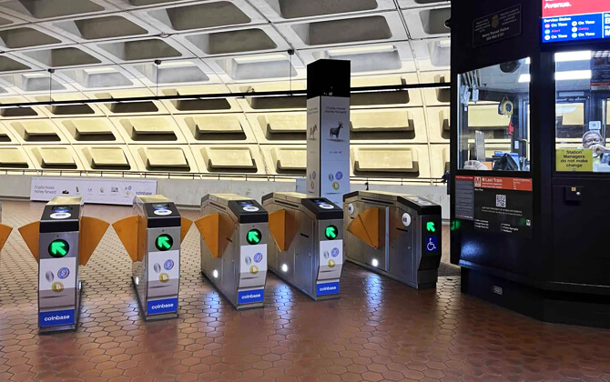
You can pay with a SmarTrip card, a virtual SmarTrip card on an Apple or Android device, or a contactless credit or debit card at the faregate or farebox. SmarTrip cards are sold at Metro stations and can be loaded with fare value or multi-day passes.
Cash is accepted on buses, but exact fare is required. If you pay cash, small bills are best because farecard machines provide only up to US$5 in change, and that change is given in coins.
- Up to two children age 4 and younger ride free with each fare-paying adult.
- Children age 5 and older pay regular fare.
- DC students attending public, private, charter, or parochial schools can ride free on Metrorail and Metrobus through the DC Kids Ride Free program.
- Metrobus-to-Metrobus transfers are free and unlimited within two hours when using SmarTrip.
- Metrobus-to-Metrorail and Metrorail-to-Metrobus transfers receive a US$2.25 discount within two hours, excluding express routes.
- Farragut Crossing allows a free transfer between the Red Line and the Orange, Silver, and Blue Lines through Farragut West and Farragut North.
Some regional services, including ART and Fairfax Connector connections, also offer discounts when the correct fare media is used.
Connections to Other Systems
The Washington Metro is closely linked with other transportation in Washington, D.C., Maryland, and Virginia. That makes it part of a broader city transport system rather than a rail network used on its own.
Metrobus connections are available at all Metrorail stations. Because WMATA operates both Metrobus and Metrorail, riders can transfer between train and bus across the area, including suburban counties and major transit centers.
Commuter rail links are concentrated at key stations. Union Station is the main interchange for MARC, Virginia Railway Express, and Amtrak. Other rail connections are available at New Carrollton, College Park-U. of Md., Greenbelt, Silver Spring, Rockville, Crystal City, King Street-Old Town, Franconia-Springfield, and L’Enfant Plaza.
Airport access is also built into the system. The Blue and Yellow Lines serve Ronald Reagan Washington National Airport, and the Silver Line serves Washington Dulles International Airport. Baltimore/Washington International Airport is not directly on Metro, but rail travel between BWI and Union Station is available by Amtrak and MARC.
Intercity bus and regional bus services connect with Metro at major hubs such as Union Station. Local and regional buses also serve many areas around Metro stations, extending public transport beyond the rail network.
Airport Connections
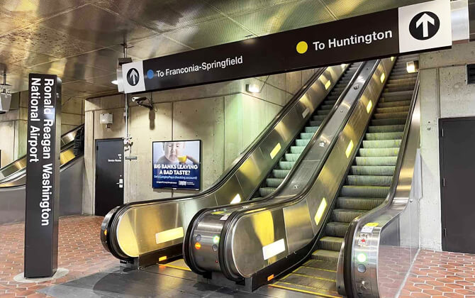
Washington Metro provides direct rail access to two major airports, with a third airport reachable by rail transfer. Ronald Reagan Washington National Airport is served by the Yellow and Blue Lines, while Washington Dulles International Airport is directly connected to the Silver Line.
For Ronald Reagan Washington National Airport, follow signs to the covered walkways and enter the station directly from the airport. The station connects with the Yellow and Blue Lines, making it a simple route for travel to and from the terminal.
Washington Dulles International Airport is served by the Silver Line. From the terminal, follow signs to the underground walkway, about five minutes away. The path between the station and the terminal includes moving sidewalks and escalators.
Baltimore/Washington International Thurgood Marshall Airport is not directly served by Metro. To reach it, take Metro’s Red Line to Union Station, then transfer to MARC. From the airport, a shuttle connects the terminal area with the MARC rail station for the trip back to Union Station and Metro.
If you arrive in Washington by Amtrak, Virginia Railway Express, or MARC, use Union Station. It is served by Metrorail’s Red Line and gives access to the rest of the system.
Metro service to Reagan National Airport can be affected by weekend track work and shuttle substitutions during construction periods, so check current service before you travel.
Parking near the Metro
Station parking can be a convenient way to reach Washington, D.C., Maryland, and Virginia by train or bus. Metro offers parking at 51 stations, with station-specific details for parking charges, space types, and payment rules. If a station does not appear in Metro parking information, parking is not available there.
Many facilities have spaces near station entrances, and multi-level garages include elevators. Metro-operated parking is free on weekends and federal holidays.
- Pick Up/Drop Off Area, also called Kiss & Ride, is for quick passenger pick-up or drop-off.
- Short-term hourly parking is available at some Kiss & Ride lots.
- Daily parking lets riders pay one flat fee for the day at Park & Ride locations.
- Monthly reserved parking is available at select rail stations for permit holders.
- Multi-day parking is offered in limited long-term spaces at four stations on a first-come, first-served basis.
- Motorcycle parking is available in dedicated spaces in Kiss & Ride lots.
- Special event parking fees may apply at select stations during major events.
Depending on the facility, parking can be paid with ParkMobile, SmarTrip, Tap. Ride. Go. contactless credit or debit payment, a credit card, or coins. At 13 stations, riders can pay less for station parking by using SmarTrip for both the return Metro ride and parking. At select locations, Tap. Ride. Go. can also qualify for the lower rate when the required steps are followed.
Exact parking charges per day and current availability vary by station. For parking help, Metro lists the Parking Office at 202-GO-METRO or 202-962-2033, and [email protected].
Tips and Rules
A safe Metro trip starts with a few simple habits. Use headphones with audio and video devices, let passengers exit before you board, and be respectful to other riders. Seats near the doors are reserved for senior citizens and riders with disabilities, so give them up when needed.
Keep stations and trains clean by using trash bins and newspaper recycling bins. Give priority to senior citizens and riders with disabilities when using elevators, and follow official instructions. If you see an unattended package, report it to a transit police officer, station manager, or train operator.
On platforms, stand at least two feet (0.6 m) behind the edge. Flashing lights along the platform edge mean a train is arriving, and a recorded voice followed by chimes warns that doors are closing. Step carefully over the gap between the train and platform.
- Do not eat, drink, smoke, or litter.
- Do not block or force train doors open.
- Do not touch or lean against train doors while they are opening or closing.
- Do not run in the station.
- Do not sit on the platform edge.
- Do not walk on the trackbed. The third rail carries 750 volts of electricity.
On escalators, stand facing forward and hold the handrail. Keep children close, keep feet away from the sides, and watch clothing and shoelaces. Do not ride barefoot, run, sit on the steps or handrail, or use the escalator with a stroller, wheelchair, handcart, or heavy load. In an emergency, use the stop button on the right-hand side near the floor under the flap.
Parents should hold a small child’s hand at all times and use elevators with strollers. Make sure children board and leave the train with you, and plan what to do if separated. If it happens, tell a Metro employee.
History
Washington Metro history began with regional debates over highways and rail in the 1950s. Early plans favored a large freeway system, but public opposition helped shift the regional transport plan toward a Capital Beltway plus rail corridors. Some funding originally tied to the Inner Loop Freeway project was redirected toward the Metro system.
In 1960, the federal government created the National Capital Transportation Agency to develop a rapid rail system. In 1966, WMATA was created by the federal government, the District of Columbia, Virginia, and Maryland, with planning authority transferred from the NCTA. A 1967 proposal was larger than the final approved network, including a Red Line extension toward Germantown instead of Shady Grove.
WMATA approved a 97.2-mile (156.4 km) regional system on March 1, 1968. An experimental station was built above ground in May 1968 to test construction methods, lighting, and acoustics before full construction began.
Construction started after a groundbreaking ceremony on December 9, 1969, at Judiciary Square. The first section opened on March 27, 1976, with 4.6 miles (7.4 km) of Red Line service and five stations between Rhode Island Avenue and Farragut North, all within Washington, D.C. Rides were free that day.
The network expanded steadily. Arlington County joined the system on July 1, 1977; Montgomery County on February 6, 1978; Prince George’s County on November 17, 1978; and Fairfax County plus Alexandria on December 17, 1983. Metro reached Loudoun County with the Silver Line expansion on November 15, 2022. The system name was suggested by Massimo Vignelli, who also designed its signage.
The 103-mile (166 km), 83-station system was completed with the Green Line segment to Branch Avenue on January 13, 2001. Later growth included the Blue Line extension to Morgan Boulevard and Largo on December 18, 2004, the NoMa-Gallaudet U infill station in November 2004, the first phase of the Dulles Airport extension on July 26, 2014, the second phase to Ashburn on November 15, 2022, and Potomac Yard on May 19, 2023.
Metro construction required billions in federal funding under the National Capital Transportation Act of 1969. The original cost split was 67% federal and 33% local, with later federal funds authorized in 1980 and 1990 through full funding grant agreements with WMATA.
Over time, underinvestment led to service problems, infrastructure failures, and several fatal incidents. By 2016, on-time rates had fallen to 84%, and rush-hour service was often disrupted by equipment, rolling stock, track, and signal issues. WMATA did not receive dedicated funding from Maryland, Virginia, and D.C. until 2018.
Major renovation work followed. In May 2018, Metro announced platform reconstruction at 20 stations across all lines except the Silver Line. The Blue and Yellow Lines south of National Airport closed from May 25 to September 9, 2019, the longest line closure in Metro history. Yellow Line service was also suspended from September 10, 2022, for Potomac River bridge and tunnel work into L’Enfant Plaza, then resumed on May 7, 2023, with the northeastern terminus shortened from Greenbelt to Mount Vernon Square.
Future Extensions
Future Extensions for the Washington Metro focus mainly on core capacity rather than simply adding new outer branches. The concepts described include a Rosslyn wye, a separate Yellow Line tunnel, additional wyes at Pentagon and L’Enfant Plaza, and a possible new path for some Yellow Line service toward Union Station.
A single improvement at Rosslyn would not solve all cross-river capacity limits. A Rosslyn wye could be paired with other projects, such as a Pentagon wye or a separate Yellow Line subway, to create space for more trains and reduce pressure on busy transfer stations and the 7th Street tunnel.
Additional service could also benefit growing areas such as Waterfront and Capitol Riverfront, where more Green Line service would better match planned downtown densities. Another idea is to split Yellow Line service so that some trains continue through L’Enfant Plaza and Archives while others use a new corridor toward Union Station.
Beyond rail expansion, Metro’s recent and planned work includes station closures for maintenance, a new bus network launched on June 29, 2025, fare system modernization, station access studies, escalator and elevator projects, and parking improvements. Future growth will likely rely on a mix of rail capacity projects, operating changes, and systemwide upgrades.
Nearby Attractions
Washington Metro makes many of the city’s best-known attractions easy to reach without a car. Several stations are close to museums, monuments, neighborhoods, sports venues, and cultural areas across downtown Washington, Arlington, and nearby districts.
| Station | Details |
|---|---|
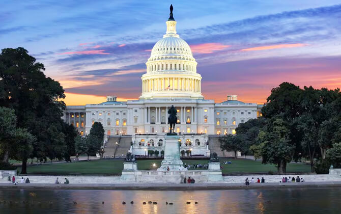
| Smithsonian | Best for the National Mall, Smithsonian museums, Washington Monument, and nearby memorials. |
| Federal Triangle | Useful for the north side of the National Mall and the National Museum of American History. |
| Federal Center SW | Close to the National Air and Space Museum, U.S. Botanic Garden, and U.S. Capitol area. |
| Gallery Place-Chinatown | Good for Capital One Arena, the National Portrait Gallery, and Smithsonian American Art Museum. |
| Archives-Navy Memorial-Penn Quarter | Convenient for the National Archives and nearby downtown attractions. |
| Arlington Cemetery | Direct access to Arlington National Cemetery. |
| Foggy Bottom-GWU | Practical for the Kennedy Center and the west end of the National Mall. |
| Woodley Park-Zoo/Adams Morgan | Serves the National Zoo and nearby Adams Morgan. |
| L’Enfant Plaza | Major hub for the National Air and Space Museum, Hirshhorn Museum and Sculpture Garden, and the Tidal Basin area. |
Metro also connects visitors with neighborhoods such as Dupont Circle, U Street, Columbia Heights, Eastern Market, Navy Yard, and the Wharf area. These stops are useful for restaurants, nightlife, markets, and local character alongside the major landmarks.
For sightseeing, staying near a central station can save time and reduce transfers. Downtown Washington and National Mall stations usually offer the easiest access to the city’s signature attractions.
Media