The Tyne and Wear Metro is a publicly owned light rail rapid transit system serving Newcastle upon Tyne, Gateshead, North Tyneside, South Tyneside, and the City of Sunderland. Operated by Nexus, the system uses both underground and overground sections, with two main routes, 60 stations, and 77.5 km (48.2 miles) of track. It opened in 1980, expanded to Newcastle Airport in 1991 and Wearside in 2002, and now forms a key part of public transport and local transport across Tyne and Wear.
| Key | Information |
|---|---|
| System | Publicly owned light rail rapid transit network operated by Nexus |
| Area served | Newcastle upon Tyne, Gateshead, North Tyneside, South Tyneside, and Sunderland |
| Lines | Green Line and Yellow Line |
| Stations | 60 stations across the network |
| Track length | 77.5 km (48.2 miles) |
| First opened | August 1980 |
| Main airport link | Green Line to Newcastle International Airport |
| Typical operating hours | Services usually start early morning and run until around midnight |
Tyne and Wear Metro Map
Map of Type & Wear Metro showing different lines and stations. Click on the map to enlarge it or download the Type & Wear Metro map in PDF format.
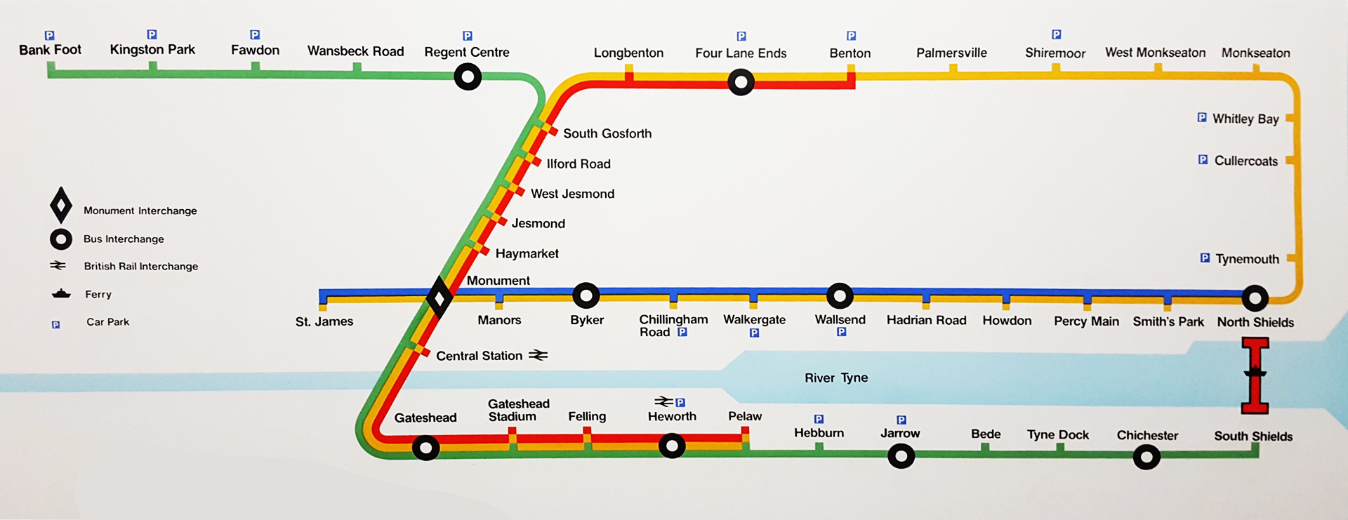
Tyne and Wear Metro Lines and Stations
The Tyne and Wear Metro has two passenger lines. The Green Line runs between Airport and South Hylton, while the Yellow Line runs between St James and South Shields. Both lines share the busy central section between South Gosforth and Pelaw, so this part of the route has the highest frequency.
The stations map includes a mix of underground city stations, former railway stations, and purpose-built Metro stops. Central, Heworth, and Sunderland connect with National Rail services; at Sunderland, Metro and National Rail trains use the same platforms.
Most stations have two platforms. South Hylton and South Shields each have one platform, North Shields has three platforms including a bay platform, and Monument has four platforms on two separate lines. All stations have ticket machines, shelters, information displays, next-train indicators, and passenger information or emergency help-points. Most are unstaffed, except underground stations, which must be staffed by law.
| Station | Details |
|---|---|
| Green Line stations list | South Hylton, Pallion, Millfield, University, Park Lane, Sunderland, St Peter’s, Stadium of Light, Seaburn, East Boldon, Brockley Whins, Fellgate, Pelaw, Heworth, Felling, Gateshead Stadium, Gateshead, Central, Monument, Haymarket, Jesmond, West Jesmond, Ilford Road, South Gosforth, Regent Centre, Wansbeck Road, Fawdon, Kingston Park, Bank Foot, Callerton Parkway, Airport |
| Yellow Line stations list | South Shields, Chichester, Tyne Dock, Simonside, Bede, Jarrow, Hebburn, Pelaw, Heworth, Felling, Gateshead Stadium, Gateshead, Central, Monument, Haymarket, Jesmond, West Jesmond, Ilford Road, South Gosforth, Longbenton, Four Lane Ends, Benton, Palmersville, Northumberland Park, Shiremoor, West Monkseaton, Monkseaton, Whitley Bay, Cullercoats, Tynemouth, North Shields, Meadow Well, Percy Main, Howdon, Hadrian Road, Wallsend, Walkergate, Chillingham Road, Byker, Manors, St James |
| Shared core route | South Gosforth to Pelaw, including both stations |
| Underground stations | Jesmond, Haymarket, Monument, Manors, St James, Central, Gateshead, and Park Lane in Sunderland |
| National Rail interchange stations | Central, Heworth, and Sunderland |
On most days, both lines run every 12 minutes from around 5:00 AM until around 7:00 PM, then every 15 minutes until around 12:30 AM. On Sundays and bank holidays, services start about an hour later and usually run every 15 minutes through the day.
Fares, Tickets and Cards
Tyne and Wear Metro fare prices are zone-based, so the ticket price depends on how far you travel. For a quick fare calculator, check how many zones your route crosses before buying a ticket. Ticket machines are available at all stations and accept cards, contactless payments, notes, and coins.
| Key | Information |
|---|---|
| Single ticket, 1 zone | £1.80, about $2.29 |
| Single ticket, 2 zones | £2.70, about $3.43 |
| Single ticket, 3 zones | £3.40, about $4.32 |
| Metro Day Pass, 1 zone | £2.70, about $3.43 |
| Metro Day Pass, 2 zones | £3.70, about $4.70 |
| Metro Day Pass, 3 zones | £4.60, about $5.84 |
| Day Rover ticket | £6.90, about $8.76, for unlimited one-day travel within Tyne and Wear |
| Transfare T1 | £2.80, about $3.56 |
| Transfare T2 | £3.60, about $4.57 |
| Transfare T3 | £4.30, about $5.46 |
| Under-16 single child fare with Pop Card | 60p, about $0.76 |
| Penalty fare | Up to £20, about $25.40 |
A single ticket is valid for 90 minutes after purchase and can be used for a continuous journey on the Metro or local rail between Newcastle and Sunderland. A Metro Day Pass gives unlimited travel in one day on the Metro, ferries, and trains.
Transfare tickets are useful when one journey needs two types of transport. You need only one ticket, but the second leg must start within 90 minutes of purchase. Family and Group Tickets are also available for two adults and up to three children under 14, and children under five travel free.
Passengers can also use a Pop Pay As You Go smart card. Top it up at stations, tap in with the card, and pay as you travel. If you travel often, this pass-style card can be more convenient than buying a paper ticket each time.
Travelling without a valid ticket can lead to a fine of up to £20, about $25.40. If it is not paid within 21 days, a £30 administration fee, about $38.10, is added, with the same amount added again after 35 days if the fine remains unpaid.
Tyne and Wear Metro Hours
The Tyne and Wear Metro does not run 24 hours a day. As of January 2026, the usual starting time is between 05:00 and 06:00 on weekdays and between 06:00 and 07:00 on Saturday and Sunday. Trains normally continue until around midnight, so the closing time and last train can vary by station and direction.
For opening hours, opening times, working hours, timings today, and the schedule today, check the route timetable before you travel. Service changes can affect the last train or the exact time stations close.
| Service detail | Timings |
|---|---|
| Monday to Friday morning | About 5 trains per hour, roughly every 12 minutes from 06:00 to 10:00 |
| Monday to Friday daytime | About 5 trains per hour, roughly every 12 minutes from 10:00 to 18:00 |
| Monday to Friday evening | About 4 trains per hour, roughly every 15 minutes from 18:00 to 00:00 |
| Saturday morning | About 4 trains per hour, roughly every 15 minutes from 06:00 to 10:00 |
| Saturday daytime | About 5 trains per hour, roughly every 12 minutes from 10:00 to 18:00 |
| Saturday evening | About 4 trains per hour, roughly every 15 minutes from 18:00 to 00:00 |
| Sunday morning | About 2 trains per hour, roughly every 30 minutes from 06:00 to 10:00 |
| Sunday daytime and evening | About 4 trains per hour, roughly every 15 minutes from 10:00 to 00:00 |
| Shared core section | Pelaw to South Gosforth has a combined interval of around 6 to 8 minutes when both lines are running |
| Peak periods | Extra trains may reduce gaps to about every 3 minutes on the busiest part of the network |
The busiest central stations in Newcastle and Sunderland, including Haymarket, Monument, Central, Sunderland, and Park Lane, are staffed until late evening. St James, St Peters, and Stadium of Light are also staffed on match days.
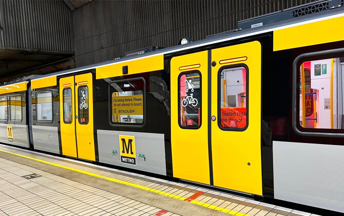
Non-folding bicycles are permitted only on selected sections between 10:00 and 15:00 and after 19:00 on weekdays, and all day at weekends. The permitted sections are Callerton Parkway to Jesmond, Manors to Jesmond via Whitley Bay, and Gateshead Stadium to South Shields or South Hylton.
Connections to Other Systems
The Metro was designed as part of an integrated public transport network, with interchanges for buses, local rail, and other city transport. Early plans used local bus routes as feeders, with ticketing and timetables built around the rail system. Bus integration ended after deregulation in 1986, but Transfare tickets still cover selected mixed-mode journeys.
Major interchange stations include Four Lane Ends, Heworth, and Regent Centre. Haymarket, Monument, Central, Wallsend, Byker, Gateshead, Jarrow, Chichester, and South Shields also connect with significant bus services. Some stations add park-and-ride facilities, which makes switching from car to transport easier.
National Rail connections are available at Central, Heworth, and Sunderland. The Sunderland extension between Pelaw and Sunderland was adapted for shared use with Network Rail services, making it one of the most distinctive mixed-operation sections in UK transportation in the region.
The Shields Ferry adds another useful link, connecting North Shields and South Shields across the River Tyne. Future expansion plans, especially the Washington route, are also shaped by how the Metro connects with wider public transport.
Airport Connections
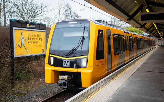
The Tyne and Wear Metro gives Newcastle International Airport a direct rail link on the Green Line. The airport extension opened in November 1991, running from Bank Foot to Airport along part of the former Ponteland Railway alignment.
The extension includes Callerton Parkway and Airport stations. Airport station is a terminal island platform, with tracks ending in buffer stops, and a covered walkway connects it with the airport terminal.
Trains generally run every 12 minutes through the day from Airport via Newcastle to Park Lane in Sunderland. Alternate trains continue to South Hylton, and peak-hour short workings also operate from Regent Centre to Pelaw. For visitors, the route plan is simple: Airport to the city centre is direct, with the journey time described as around 20 minutes.
Parking
Station parking and park-and-ride facilities are available at selected Tyne and Wear Metro stations. Parking charges vary across the network, and normal charges still apply at some locations, so check station-specific information before leaving your car.
Great Park park-and-ride, NE13 9NR, connects to bus services and operates Monday to Saturday. Its car park is open from 6:00 AM to 7:00 PM. Some park-and-ride stations charge £1.60 per day, about $2.03, so parking charges per day depend on the site.
Callerton Parkway is also planned to receive more parking. Nexus has submitted an application for 159 new spaces there, reduced from an earlier 500-space proposal to limit loss of landscaping and biodiversity. The application notes that 4,750 homes are being developed nearby.
| Station | Details |
|---|---|
| Four Lane Ends | Named in free-parking offers |
| Callerton Parkway | Named in free-parking offers and planned for additional parking capacity |
| Bank Foot | Named in free-parking offers |
| Stadium of Light | Named in free-parking offers |
| Kingston Park | Named in free-parking offers on Sundays |
| Regent Centre | Named in free-parking offers on Sundays |
| Hebburn | Named in free-parking offers on Sundays |
| Felling and Heworth | Excluded from the free-parking initiative |
Rules and Tips
Tyne and Wear Metro is a public transport system with rules designed to keep travel safe, accessible, and predictable. A little planning helps too, especially if you are new to the route or changing between Metro, bus, ferry, and local rail.
- Stations and trains have 24-hour CCTV for security.
- Alcohol consumption and smoking are not allowed in stations or on trains.
- Always travel with a valid ticket, pass, or card for your journey.
- Passengers without a valid ticket may receive a penalty fare.
- Photography and videography in stations and on trains require written permission from the Metro Communications Department.
- Only folded bicycles are allowed across the full Metro system.
- Small pets are allowed if they are under control or on a lead.
- Powered mobility scooters are not allowed.
- Check the station map and zone map before travelling, especially if you are working out the cost of a trip.
- Use the timetable if you need a specific last train or close connection.
- Buy single tickets and day tickets from station machines; they accept cash, cards, and contactless payment.
- If you travel regularly, a Pop Pay As You Go card may be easier than buying a ticket every time.
- For two-leg journeys using different transport modes, Transfare can be useful, but the second leg must begin within 90 minutes.
- Most stations have cycle racks, and some offer bicycle parking facilities.
- Some stations are underground, so allow time for stairs, lifts, or escalators.
- Help points are available if staff are not present at the station.
| Key | Information |
|---|---|
| Children under 5 | Travel free |
| Under-16 tickets | Valid for all 3 zones |
| Transfare tickets for under-16s | Valid for all 3 Transfare zones |
History
The history of the Tyne and Wear Metro begins with older railway infrastructure, much of it built between 1834 and 1882. The Newcastle and North Shields Railway opened in 1839, and in 1904 the North Eastern Railway began electrifying local lines north of the River Tyne with a 600 V DC third-rail system. That suburban network became known as the Tyneside Electrics.
British Rail de-electrified the Tyneside Electrics in the 1960s as passenger numbers fell and equipment aged. The Newcastle to South Shields line changed to diesel operation in 1963, followed by the North Tyneside routes in 1967. Many saw the change as a backward step because diesel trains were slower than the electric services they replaced.
In 1971, the newly created Tyneside Passenger Transport Authority, now Nexus, commissioned a study into improving regional transport. The study recommended rebuilding the run-down suburban rail network as an electrified rapid transit system, with a new underground route through central Newcastle and Gateshead.
The plans were approved by the Tyneside Metropolitan Railway Act 1973, and construction began in October 1974. Three railway lines, totalling 42 km (26 miles), were converted for the initial Metro: the North Tyneside Loop, the Newcastle to South Shields branch, and a short section of the Ponteland Railway between South Gosforth and Bank Foot. Around 10 km (6 miles) of new infrastructure was added, including tunnels, elevated structures, the Queen Elizabeth II Bridge, and the Byker Viaduct.
By 1984, the project cost had reached £265 million, about $336.55 million. The Metro was the first railway in the United Kingdom to use the metric system for speeds and distances, and the first UK transport system designed to be fully accessible for passengers with disabilities, with step-free access at all stations.
| Station | Details |
|---|---|
| Haymarket to Tynemouth section | Opened 11 August 1980, including Haymarket, Jesmond, West Jesmond, Ilford Road, South Gosforth, Longbenton, Four Lane Ends, Benton, Shiremoor, West Monkseaton, Monkseaton, Whitley Bay, Cullercoats, and Tynemouth |
| Regent Centre to Bank Foot | Opened 10 May 1981 |
| Heworth to Monument section | Opened 15 November 1981, including Heworth, Felling, Gateshead Stadium, Gateshead, Central Station, and Monument |
| North Shields to St James section | Opened 14 November 1982 |
| Hebburn to South Shields section | Opened 24 March 1984 |
| Kingston Park and Pelaw | Opened in September 1985 |
| Palmersville | Opened 19 March 1986 |
| Airport extension | Callerton Parkway and Newcastle Airport opened 17 November 1991 |
| Sunderland and South Hylton extension | Opened 31 March 2002, with Park Lane added on 28 April 2002 |
| Northumberland Park | Opened 11 December 2005 |
| Simonside | Opened 17 March 2008 |
The first extension beyond the original network reached Newcastle Airport in November 1991. This 3.5 km (2.2 miles) section followed the former Ponteland Railway and added Callerton Parkway and Airport.
In March 2002, the Metro expanded from Pelaw to Sunderland and South Hylton. The extension covered 18.5 km (11.5 miles), used part of the Durham Coast Line, and included about 4.8 km (3 miles) of the former Penshaw-Sunderland line between Sunderland and South Hylton.
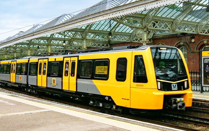
Modernisation followed. Project Orpheus, announced in 2002, was a 15-year transport plan valued at £1.5 billion, about $1.91 billion. Metro: All Change added new ticket machines, barriers at 13 stations, smart card validators, station refurbishments, track work, power upgrades, and communications improvements. Under Metro Flow, £103 million, about $130.81 million, is being used to increase frequency, reduce journey times, and improve reliability. The first replacement Class 555 articulated light rail train entered passenger service on 18 December 2024.
Future Extensions
The most advanced future expansion project is the planned Washington extension. Reported in 2025 as part of wider public transport funding for the North East, the route would use the former Leamside Line to connect Pelaw and South Hylton through Washington.
The current proposal includes new stations at Follingsby, Washington North, and Washington South, with a targeted opening date of 2033. It is intended to improve east-west connectivity and support the longer-term idea of reopening more of the Leamside Line.
Other ideas have been discussed but remain unconfirmed. These include wider restoration of the Leamside Line, potential service to places such as Shincliffe, Belmont, West Rainton, Fencehouses, and Penshaw, and possible new public transport links west from Central Station or St James. New stations in central Gateshead, the Quays, and parts of Northumberland and North Tyneside have also been suggested.
Nearby Attractions
The Tyne and Wear Metro is a practical way to reach attractions across Newcastle, Gateshead, Sunderland, and the coast without using a car. It connects city landmarks, cultural venues, seaside areas, and university districts through one regional transport network.
In Newcastle, central Metro stations put passengers near Tyne Bridge, High Level Bridge, Queen Elizabeth Bridge, Swing Bridge, Newcastle Chinatown, Haymarket, and other city-centre destinations. Gateshead stops are useful for Gateshead Sage and the Gateshead Baltic art centre.
On the Sunderland side, the Metro serves the University of Sunderland, The Murray Library, Sunderland Minster, Sunderland Empire Theatre, Sunderland Museum and Winter Gardens, and Keel Square. Coastal trips are easy too, with access to Roker and Seaburn Seafront, South Shields Beach, Cullercoats Beach, Tynemouth Castle and Priory, and South Shields.
| Station | Details |
|---|---|
| Haymarket Metro Station | Good for central Newcastle |
| Jesmond Metro | Useful for Jesmond Dene |
| Newcastle Central Station | Good for the city centre and major bridges |
| Gateshead Interchange | Useful for Gateshead attractions |
| Seaburn Metro Station | Good for the seafront |
| Tynemouth Metro Station | Useful for the coast and Tynemouth attractions |
| Cullercoats Metro Station | Good for coastal walks and Cullercoats Beach |
| South Shields Metro Station | Useful for the beach and riverside area |