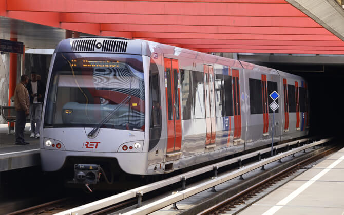
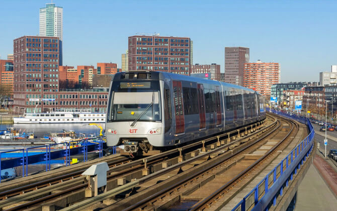
The Rotterdam Metro is the rapid transit system serving Rotterdam and nearby municipalities in the Netherlands. Operated by RET, it opened in 1968 with the Noord-Zuidlijn between Centraal Station and Zuidplein, crossing the Nieuwe Maas in a tunnel. The system now has five lines, A through E, and Line E also connects Rotterdam with The Hague through RandstadRail. Some outer branches use level crossings and overhead wires, so they work partly like light rail, but locally they are still treated as metro routes.
| Key | Information |
|---|---|
| System | Rotterdam Metro |
| Operator | RET |
| Opened | 1968 |
| First route | Noord-Zuidlijn from Centraal Station to Zuidplein |
| Current lines | Five lines: A, B, C, D, and E |
| Active stations | 70 stations |
| Regional link | Line E connects Rotterdam with The Hague |
| Notable feature | Some branches combine metro and light rail characteristics |
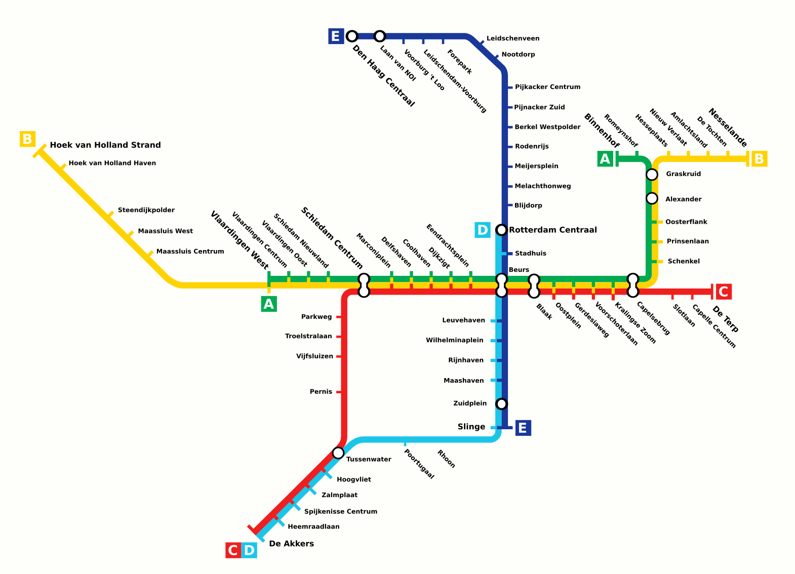
Rotterdam Metro Map
Map of Rotterdam Metro showing different lines and stations. Click on the map to enlarge it or download the Rotterdam Metro map in PDF format.
Rotterdam Metro Lines and Stations
The Rotterdam Metro route plan is built around five lettered lines. The core stations in the city center handle most transfers, while outer branches reach Schiedam, Hoek van Holland, Spijkenisse, Capelle aan den IJssel, Vlaardingen, and The Hague. For trip planning, use the stations map together with the current route timetable, because some services terminate earlier outside peak periods.
| Line | Route and details |
|---|---|
| A | Runs to Binnenhof and shares much of its route with Line B. It serves Schiedam Centrum, Beurs, Capelsebrug, and Kralingse Zoom, and outside peak hours it terminates at Schiedam Centrum. Since 1 November 2019, Line A has also run as far as Vlaardingen West on the Schiedam-Hoek van Holland railway line. |
| B | Runs between Nesselande and Hoek van Holland Strand. It was extended from De Tochten to Nesselande in September 2005 and connected to the Schiedam-Hoek van Holland railway line on 30 September 2019. Parts of the route use level crossings and overhead wires. |
| C | Runs from De Terp in Capelle aan den IJssel to De Akkers. The former Calandlijn was extended through Schiedam toward Spijkenisse on 4 November 2002, adding stations including Schiedam Centrum and Pernis. Line C meets Line D at Tussenwater. |
| D | Runs from Rotterdam Centraal via Beurs, Slinge, Rhoon, Tussenwater, and Spijkenisse Centrum to De Akkers. It connects with Lines A, B, and C at Beurs. Before the Line E connection at Rotterdam Centraal was completed in December 2011, some rush-hour trains terminated at Slinge. |
| E | Runs between Den Haag Centraal and Slinge as part of RandstadRail. It is a conversion of the former Hofpleinlijn, which became a rapid transit route in 2006, and serves Rotterdam Centraal, Pijnacker Zuid, Leidschendam-Voorburg, Laan van NOI, and Den Haag Centraal. |
The main stations list for visitors is short and easy to remember. Beurs is the key interchange, and Rotterdam Centraal is the main gateway for national rail, metro, tram, bus, and other city transport connections.
| Station | Details |
|---|---|
| Rotterdam Centraal | Main railway and metro hub, with connections to Line D, Line E, trams, buses, pedestrian routes, cycle routes, and parking. |
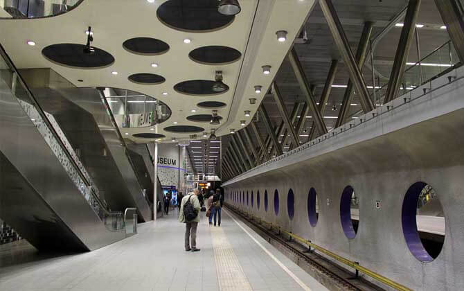
| Beurs | Main underground interchange and the only station where passengers can transfer among all five metro lines. |
| Stadhuis | Central station useful for the city center. |
| Blaak | Important central station and useful stop for exploring Rotterdam. |
| Capelsebrug | Major branching point for eastern services. |
| Schiedam Centrum | Important western station and part of the Schiedam-Hoek van Holland corridor. |
| Tussenwater | Transfer point where Line C meets Line D. |
| Hoek van Holland Strand | Line B terminus serving the coast. |
| Meijersplein | Useful for airport access by changing to bus 33. |
| Den Haag Centraal | Northern terminus of Line E and the Rotterdam-The Hague metro link. |
| Line | Termini | Stations | Length | Notes |
|---|---|---|---|---|
| A | Binnenhof – Vlaardingen West | 24 | 17.2 km (10.7 mi) | Terminates at Schiedam Centrum outside peak hours. |
| B | Nesselande – Hoek van Holland Strand | 32 | 42.4 km (26.3 mi) | Alternate trains terminate at Steendijkpolder. |
| C | De Terp – De Akkers | 26 | 30 km (18.6 mi) | Connects eastern branches with Spijkenisse. |
| D | Pijnacker Zuid – De Akkers | 23 | 21 km (13 mi) | Terminates at Rotterdam Centraal outside peak hours. |
| E | Den Haag Centraal – Slinge | 23 | 27 km (16.8 mi) | Part of RandstadRail. |
Rotterdam Metro Schedule and Frequency
The confirmed full train schedule is not listed here, so check the current RET timetable before you travel. In practical terms, the metro is described as running from early morning until late at night, with frequent service during peak hours and reduced service on weekends and public holidays.
For opening hours, opening times, operating hours, working hours, timings today, closing time, and the last train, always confirm the schedule today in the current journey planner. This is especially important for late trips, holiday service, and any route timetable changes.
| Service detail | Timings |
|---|---|
| Starting time | Early morning service is available, but exact first train times are not confirmed in the provided details. |
| Regular running time | Service runs from early morning until late at night. |
| Peak frequency | Trains run frequently during peak hours. |
| Weekend and public holiday service | Service is reduced, but trains still run regularly. |
| Friday and Saturday evenings | Some lines extend service until 02:00. |
| Closing time and last train | Check the current timetable before travel, as exact last train times are not confirmed here. |
Ticket Pricing and Types
Rotterdam Metro tickets are part of the wider RET public transport system, so the same payment setup works across metro, tram, and bus services. Options include the OV-chipkaart, disposable tickets, mobile tickets in the RET app, tourist passes, day pass products, and contactless OVpay tap-in and tap-out.
USD amounts below are approximate and included for quick comparison. Actual card charges can vary when using distance-based fares.
- RET Tourist Day Ticket: 1 day of unlimited travel across South Holland by bus, tram, metro, and waterbus for €17.50, about $19.
- RET 1 day: €12.00, about $13, for adults and €6.00, about $6.50, for children.
- RET 2-hour ticket: €5.50, about $6.
- Day ticket for 24-hour unlimited travel: €9.00, about $10.
- Multi-day ticket for 2 to 7 days: €14.00-€34.00, about $15-$37.
- OV-chipkaart: charged by actual distance, with a minimum fare of €0.99, about $1.10.
- RET 1-day family ticket: €20, about $22.
- RET 1-day group ticket: €19, about $21, for two people; €25, about $27, for three; €27.50, about $30, for four; and €30, about $32, for five.
The Rotterdam City Card is another visitor-friendly pass. It includes unlimited travel on RET public transport for 1, 2, or 3 days and gives a discount of 25% or more at selected attractions, museums, tours, and restaurants.
You can buy tickets and cards at Rotterdam Tourist Information points, RET service stores and service points, vending and charging machines in metro stations, and in some cases from bus or tram drivers. If you will ride several times, the OV-chipkaart is often the most economical card. For a distance-based ticket price, check the fare shown before you travel or use a fare calculator if your journey planner provides one.
Integration with Other Transportation Modes
Rotterdam is well connected for public transport, and the metro sits at the center of the local transport network. At Rotterdam Centraal, travelers can switch between metro, trams, buses, pedestrian routes, cycle routes, and parking in one area, which makes transfers straightforward.
The city is also working on better multimodal travel. A pilot involving RET, TU Delft, Siemens Mobility, and other partners is designed to let travelers plan combined journeys in a single app, mixing bus, tramway services, metro, shared bikes, and e-scooters.
Research in Rotterdam shows that shared micromobility can work well after a metro trip, especially when it reduces total travel time. That makes the metro more than a standalone system; it is part of a broader approach to transportation in Rotterdam and the surrounding region.
Access to the Airport
Rotterdam The Hague Airport is reachable by metro, bus, shared mobility, and car. The airport address is Rotterdam Airportplein 60, 3045 AP Rotterdam.
By public transport, take metro Line E from Rotterdam Centraal or Den Haag Centraal to Meijersplein, then change to RET bus 33 for the airport. From Rotterdam Centraal, you can also take bus 33 directly. On weekdays, the metro and bus connection can reach the airport from 05:48 in the morning, and the trip from Rotterdam Centraal takes about 30 minutes.
If you drive, use the official airport parking lots. For quick pick-up and drop-off, use the Kiss & Ride near the terminal building. Shared bikes and scooters are available in a hub directly in front of the terminal. Parking charges and parking charges per day are not listed here, so check current airport rates before driving.
- Metro Line E to Meijersplein, then bus 33
- Direct bus 33 from Rotterdam Centraal
- Kiss & Ride for pick-up and drop-off
- Official parking lots for drivers
- Shared bikes and scooters at the terminal
Useful Tips
The Rotterdam Metro is one of the fastest ways to cover longer distances in the city. It is especially useful for moving between the center, suburbs, the coast at Hoek van Holland, and The Hague on Line E.
- Look for the M signs at stations.
- Check the destination on the front of the train before boarding; the line letter and final station confirm the path train you need.
- Use Beurs for easy transfers, since all five lines meet there.
- Use OVpay if you want simple contactless tap-in and tap-out payment.
- Remember to check in and check out on every trip.
- For short stays, consider a day ticket, tourist pass, or Rotterdam City Card.
- For longer stays, a reusable OV-chipkaart is practical for metro, tram, and bus travel.
- Check a journey planner before you travel, especially for late-night service, weekend reductions, or route changes.
- If you plan to drive to a station, check station parking availability and any parking charges before you go.
System Rules
RET applies passenger rules to keep the Rotterdam Metro safe, clean, and orderly. The basics are simple: travel with a valid ticket, respect other passengers, and follow staff instructions.
- Passengers must have a valid ticket at all times.
- Vandalism of the system can lead to a fine of up to €90, about $97.
- Prams are allowed on board, but wheelchairs have priority.
- Dogs may travel for free, but they must not occupy seats.
- Bicycles are allowed only during off-peak times: weekdays from 09:00 to 16:00 and after 18:30, and all day at weekends.
- Eating, drinking, and smoking are not allowed in system facilities.
Operating times can change on special dates. On Friday and Saturday evenings, some lines extend service until 02:00, while holiday timetables may differ from the usual train schedule. Major stations provide multilingual information desks, and Chinese guide maps are available at Rotterdam Centraal.
Future Developments
Rotterdam Metro is moving into a major modernization and expansion phase. RET has approval to acquire up to 46 trainsets, including 38 trains under a fixed €578 million contract, about $624 million. First deliveries are planned for 2029, with passenger service expected to begin in 2030.
The new fleet will replace older trains and increase capacity on Line E, where headways are planned to drop from ten minutes to five minutes. If demand on Line C grows faster than expected, the city may buy eight additional trains.
The new trains are designed with wide walkways, a length of 90 meters, and a maximum speed of 100 km/h. They will also include driverless operation capability, which could support automation later. To prepare for them, approach tracks near Waalhaven harbor will be upgraded with more than €60 million, about $65 million, in public funding.
RET has also described wider long-term ambitions, including new connections toward Kralingse Zoom, Feijenoord City, Zuidplein, Charlois, and Rotterdam Central Station. Another idea is to convert part of the heavy-rail route between Rotterdam Central and Dordrecht to metro operation. The aim is to add more stations, increase service frequency, and eventually support shorter automated headways.
History
The history of the Rotterdam Metro began in 1968, when RET opened the Noord-Zuidlijn between Centraal Station and Zuidplein. The line crossed the Nieuwe Maas in a tunnel and was the first metro system in the Netherlands. At 5.9 km, or 3.7 mi, it was also one of the shortest metro lines in the world at the time.
The second line, the Oost-Westlijn, opened in 1982 between Capelsebrug and Coolhaven. In the late 1990s, the two lines were renamed the Erasmus Line and the Caland Line after Desiderius Erasmus and Pieter Caland. In December 2009, RET replaced those names with the current letter-and-color system to make the branches easier to identify.
The 2000s brought important rail conversions. Line E was created from the former Hofpleinlijn in 2006. It first used the old Hofplein station as its southern terminus, before a new tunnel opened on 17 August 2010 linking Rotterdam Centraal to the existing tracks near Melanchthonweg. At the northern end, former railway platforms at Den Haag Centraal were used until 12 February 2016, when service was suspended for construction of a new elevated station. That station opened on 22 August 2016.
Some parts of Lines A and B, north of Capelsebrug and west of Schiedam Centrum, still differ from the rest of the metro because they use level crossings and overhead wires. Most of the system uses a third rail, while Line E is another exception. Even with those differences, these branches are still generally called metro routes in Rotterdam.
Fascinating Facts
- The Rotterdam Metro was the first metro system in the Netherlands.
- The original 1968 line was only 5.9 km, or 3.7 mi, long.
- Beurs is the only station where passengers can transfer among all five metro lines.
- Line E links Rotterdam with The Hague as part of RandstadRail.
- Some outer branches function technically like light rail because they use level crossings and overhead wires.
- The current letter-and-color line names replaced older historic names in December 2009.
Touring Rotterdam via Metro
A simple metro tour of Rotterdam can start at Rotterdam Centraal and follow the central network through major underground stations. The route is useful for visitors because it keeps travel easy while showing how the city center connects with the wider metro system.
- Start at Rotterdam Centraal.
- Continue to Stadhuis for the city center.
- Travel via Beurs, the main transfer hub.
- Continue to Leuvehaven.
- End the central part of the loop at Wilhelminaplein.
The metro is also useful beyond sightseeing. Line B reaches Hoek van Holland, while Line E connects Rotterdam with The Hague. If you plan to explore all day, the Rotterdam City Card can make travel easier because it includes unlimited RET public transport for 1, 2, or 3 days.
Does the Rotterdam card provide unlimited free access to the Rotterdam metro?
Thank you