The Paris Métro is the rapid transit heart of Paris, featuring 16 lines and over 300 stations crisscrossing the city. This comprehensive 2026 guide covers everything you need for navigating the Paris Metro – from the latest Paris Metro map 2026 (available as a PDF download) to current timetables, all metro lines and major stations, updated ticket prices (in euros and USD), and an airport transfer guide. Read on for a complete Paris public transport overview, including RER commuter lines and handy travel tips to make the most of your journey in Paris.
Paris Metro Map 2026
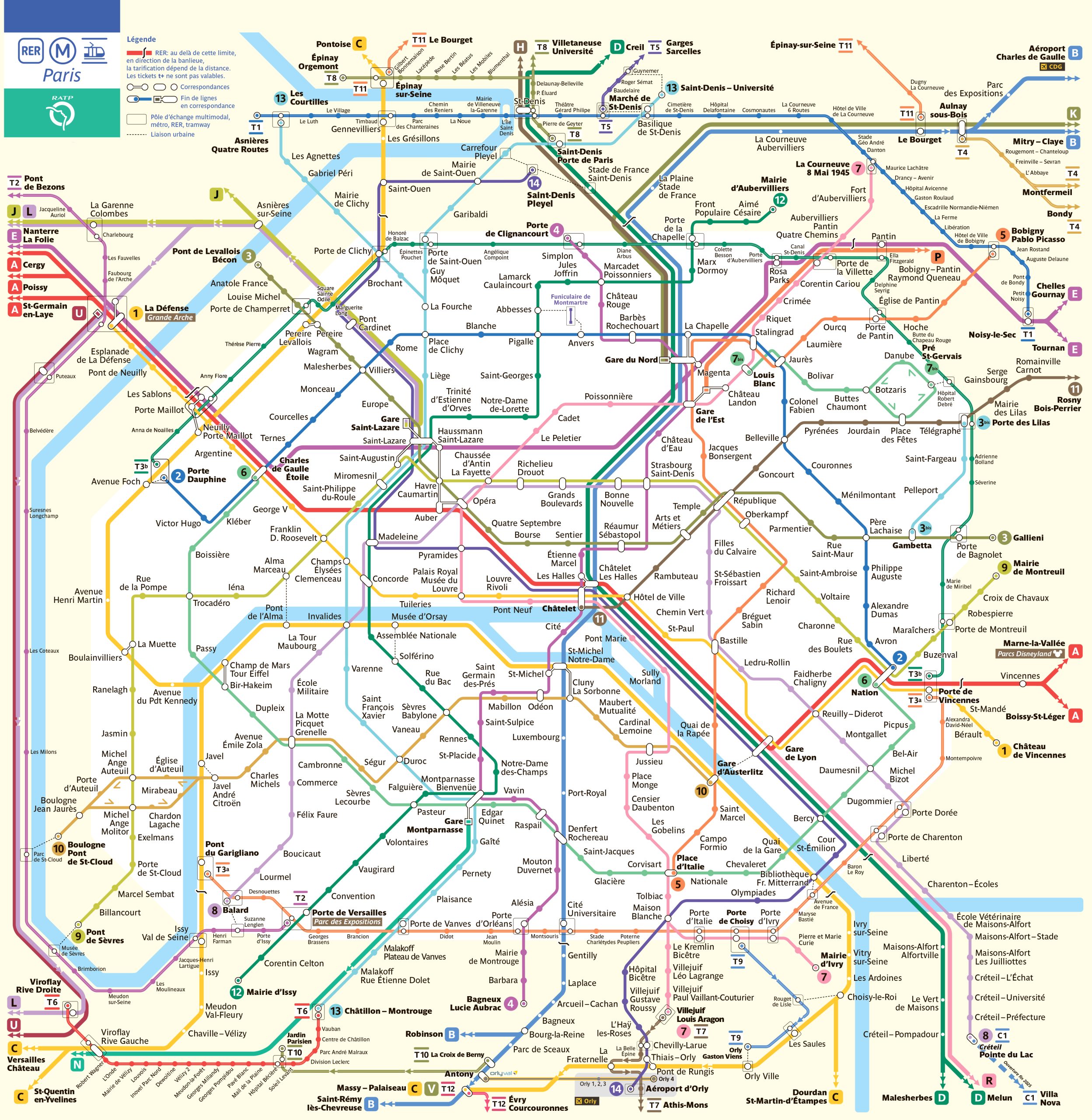
The Paris Metro map (2026 edition) reflects the extensive network of lines covering Paris and its immediate suburbs. The Metro network spans about 225 km (approximately 140 miles) and includes 16 lines (numbered 1 to 14, plus 3bis and 7bis). There are a total of 308 physical stations (with 321 station stops counting transfers), making it one of the densest metro systems in the world – on average, there is a station every 500–600 meters (about 1,600–2,000 feet) within central Paris. The official RATP Metro map can be obtained as a PDF download from the RATP website or tourist information centers. This map highlights all metro lines with their colors and terminus stations, as well as connections to RER lines, tramways, and key bus routes. It includes the latest extensions, such as the new Metro Line 14 extension to Orly Airport and Line 11’s eastward extension.
How to use the map: Each metro line is color-coded and numbered. Stations where you can transfer lines are indicated with interchange symbols. The direction of travel is indicated by the terminus station in that direction (for example, a train “Line 1 to La Défense” is heading westbound toward La Défense). Most Paris Metro maps also show the RER (suburban express) lines labeled with letters (A, B, C, D, E) and major train stations. We recommend downloading the Paris Metro 2026 PDF map to your phone or carrying a small printed copy for offline reference.
Paris Subway Map showing different lines and stations. Click on the map to enlarge it or download the Paris Metro map in PDF format.
Paris Metro Lines and Stations
The Paris Metro consists of 16 lines, each designated by a number (1 through 14, plus two minor lines 3bis and 7bis). These lines largely run within Paris city limits (Zone 1), with some extensions just beyond. Together they form an intricate grid, ensuring that most of Paris is within a few minutes’ walk of a metro station. Here’s an overview of each line and key stations:
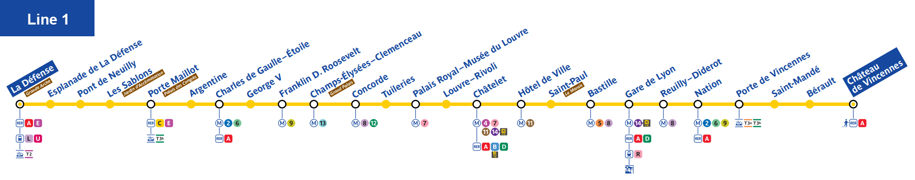
- Line 1: La Défense – Château de Vincennes. Main east-west route through the city center (Champs-Élysées, Louvre, Le Marais). Fully automated, very frequent.
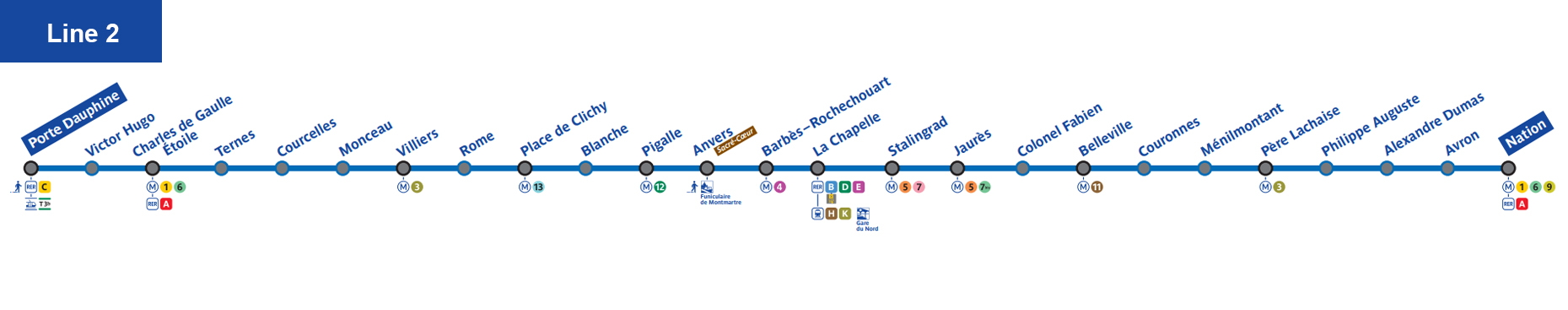
- Line 2: Porte Dauphine – Nation. Northern arc through Montmartre (Sacré-Cœur), Pigalle, Charles de Gaulle–Étoile.
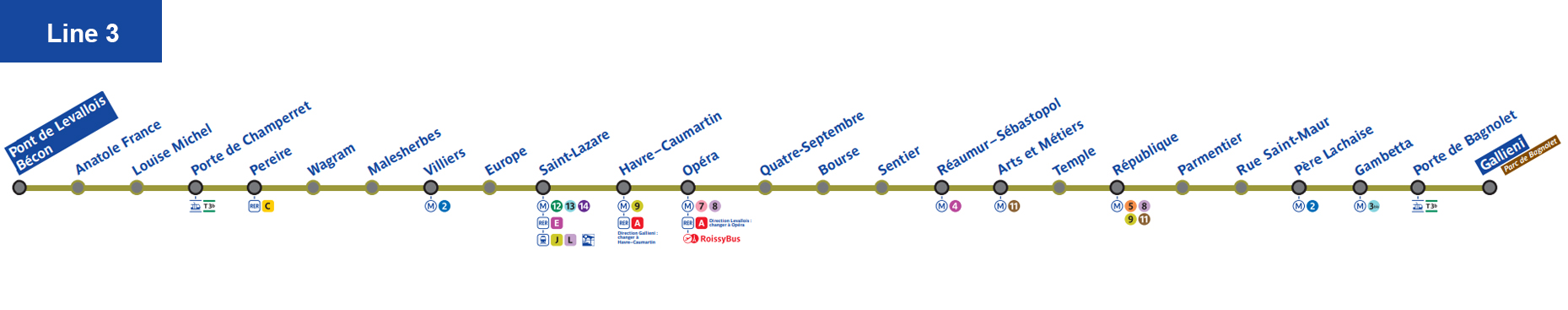
- Line 3: Pont de Levallois – Gallieni. East-west across north-central Paris (Opéra, République).
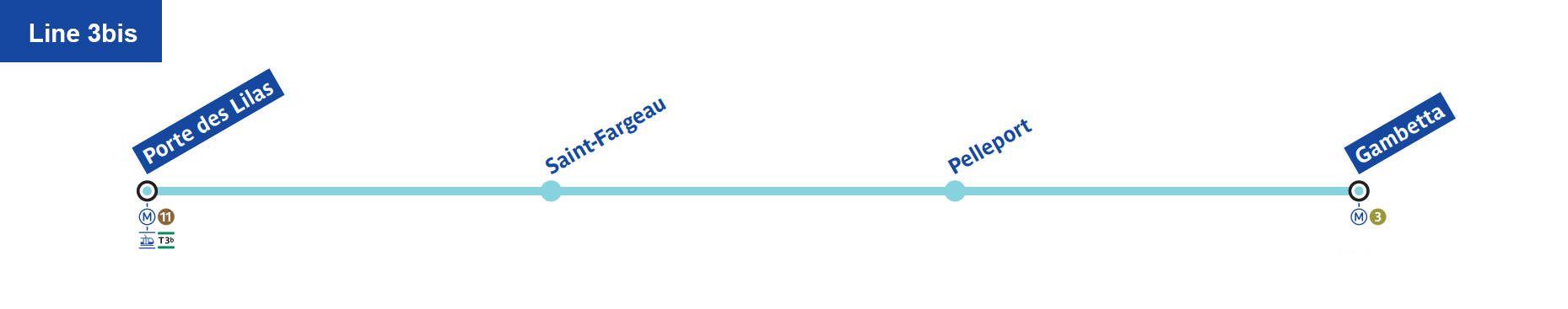
- Line 3bis: Gambetta – Porte des Lilas. Short northeast spur in the 20th arrondissement.
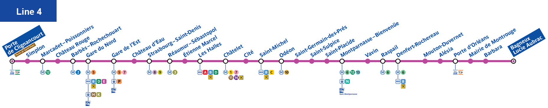
- Line 4: Bagneux – Porte de Clignancourt. North-south through Montparnasse, Saint-Germain, Châtelet–Les Halles, Gare du Nord. Recently automated and extended.
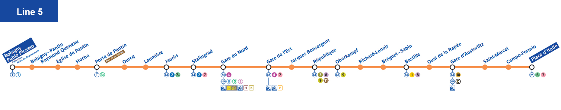
- Line 5: Place d’Italie – Bobigny–Pablo Picasso. East-west in eastern Paris (Bastille, Gare du Nord, La Villette).
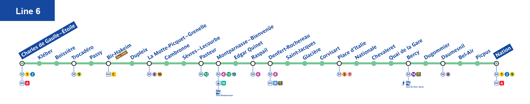
- Line 6: Charles de Gaulle–Étoile – Nation. Semi-circle south of center, elevated sections with Eiffel Tower views.
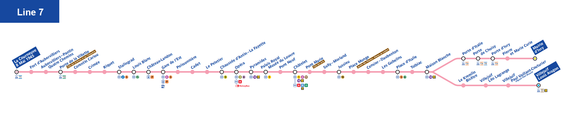
- Line 7: La Courneuve – Villejuif / Mairie d’Ivry. Two southern branches via the Louvre and Latin Quarter.
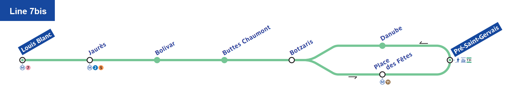
- Line 7bis: Louis Blanc – Pré Saint-Gervais. Short northeast branch.
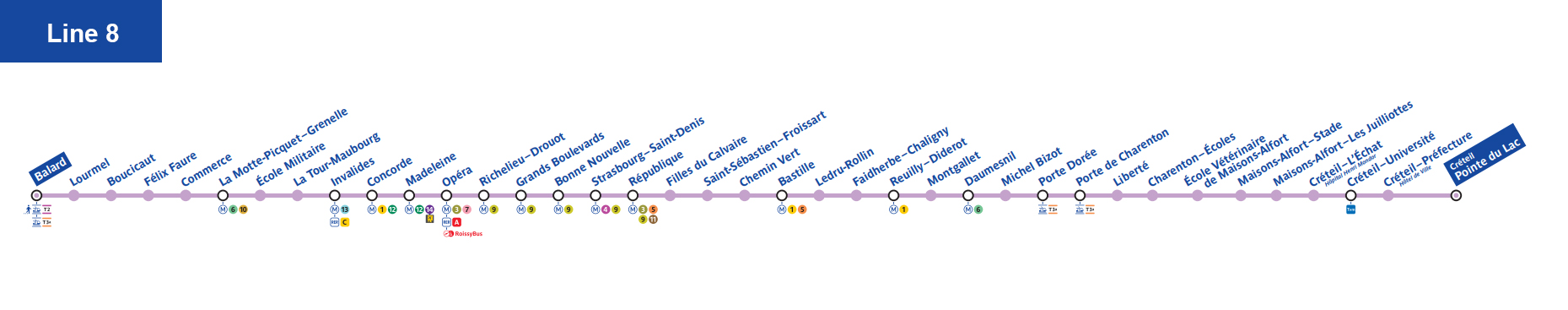
- Line 8: Balard – Pointe du Lac. Southwest to southeast (Invalides, Concorde, Bastille, Créteil).
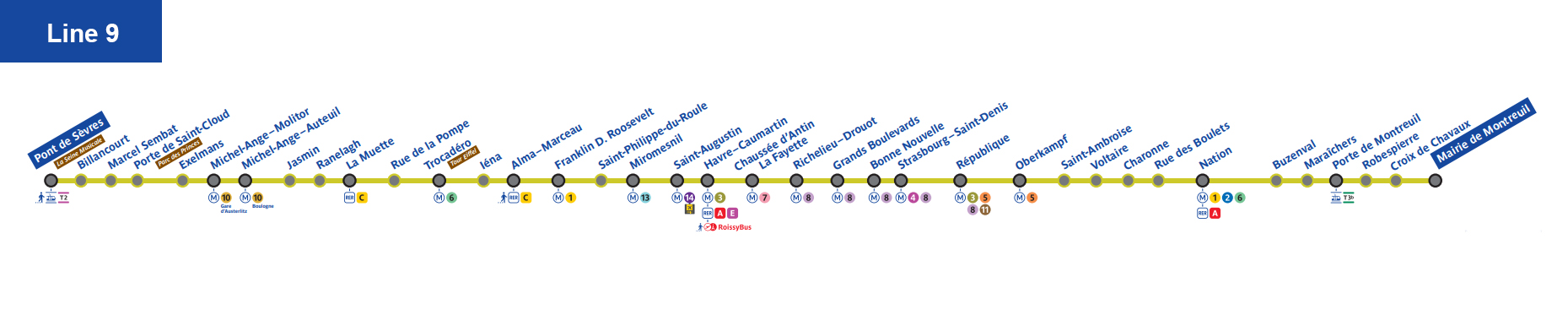
- Line 9: Pont de Sèvres – Mairie de Montreuil. West-east south of Line 1 (Trocadéro, Franklin D. Roosevelt, Nation).
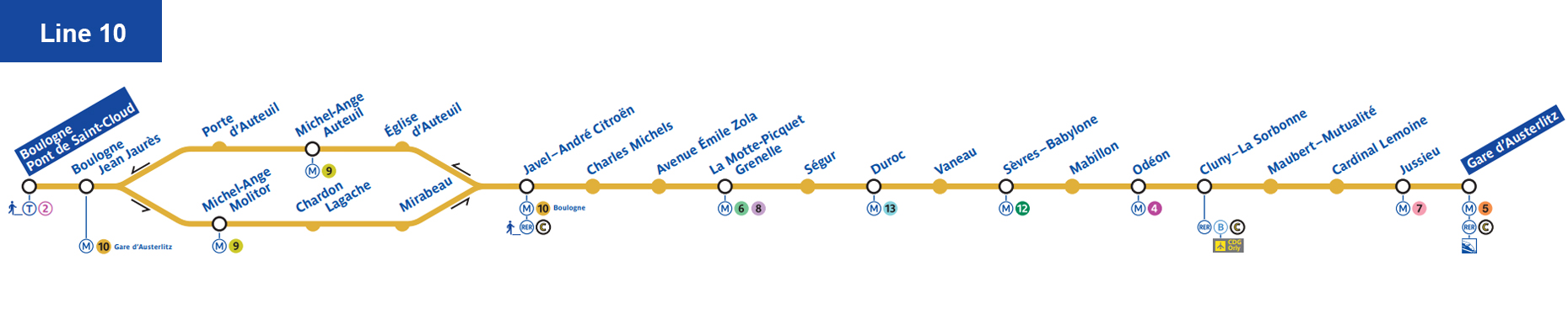
- Line 10: Boulogne–Pont de Saint-Cloud – Gare d’Austerlitz. Left Bank line (Latin Quarter).
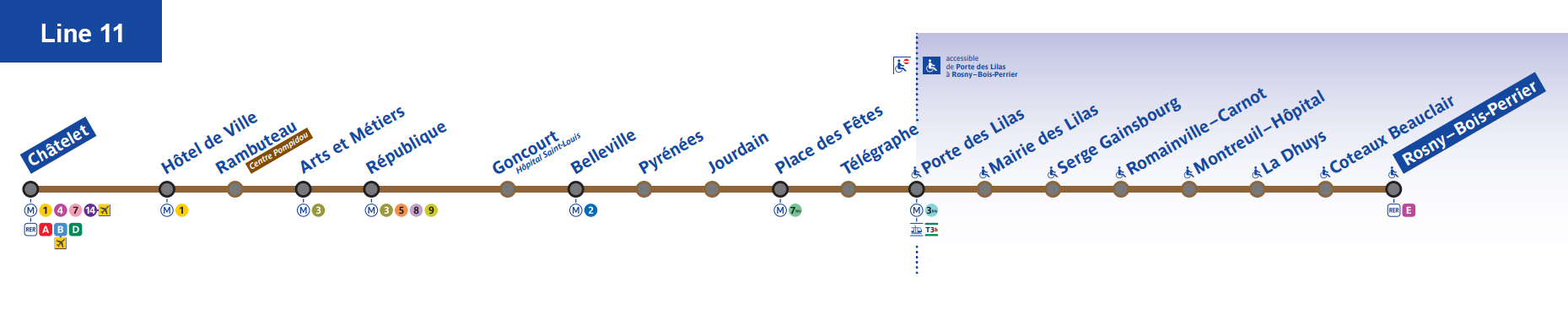
- Line 11: Châtelet – Rosny–Bois-Perrier. Extended east in 2023; future extension to Noisy–Champs planned.
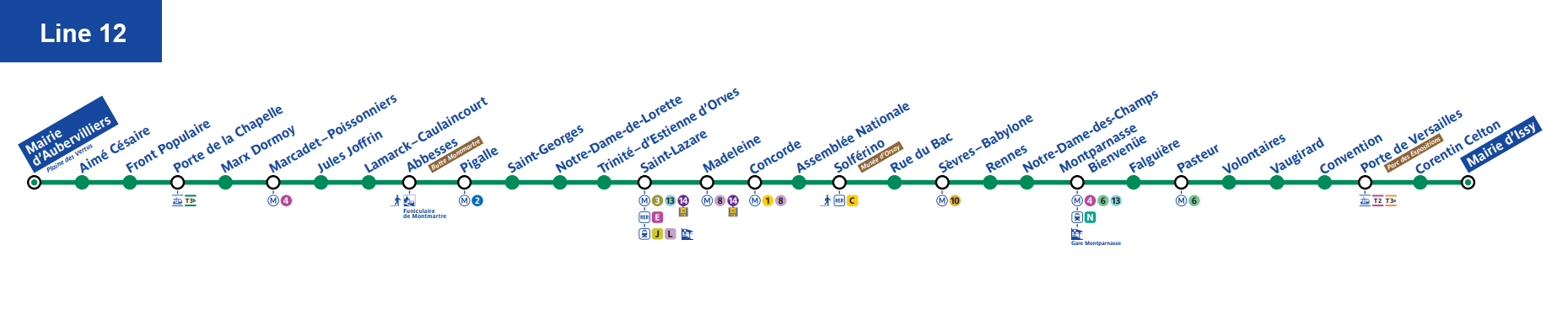
- Line 12: Mairie d’Issy – Aubervilliers. North-south via Montparnasse, St-Lazare, Pigalle; extended north in 2022.
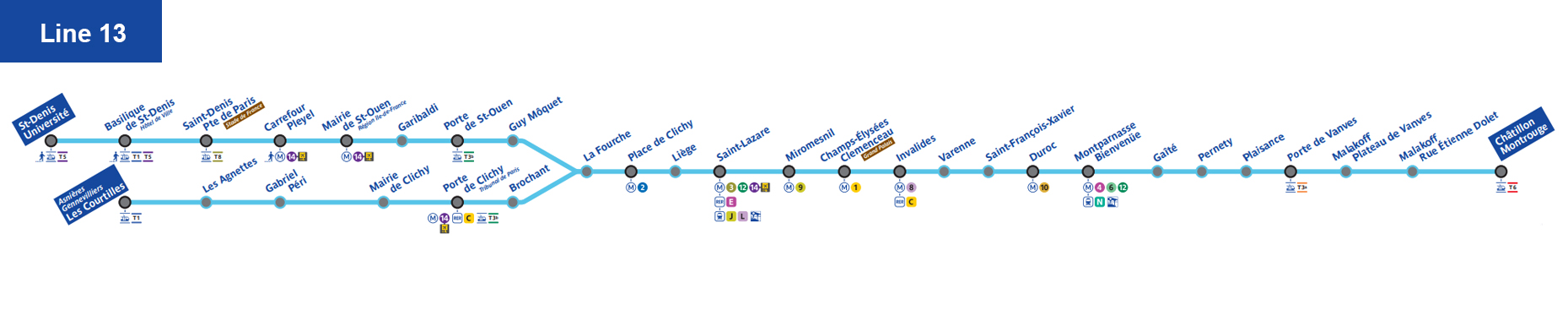
- Line 13: Châtillon–Montrouge – Saint-Denis / Asnières. Two northern branches; very crowded at peak.
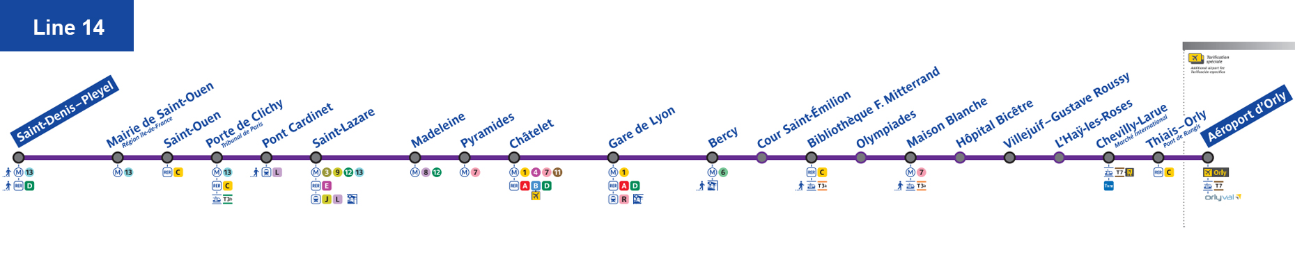
- Line 14: Saint-Denis Pleyel – Aéroport d’Orly. Fully automated; extended both north and south by 2024.
Accessibility: As of 2026, about 23 stations (mostly on newer/extended lines) have elevators. Most older stations still require stairs.
RER Lines – Paris Suburban Trains
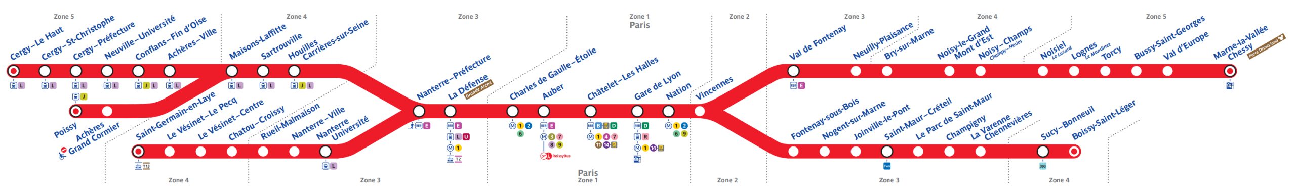
- RER A: East-west express. Key stops: La Défense, Châtelet–Les Halles, Auber. Direct to Disneyland Paris (Marne-la-Vallée–Chessy).
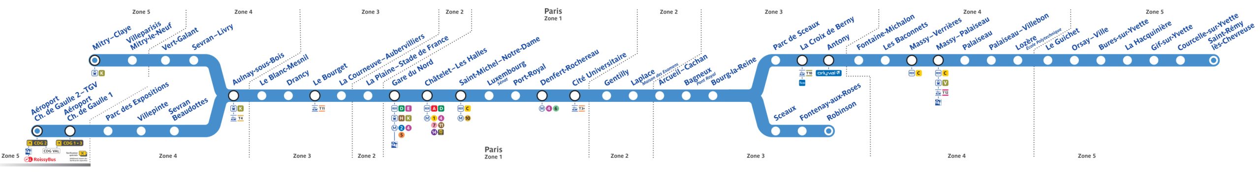
- RER B: North-south. Key stops: Gare du Nord, Châtelet, Denfert-Rochereau. Direct to Charles de Gaulle (CDG) and Orlyval at Antony.
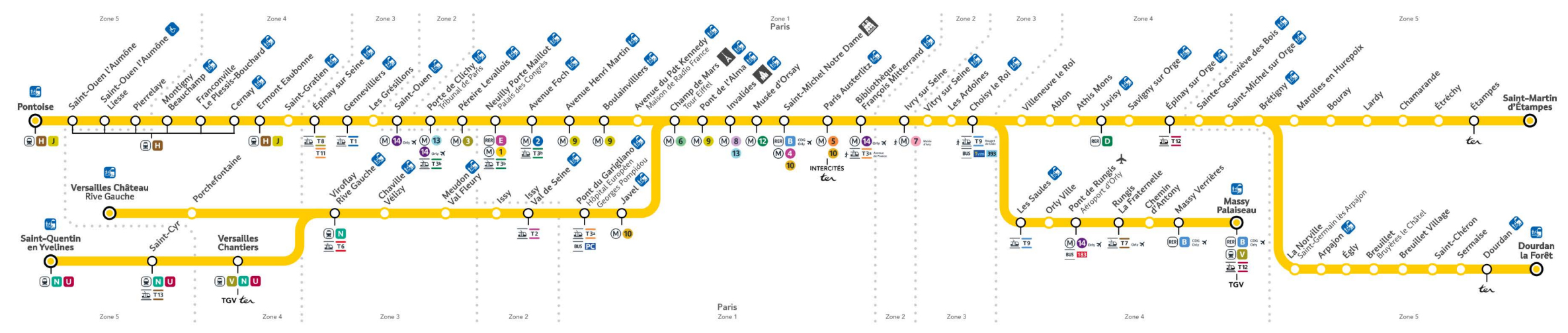
- RER C: Left Bank loop. Stops: Champ de Mars–Tour Eiffel, Musée d’Orsay, St-Michel–Notre-Dame. Direct to Versailles Château Rive Gauche.
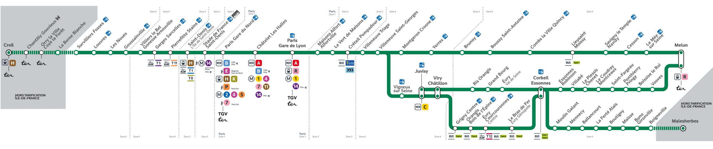
- RER D: North-south via Gare du Nord, Châtelet, Gare de Lyon. Primarily commuter line.
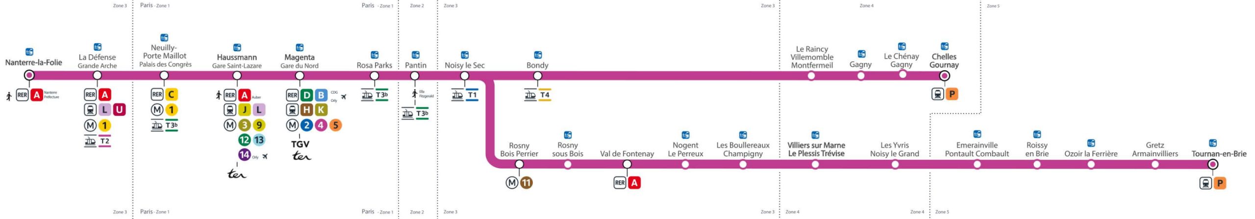
- RER E: East-west, extended to La Défense by 2026. Connects Gare du Nord and Haussmann–St Lazare to suburbs.
Paris Metro Timetable and Operating Hours
Operating hours: Paris Metro service starts early and runs until after midnight. The first trains of the day leave the end-of-line termini at around 5:30 a.m. every morning. Services run continuously throughout the day and evening, with the last trains (often called the “balai” or broom) arriving at their terminus around 1:15 a.m. on most nights. On Fridays, Saturdays, and nights before public holidays, the Metro runs an hour longer – last trains reach termini at approximately 2:15 a.m. This extended service on weekend nights makes it convenient for late outings.
Frequency: Trains are very frequent, especially in central Paris. During peak commute hours (roughly 8–10 a.m. and 5–8 p.m. on weekdays), metros typically run every 2 to 3 minutes on busy lines. Outside of rush hour, you can expect a train every 4–6 minutes, and perhaps every 7–10 minutes in later evenings or early Sunday mornings. The automated lines (Line 1, Line 4, and Line 14) usually have the shortest intervals between trains (as low as 90 seconds on Line 14 during peak times). Because of this high frequency, you rarely need to consult a timetable – just head to the platform, and a train should arrive shortly.
Night service and special events: The Metro is generally closed overnight (no service between about 1:15–5:30 a.m. on weekdays, or 2:15–5:30 a.m. on weekend nights). During these hours, the city is served by night buses (Noctilien). However, on certain special occasions the Metro may operate all night on select lines (New Year’s Eve, Fête de la Musique, Nuit Blanche, etc.). It’s always wise to check RATP announcements if you plan to be out very late on a holiday.
Paris Metro Ticket Prices and Fares
Paris Visite Pass – Pase París Visité
- 1-day (zones 1–5): €29.90 (~$32.00)
- 2-day: €44.45 (~$47.60)
- 3-day: €62.30 (~$66.65)
- 5-day: €76.25 (~$81.60)
Navigo Découverte Card – Pase Navigo Découverte
- One-time card cost: €5
- Weekly (Mon–Sun) all zones: €31.60 (~$33.80)
- Monthly all zones: €88.80 (~$95.80)
Mobilis Pass
- Day pass zones 1–2: €8.45 (~$9.05)
- Day pass zones 1–5: €20.00 (~$21.40)
Paris Pass
Paris Pass (tourist attraction bundle) includes transport unlimited for selected zones; pricing varies by duration.
Paris Metro Fare Calculator – How Much Does Paris Metro Cost?
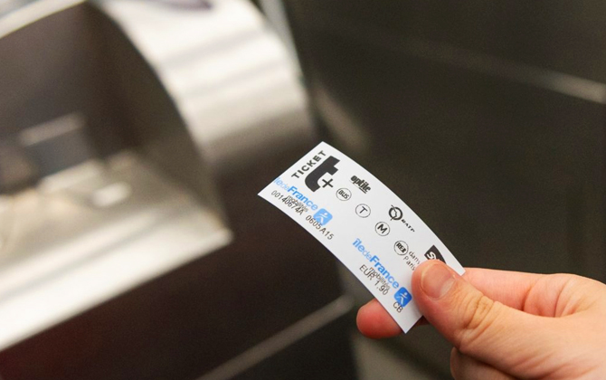
Single ride (Metro/RER): €2.50 (~$2.68), valid 2 hours including transfers (excluding airports).
Bus/Tram single: €2.00 (~$2.14).
Airport ticket: €13.00 (~$13.90) covers CDG & Orly.
Fines in the Paris Metro – Avoid Penalties
Inspectors conduct random checks. Fine for no valid ticket: €50–€150. Always validate your ticket/pass upon entry.
Accessibility in the Paris Metro System
Only ~23 stations are wheelchair-accessible (with elevators), mostly on Lines 14, 1 extensions, and recent branch extensions. Consider buses or RER for step-free travel.
Paris Metro Expansion Plans
Key 2026 projects:
- Line 14 extensions: Completed to Orly and Saint-Denis Pleyel.
- Line 11 extension: Extended east to Rosny–Bois-Perrier in 2023.
- Grand Paris Express:
- Line 15 South: Pont de Sèvres ↔ Noisy–Champs (opening late 2026).
- Line 16 & 17: Phased openings 2026–2028.
- Line 18: Orly ↔ Saclay ↔ Versailles (2026–2030).
Connection from Paris Metro to Airport
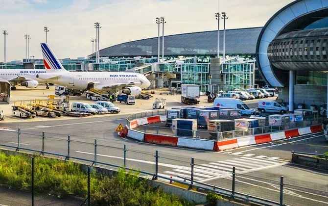
Charles de Gaulle Airport (CDG)
- RER B: Châtelet → CDG in ~35 min, €13
- Roissybus: Opéra → CDG in ~60 min, €13
- Taxi: Flat €55–€60 (30–60 min depending on traffic)
Orly Airport (ORY)
- Metro Line 14: Châtelet → Orly in ~30 min, €13
- RER B + Orlyval: Châtelet → Antony → Orly in ~30 min, €13
- Tram T7: Villejuif → Orly in ~30 min, €2 ticket
- Taxi: Flat €35–€40 (20–30 min)
Beauvais Airport (BVA)
- Shuttle bus: Porte Maillot ↔ BVA in ~75 min, €17 one-way
- Train + bus: Gare du Nord → Beauvais (~1h15, €12) + local bus/taxi (~€3)
Parking Charges at Paris Metro Stations (Cost per Day)
- Typical park-and-ride: €4–€7 per day
- Major hubs (La Défense, Clichy): €8–€12 per day
- Smaller suburban stations: €2–€5 per day
Paris Metro Safety Tips – Is Paris Metro Safe?
- Keep bags zipped and in front of you.
- Stand right, walk left on escalators.
- Offer priority seats to those in need.
- Follow station signage and staff instructions.
How to Use the Paris Metro (Beginner’s Guide)

- Buy/validate your ticket or pass before entering.
- Check direction by terminus station name.
- Allow extra time for large transfer stations.
- Use official apps for real-time updates.
Bus & Tramway Connections in Paris
Buses and trams fill gaps outside Metro coverage. A single €2 ticket (bus/tram) allows transfers for 90 min. Popular bus routes: 72 (Seine sightseeing), 69 (to Gare du Nord), 82/91 (to Montmartre).
Curious Facts and History
- Opened in 1900 for the Exposition Universelle.
- Art Nouveau entrances designed by Hector Guimard.
- One of the world’s busiest — ~4 million daily riders pre-pandemic.
- Line 14 is the first fully automated line (opened 1998, extended 2024).
- Grand Paris Express will add 200 km of new lines by 2030.