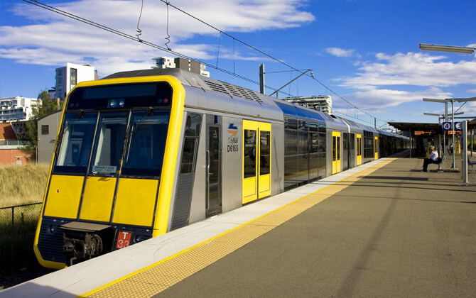
CityRail was the passenger railway brand used for train services in Sydney, Newcastle, and Wollongong in New South Wales, Australia. It began in January 1989 and remained in use until June 2013, when the system was replaced by Sydney Trains and NSW TrainLink. In its final month, CityRail covered 307 stations and more than 2,060 km (about 1,280 miles) of track, linking suburban Sydney with intercity and regional destinations.
| Key | Information |
|---|---|
| System name | CityRail |
| Service area | Sydney, Newcastle, Wollongong, and surrounding regions in New South Wales |
| Operating period | January 1989 to June 2013 |
| Successor operators | Sydney Trains and NSW TrainLink |
| Final network size | 307 stations and more than 2,060 km (about 1,280 miles) of track |
| Annual journeys | 306 million journeys in the year ended 30 June 2012 |
| Main hub | Central Station |
| Transport role | Suburban, intercity, regional, and late-night bus connections for public transport across the region |
Sydney CityRail Map
Map of Sydney Metro showing different lines. Click on the map to enlarge it or download the Sydney Metro map in PDF format.
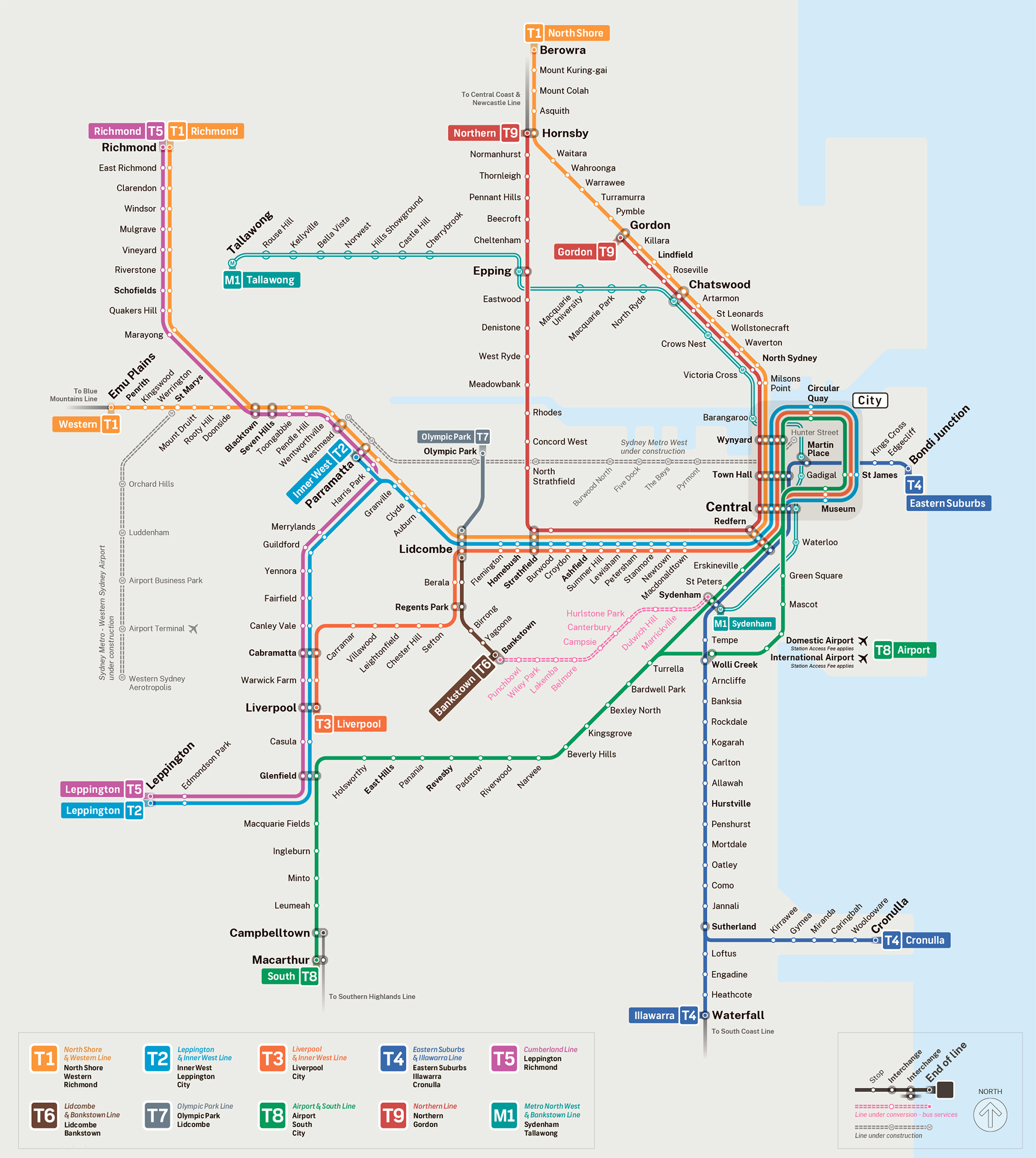
Sydney Metro Lines and Stations
CityRail ran a wide rail network across Sydney and beyond. Its route plan connected the city centre with suburbs and regional destinations including Newcastle, Bathurst, Goulburn, Kiama, Bomaderry, and Port Kembla. The suburban network was centred on Central Station, with many trains passing through the City Circle before continuing outward.
Most intercity services also used Central as their terminus, while regional services operated from Newcastle. For anyone reading an old CityRail stations map or stations list, it helps to remember that the network mixed metro-style suburban travel with longer interurban trips.
| Station | Details |
|---|---|
| Airport & East Hills Line | City Circle to Macarthur, with peak services to Kingsgrove via Sydenham or the Airport. |
| Bankstown Line | City Circle to Liverpool or Lidcombe via Bankstown. |
| Carlingford Line | Clyde to Carlingford, with limited services to Lidcombe and Central. |
| Cumberland Line | Blacktown to Campbelltown. |
| Eastern Suburbs & Illawarra Line | Bondi Junction to Waterfall or Cronulla. |
| Inner West Line | City Circle to Bankstown or Liverpool via Regents Park. |
| Northern Line | Epping to Hornsby via Strathfield, Central, and Macquarie Park. |
| North Shore Line | Central to Berowra via Gordon. |
| Olympic Park Line | Lidcombe to Olympic Park, with selected special-event services from Central. |
| South Line | City Circle to Campbelltown via Granville. |
| Western Line | Central to Emu Plains or Richmond via Parramatta. |
| Blue Mountains Line | Central to Lithgow, with limited services to Bathurst. |
| Newcastle & Central Coast Line | Central to Newcastle. |
| South Coast Line | Central to Bomaderry or Port Kembla. |
| Southern Highlands Line | Campbelltown to Moss Vale, with limited services to Goulburn. |
| Central Station | Main hub for suburban and intercity services. |
| Town Hall, Wynyard, Lidcombe, Parramatta, Liverpool, Glenfield, Hornsby, Chatswood, Circular Quay, and Campbelltown | Major interchange stations, with connections to trains and, at selected locations, bus, ferry, light rail, or other rail services. |
CityRail also used connecting bus services on several intercity corridors, including routes linked with the Blue Mountains, Newcastle & Central Coast, South Coast, and Southern Highlands lines. In the suburban core, trains often continued across the city, while intercity and regional services usually ended at Central.
Operating Hours
For today’s successor Sydney Trains services, the general operating hours run from 3:51am to 2:25am the following day. Some timetable information also lists opening hours as around 4:00am to 1:00am, so the exact opening times, closing time, and last train depend on the route.
| Service detail | Timings |
|---|---|
| Typical starting time | From about 3:51am, with some services shown from around 4:00am. |
| Typical closing time | Until about 2:25am the following day, though some route timetable information shows services finishing around 1:00am. |
| Regular frequency | Usually every 6-8 minutes. |
| Peak frequency | About every 3-5 minutes. |
| Schedule today and timings today | Check the current train schedule before travelling, as timings vary by route and time of day. |
The working hours are broad, but the network does not run the same way on every line all day. Some services start earlier, some run later, and the last train can change by route. For current timetable updates and service information, passengers can use the official trip planning tools or call 131 500.
Fares
Sydney Trains uses the Opal ticketing system. Passengers tap on and tap off with an Opal card, a credit or debit card, or a linked device. If none of those options is available, an Opal single trip ticket is required.
Opal cards are smartcards for public transport in New South Wales. Reduced fare options are available for Concession, Child/Youth, and Gold Senior/Pensioner Opal card holders. The ticket price is based on distance travelled, and trips involving suburban, metro, and intercity train services are calculated as one fare with no interchange penalty.
| Fare band | Distance | Adult card/contactless peak | Adult card/contactless off-peak | Other cards peak | Other cards off-peak | Adult single trip | Child/Youth single trip |
|---|---|---|---|---|---|---|---|
| Short trip | 0-10 km (0-6.2 miles) | A$4.33 | A$3.03 | A$2.16 | A$1.51 | A$5.20 | A$2.60 |
| Medium trip | 10-20 km (6.2-12.4 miles) | A$5.38 | A$3.76 | A$2.69 | A$1.88 | A$6.50 | A$3.20 |
| Longer suburban trip | 20-35 km (12.4-21.7 miles) | A$6.20 | A$4.34 | A$3.10 | A$2.17 | A$7.40 | A$3.70 |
| Intercity-style trip | 35-65 km (21.7-40.4 miles) | A$8.28 | A$5.79 | A$4.14 | A$2.89 | A$9.90 | A$4.80 |
| Longest band | 65 km+ (40.4 miles+) | A$10.66 | A$7.46 | A$5.33 | A$3.73 | A$12.80 | A$6.40 |
For the fares above, senior and pensioner card values are A$2.50 where applicable. Off-peak travel is cheaper on weekdays between 10am and 3pm, and again after 7pm. On weekends and holidays, riders receive a 30% discount on Train, Bus, and Light Rail services when using an Opal card or contactless payment method.
Airport station access fees are added when using the privately operated Sydney Airport stations. A fare calculator can help estimate the full cost before travel.
| Airport station access fee | Route | Adult cards | Other cards |
|---|---|---|---|
| Airport access | Domestic or International Airport to/from all other stations | A$17.92 | A$16.03 |
| Airport to Green Square | Domestic or International Airport to/from Green Square | A$12.05 | A$12.05 |
| Airport to Mascot | Domestic or International Airport to/from Mascot | A$9.65 | A$9.65 |
| Between airport terminals | Domestic to/from International | A$5.00 | A$5.00 |
| Cap type | Adult cards | Other concession cards | Senior/pensioner cards |
|---|---|---|---|
| Daily Monday-Thursday | A$19.30 | A$9.65 | A$2.50 |
| Daily Friday, Saturday, and Sunday | A$9.65 | A$4.80 | A$2.50 |
| Weekly | A$50.00 | A$25.00 | A$17.50 |
| Weekly airport station access fee | A$36.36 | A$32.58 | A$32.58 |
The minimum Opal top-up is A$10 for an adult card and A$5 for a child card. Top-ups are available in A$10 increments, and unused balance refunds must be requested by mail. Students travelling to and from school can apply for a free school Opal card. Opal single trip tickets are available only for metro, train, ferry, and light rail services.
Connection to the Airport
The train was one of the quickest ways to reach Sydney Airport. Services ran from City Circle stations, Central Station, and stations on the Airport & East Hills Line. The route served both Domestic Airport Station and International Airport Station.
| Service detail | Timings |
|---|---|
| Central to Domestic Airport Station | About 10 minutes. |
| Central to International Airport Station | About 12 minutes. |
| Weekday frequency | About six to eight services per hour from 6:00am to 10:00pm, then four per hour until the last train. |
| Weekend and public holiday frequency | Four services per hour. |
Tickets to airport stations were available from any CityRail station. Return tickets covered two trips to and from one destination only, and passengers had until 4:00am the next day to complete travel. Because the airport stations were managed by AirportLink, an extra Station Access Fee applied unless Domestic Airport or International Airport was listed as the origin or destination on the ticket.
Concession fares, group fares, and tourist tickets could also be purchased. The fare calculator was useful for checking the price before the trip.
Central Station was the main interchange for the Airport Line. Passengers could connect there from the Eastern Suburbs Line, Bankstown Line, Inner West Line, South Line, North Shore Line, Western Line, Northern Line, Blue Mountains Line, and Newcastle & Central Coast Line. Travellers from the Illawarra Line and South Coast Line could change at Wolli Creek.
The airport stations are inside the Domestic and International terminals, only minutes from check-in desks by escalator or lift. The International station is accessed from the arrivals level past Arrivals Hall A, while the Domestic station is reached from the arrivals level of the T2 and T3 terminals. Trains have luggage space in the end vestibule areas near carriage entrances.
Interconnections
CityRail stations were tightly connected with buses and other rail lines, making the system a core part of local transport and city transport across Sydney. Central Station was the main interchange, and many suburban routes shared platforms or continued through the city rather than ending there.
| Line | Interconnection details |
|---|---|
| T1 | Wynyard, Town Hall, Central, and Redfern connected with T2, T3, T4, and T8. Central also linked to light rail. Other interchange points included Burwood, Strathfield, Lidcombe, Auburn, Clyde, Granville, Harris Park, Parramatta, Westmead, Wentworthville, Pendle Hill, Toongabbie, Seven Hills, Blacktown, Marayong, Quakers Hill, and Schofields. |
| T2 | Museum, St. James, Circular Quay, Wynyard, Town Hall, Central, and Redfern connected with other CityRail lines. Further links were available at Burwood, Strathfield, Lidcombe, Auburn, Clyde, Granville, Harris Park, Parramatta, Cabramatta, Warwick Farm, Liverpool, Glenfield, and several T5 stations. |
| T3 | Town Hall, Wynyard, Circular Quay, St. James, Museum, Central, and Redfern provided city-centre interchange. St. Peters and Sydenham connected with selected lines during peak hours, while Lidcombe, Cabramatta, Warwick Farm, and Liverpool linked with other suburban services. |
| T4 | Town Hall, Central, and Redfern connected with T1, T2, T3, and T8. Sydenham connected with T3 and T8 during peak hours, and Wolli Creek connected with T8. |
| T5 | Parramatta and Harris Park connected with T1 and T2. Cabramatta, Warwick Farm, Liverpool, Glenfield, Schofields, Quakers Hill, Marayong, Blacktown, Seven Hills, Toongabbie, Pendle Hill, Wentworthville, and Westmead also served as interchange points. |
| T6 | Clyde connected with T1 and T2. |
| T8 | Town Hall, Wynyard, Circular Quay, St. James, Museum, Central, and Redfern connected with multiple city lines. Wolli Creek connected with T4, and Glenfield connected with T2 and T5. |
These interchanges made it possible to build a practical path train route across the city, often using one transfer at a major station rather than several smaller changes.
Regulations
Sydney Metro rules require passengers, operators, and contractors to follow safety and operating conditions when rolling stock is planned, moved, removed, or operated on Sydney Metro rail infrastructure. The aim is simple: keep people, rolling stock, and rail assets safe.
All work in the rail corridor must be planned, risk assessed, carried out by competent and fit persons, supported by certified plant and equipment, and authorised before it begins. Rolling stock must be registered before use unless an authorised Sydney Metro representative has issued a specific waiver or exemption.
Before travel or operation, vehicle operators must receive instructions covering the technical and safety requirements they need to follow. Movement of classified rolling stock must be authorised by the Possession Protection Officer, and access to a track section is allowed only within the limits of a Sydney Metro Local Possession Authority.
Self-propelled rolling stock must have radio communication, headlights, warning lights, audible warning equipment, and minimum emergency equipment. Additional controls apply to consist operations, loading, handbrake and parking brake requirements, level crossings, points, hot weather speed restrictions, disabled rolling stock, fire response, convoy operation, and stabling.
History
CityRail was established in January 1989 as a passenger rail brand operated by the State Rail Authority. It served Sydney, Newcastle, and Wollongong, and became part of RailCorp in 2004. The brand ended in June 2013, when Sydney Trains took over suburban services and NSW TrainLink took over intercity and regional services.
CityRail was created under the Transport Administration Act 1988 (NSW) and was first mentioned as a separate entity from the State Rail Authority in the Parliament of New South Wales on 21 February 1990. Its blue and yellow version of the State Rail Authority L7 logo remained in use until 2010, when it was replaced by the NSW Government’s Waratah logo.
On 1 January 2004, RailCorp took over all functions of the State Rail Authority and later absorbed functions from the Rail Infrastructure Corporation and Rail Access Corporation. CityRail then sat within RailCorp alongside CountryLink.
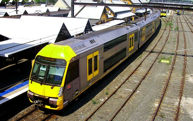
When the CityRail brand appeared, the State Rail Authority was already receiving 450 Tangara carriages. The last single-deck suburban sets were withdrawn in 1992, followed by the last U set interurban trains in 1996.
In February 1994, the first of 15 two-car Endeavour railcars arrived, replacing Class 620/720 railcars, Class 900 railcars, and locomotive-hauled stock. The Airport railway line opened to CityRail services in May 2000. The first of 141 M set carriages entered service in July 2002, followed by the first of seven two-car Hunter railcar trains in November 2006.
More changes followed: Oscar carriages on the South Coast Line in December 2006, the Epping to Chatswood shuttle in February 2009, integration of that line into the Northern Line later in 2009, and the first Waratah trains in July 2011. A new Bathurst to Sydney service began in October 2012.
By the time CityRail ceased in June 2013, the network reached the upper Hunter Valley to the north, the Shoalhaven and Southern Highlands to the south, and Bathurst to the west. In the year ended 30 June 2012, it recorded 306 million journeys.
Future Projects
Sydney Metro expansion is continuing through major projects under construction and others in planning. The City & Southwest project will extend the current network from Sydenham to Bankstown, with completion scheduled for mid-to-late 2026.
Sydney Metro West will add a 24 km (about 14.9 miles) line from Westmead to Hunter Street in the Sydney CBD. The project includes ten stations and fully underground twin tracks, with planned service to Parramatta and Sydney Olympic Park when it opens in 2032.
The Western Sydney Airport project will add about 23 km (about 14.3 miles) of rail from St Marys to Bradfield Station in Badgerys Creek. It will include six stations and serve Western Sydney International Airport when the airport opens for passenger services.
Longer-term planning includes business cases funded in the 2023-24 NSW Budget for:
- a future rail connection between St Marys and Tallawong via Schofields and Marsden Park
- future rail connections between Bradfield and Leppington or Glenfield
- future rail connections between Bradfield and Campbelltown or Macarthur
Other planning proposals include a possible North West line extension to St Marys via Schofields, a western extension from Westmead to Bradfield Station or Western Sydney Airport, and further southern extensions from Bankstown toward Glenfield and beyond. When all current projects are complete, Sydney Metro is expected to reach 46 stations and 113 km (about 70.2 miles) of track.
Tourist Sites
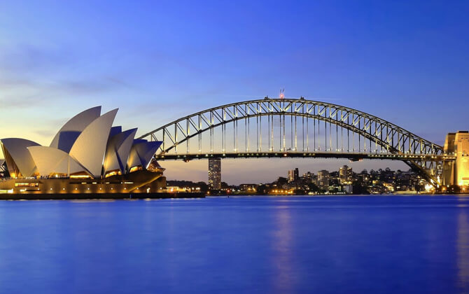
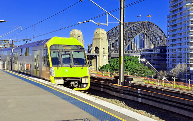
Sydney’s best-known landmarks are easy to reach by train, especially around the central city and harbour. The Sydney Opera House is near Circular Quay Station, served by the T2, T3, and T8 lines. The Sydney Harbour Bridge is also accessible from Circular Quay, making the station one of the most useful stops for visitors.
Both landmarks are especially striking at night and offer classic views of Sydney Harbour. For many travellers, Circular Quay is the easiest starting point for sightseeing.
Nearby areas include The Rocks, known for harbour views and historic streets, and the wider CBD, which is well connected by Sydney’s train network. Light rail also links destinations such as Chinatown, Central Station, and the harbour. These modern tramway-style services are useful when combining transport with sightseeing.
From Circular Quay, ferries, trains, and light rail services connect visitors with key attractions and scenic waterfront areas across the city.