Public transportation in New York is one of the largest and most heavily used urban transport systems in the world. It includes the subway, city bus routes, taxis, ferries, commuter rail, the Roosevelt Island Tram, and airport links. For many residents and visitors, public transport is the main way to move around the city, not a backup option. The subway is the core of the system, but buses, local transport connections, and airport services also play a big role in daily transportation in New York.
| Key | Information |
|---|---|
| Main public transport operator | Metropolitan Transportation Authority (MTA) |
| Main system | New York City Subway |
| Subway opening date | October 27, 1904 |
| Subway stations | 472 stations in operation |
| Subway route length | 248 miles (399 km) |
| Revenue track length | 665 miles (1,070 km) |
| Total track length | 850 miles (1,368 km) |
| Subway service pattern | Typically 24/7, with exceptions during emergencies, disasters, and planned service changes |
| ADA-accessible subway stations | 159 as of January 2025 |
| Bus network size | More than 300 routes |
| Bus fleet | More than 5,000 buses |
| Taxi fleet | Over 12,000 taxis as of 2023 |
| Tram service | Roosevelt Island Tram |
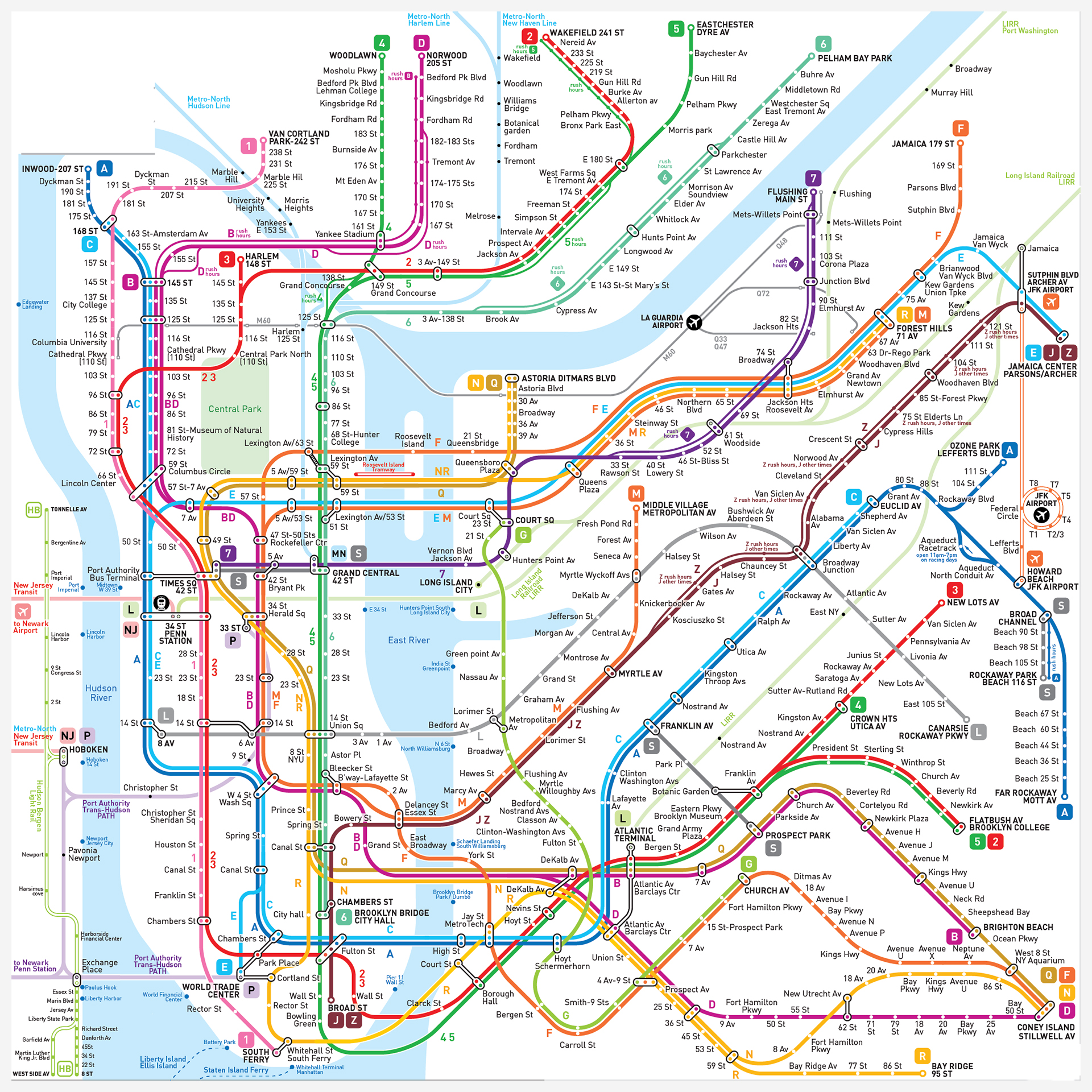
Map of Public transportation In New York
Map of New York Subway showing different lines and stations. Click on the map to enlarge it or download the Yerevan Metro map in PDF format.
New York Subway (MTA New York City Transit)
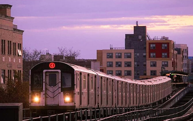
The New York City Subway is the main rapid transit system for Manhattan, Brooklyn, Queens, and the Bronx. It is owned by the City of New York and leased to the New York City Transit Authority, an affiliate of the MTA. For anyone planning city transport in New York, this is the system most trips revolve around.
New York City Transit manages subway and bus service across the city. For service information and customer support, riders can call 511. The main address listed is 2 Broadway, New York, NY 10004.
Opened on October 27, 1904, the subway is one of the oldest and busiest public transport systems anywhere. It has 472 stations in operation, and its operating hours are famously broad: service has historically run 24 hours a day, every day, except during emergencies and major disruptions.
The network is also huge. It includes 248 miles (399 km) of routes, 665 miles (1,070 km) of revenue track, and 850 miles (1,368 km) in total when non-revenue trackage is included. Around 40% of the track is above ground, and many lines provide both local and express service.
The subway uses 28 routes or services, including three short shuttles. Routes are identified by letters or numbers, while lines refer to the physical tracks. If you are checking a route plan, train schedule, or timetable, that distinction matters. Service changes can happen late at night, on weekends, or during construction, and shuttle bus replacements may be introduced when trains are not running.
Station access and fare payment
Most stations are entered from street level by stairs, and many include mezzanines with fare control areas. Riders can still use station booths or vending machines, but fare payment is now mainly handled through OMNY. MetroCard remains accepted during the transition period.
This is the key ticket and fare setup for most subway trips. If you are comparing fare options, the system accepts standard contactless payment through OMNY, and unlimited passes are still part of the wider transit setup during the transition from MetroCard.
Many stations were built long before current accessibility standards. The MTA has been adding elevators and other upgrades, and as of January 2025 there were 159 ADA-accessible stations.
Operations and modernization
The MTA has continued to modernize the system to improve reliability, capacity, and station conditions. Work has included signal upgrades, station rebuilds, and new rolling stock intended to carry more passengers.
Safety and day-to-day service management remain central priorities. At the same time, the system still faces familiar pressures: heavy demand, maintenance needs, and budget constraints. So while the subway runs around the clock, actual opening times, timings today, route timetable details, and last train information can vary by line and planned work.
Useful contact information
- Agency: Metropolitan Transportation Authority
- Division: Metropolitan Transportation Authority Customer Service
- Phone Number: 511
- Business Hours: Daily, 6 AM – 10 PM
Bus service in New York
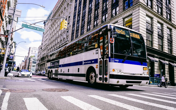
Bus service is a major part of public transport in New York and helps fill the gaps the subway does not cover directly. New York City Transit, a division of the MTA, operates the city bus network across all five boroughs.
MTA Regional Bus Operations runs local, limited-stop, express, and Select Bus Service routes. The network includes more than 300 routes, many with 24/7 service, and a fleet of over 5,000 buses, the largest in the United States.
Two operating companies make up the bus system: MTA New York City Bus, which covers most city routes, and MTA Bus, which mainly serves Queens and grew out of seven former private bus companies. In practice, though, they function as one system with shared fare rules, customer service, and schedule information.
Routes are organized by borough and service type. Local routes use borough prefixes such as B, Bx, M, Q, and S, while express routes use X. Riders can check bus arrival information through QR codes at many stops, and some stops also have digital displays showing live timings.
Select Bus Service is New York City’s bus rapid transit brand. It was developed by NYC DOT and the MTA to improve speed, frequency, and reliability through bus lanes, off-board fare payment, and transit signal priority. NYC DOT also supports bus operations through street design, bus shelters, and wider bus priority work across the city.
For bus schedule, route, and timetable information, riders can use MTA bus schedules or call 511. NYC DOT supports infrastructure, but it does not operate bus service directly.
Taxi service in New York
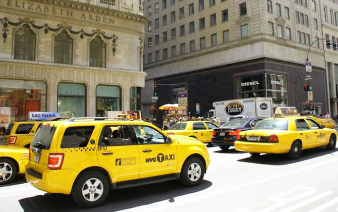
Taxi service remains one of the most recognizable parts of transportation in New York. The city has two main street-hail taxi types: yellow medallion taxis and apple green street hail livery vehicles, usually called boro taxis.
Yellow taxis can pick up passengers anywhere in the five boroughs. Green boro taxis can pick up passengers in Upper Manhattan, the Bronx, Brooklyn, Queens, and Staten Island, but not at LaGuardia Airport or John F. Kennedy International Airport. Both use the same fare structure.
All taxis are licensed by the New York City Taxi and Limousine Commission, or TLC. The agency also regulates other for-hire vehicles. Medallion taxis must operate under the medallion system, which dates back to 1937 and limits the number of licensed cabs.
Hailing a cab
Medallion taxis can be hailed in any of the five boroughs, typically by raising your hand or using a taxi stand. Boro taxis can be hailed in the outer boroughs and in northern Manhattan, above 96th Street on the East Side and above 110th Street on the West Side.
The roof light indicates whether a cab is available. Put simply, if the light is on, the taxi is available; if it is off, it is not.
Most taxis carry up to four passengers, while some minivans can take five. Drivers are required to accept trips to destinations within the five boroughs and may not refuse passengers based on destination.
Fares and payment
Taxi fare is metered, so the final price depends on distance and time spent in traffic. Extra charges may apply during peak periods, overnight, and on some airport or toll-road trips. Travel between Manhattan and John F. Kennedy International Airport uses a flat fare, while trips to Newark Airport are charged by meter plus an additional fee.
Passengers can pay by cash or card, and receipts are available on request. Tips are customary, though not mandatory.
Taxi service today
Taxis now compete with rideshare services, but New York still has one of the biggest taxi fleets in North America. As of 2023, there were more than 12,000 taxis in the city.
The TLC continues to regulate taxis and other licensed vehicles, including black cars, commuter vans, and paratransit vehicles. Riders can also book trips through smartphone apps for yellow taxis, boro taxis, and other TLC-licensed services, depending on the rules for each category.
Roosevelt Island Tram
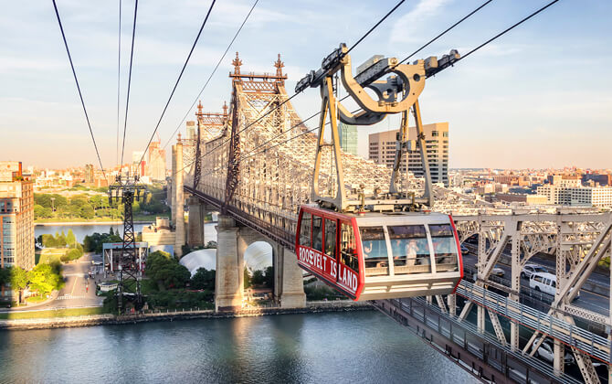
The Roosevelt Island Tram is a fast, memorable link between Roosevelt Island and Manhattan. It opened in 1976 as an interim solution, but it became a permanent part of New York’s public transport system.
The tram runs year-round between Tramway Plaza on Roosevelt Island and East 60th Street and Second Avenue in Manhattan. Besides being practical, it offers wide views of the East River and skyline. Operations and maintenance are overseen by the Roosevelt Island Operating Corporation, including inspections and planned maintenance work to keep the service safe and reliable.
Service and Hours
The tram accepts standard MTA fare payment, including OMNY tap-to-pay and unlimited passes. Cabins are accessible for riders with mobility devices, strollers, and bicycles.
| Service detail | Timings |
|---|---|
| Operating hours / opening hours | Sunday-Thursday, 6:00 a.m. to 2:00 a.m.; Friday-Saturday, 6:00 a.m. to 3:30 a.m. |
| Rush hour service | Weekday mornings from 7:00 a.m. to 10:00 a.m. and weekday evenings from 2:30 p.m. to 7:00 p.m. |
| Frequency | Every 7.5 minutes during rush hours and every 15 minutes outside rush hours |
For riders checking opening times, working hours, or the last tram before close, those are the standard service timings. The tram remains one of the city’s most distinctive transit links, useful for daily travel and enjoyable at the same time.
Other Systems
New York’s transport system goes well beyond the subway. The MTA operates most city buses and commuter rail, while ferries, taxis, bikes, and other networks round out the wider public transport picture.
Regional rail and rapid transit options include PATH to New Jersey, the Long Island Rail Road, Metro-North Railroad, and Amtrak. Nearby New Jersey also has light rail systems, including the Hudson-Bergen Light Rail and Newark Light Rail. If you are searching for a path train connection, these regional systems are often part of the broader route.
Bus services also extend beyond the MTA network. Other operators connect the city with surrounding counties and neighboring states, including Bee-Line Bus, Nassau Inter-County Express, New Jersey Transit, and private long-distance bus companies.
Ferries are another important part of local transport around the harbor. Options include the Staten Island Ferry, NYC Ferry, NY Waterway, and other private or seasonal services linking Manhattan with Brooklyn, Queens, the Bronx, Staten Island, and New Jersey.
Other travel options include yellow taxis, boro taxis, pedicabs, Citi Bike, and the Roosevelt Island Tram. These are especially useful for short trips, first- and last-mile connections, or areas that do not sit close to subway stations.
Because so many New Yorkers rely on public transportation, car ownership is lower than in many other U.S. cities. Even so, congestion remains a major issue, especially in Manhattan, where congestion pricing applies south of 61st Street.
Airport Connections
New York’s three main airports, JFK, LaGuardia, and Newark Liberty, can all be reached by public transit. For travelers watching cost, train, subway, and bus connections are often a practical alternative to taxis and rideshares, especially when traveling light.
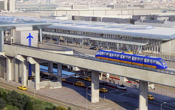
JFK has the most direct public transport links. AirTrain JFK connects the airport with both the subway and the Long Island Rail Road. From there, travelers can continue toward Manhattan on the A, E, J, or Z lines, or use LIRR for a faster rail trip. JFK is also served by city buses and shared shuttle services.
LaGuardia does not have a direct rail connection, but it is still easy enough to reach by local transport. The free Q70 bus links the airport with major subway and Long Island Rail Road connections in Queens, while the M60 bus runs toward Harlem and other parts of Manhattan. For many travelers, public transport is the cheapest option.
Newark Liberty International Airport is also accessible by transit, though the route is a bit more involved. AirTrain Newark connects the terminals to NJ Transit and Amtrak at Newark Liberty Airport Station. From there, NJ Transit trains run to New York Penn Station, and PATH can be used for Lower Manhattan after a connection through Newark Penn Station.
Before heading to any airport, it is smart to check the latest schedule today, train schedule, and service changes. JFK and LaGuardia are generally the easiest New York-area airports to reach by subway and bus, while Newark is usually best handled with a combination of AirTrain and commuter rail.