The Istanbul Metro is a fast-growing transit network serving both the European and Asian sides of Turkey’s largest city. As of 2026, it has 11 lines, 159 stations, and about 243 km (151 miles) of track. No line crosses the Bosphorus yet; instead, passengers switch continents using the Marmaray rail tunnel. The system, run by Metro İstanbul, connects with ferries, trams, buses, and funiculars.
The metro also links to other major transport lines. The Marmaray commuter rail meets the metro at Yenikapı (M1/M2), Ayrılık Çeşmesi and Bostancı (M4), and Üsküdar (M5). The F1 funicular connects Taksim (M2) to Kabataş (tram T1), while the F4 funicular links Boğaziçi Üniversitesi (M6) with the Bosphorus. Istanbul Airport is served by the M11 line, and Sabiha Gökçen Airport is connected via the M4 line on the Asian side.
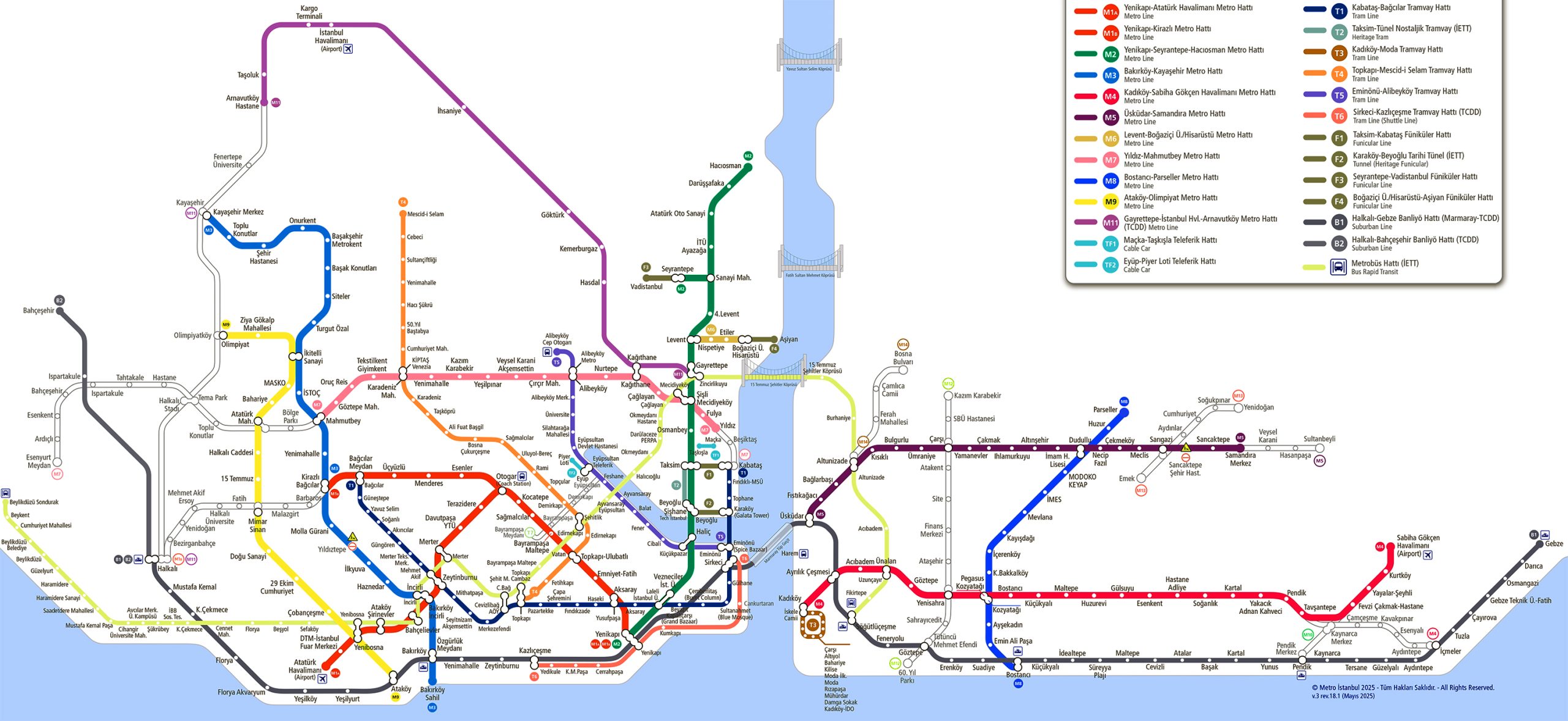
Istanbul Metro Map
The official 2026 Istanbul rail map displays all current lines (M1A/B, M2, M3, M4, M5, M6, M7, M8, M9, M11).
Map of Istanbul Metro showing different lines. Click on the map to enlarge it or download the Istanbul Metro map in PDF format.
Lines and Stations
The Istanbul Metro currently has 11 active lines. Below are the main routes with their lengths and number of stations:
- M1A Yenikapı–Atatürk Airport (26.8 km / 16.7 miles, 18 stations): Opened in 1989. Runs from Yenikapı (Sea Bus/Marmaray) through the Otogar bus terminal and Bağcılar to the former Atatürk Airport (Atatürk Havalimanı).
- M1B Yenikapı–Kirazlı (26.8 km / 16.7 miles, 13 stations): Branches off after Otogar. Connects Yenikapı (historic peninsula) with Kirazlı in western Istanbul.
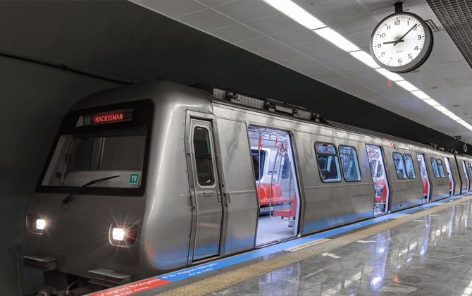
- M2 Yenikapı–Hacıosman (23.5 km / 14.6 miles, 16 stations): Opened in 2000. Runs north–south from Yenikapı (with Marmaray and Sea Bus) through Taksim Square, the Levent business district, and Şişli to Hacıosman (northern European side).
- M3 Bakırköy Sahil–Kayaşehir Merkez (26.7 km / 16.6 miles, 19 stations): Opened in stages since 2013. Runs northwest from Bakırköy Sahil through Bağcılar to Kayaşehir (near the Olympic Stadium).
- M6 Levent–Boğaziçi Üniversitesi/Hisarüstü (3.3 km / 2.1 miles, 4 stations): A short shuttle line opened in 2015. Links Levent (M2) with Boğaziçi University.
- M7 Yıldız–Mahmutbey (20.0 km / 12.4 miles, 17 stations): Istanbul’s first fully driverless line. The full route, Yıldız to Mahmutbey, opened in January 2023.
- M9 Ataköy–Olimpiyat (17.2 km / 10.7 miles, 14 stations): Opened between 2021 and 2024. Runs west from Ataköy (M1) through Başakşehir. Connects with M1A at Yenibosna and M3 at İkitelli Sanayi.
Asian Side:
- M4 Kadıköy–Sabiha Gökçen Airport (33.5 km / 20.8 miles, 23 stations): Opened in 2012 (Kadıköy–Kartal). Extended in October 2022 to Sabiha Gökçen Airport.
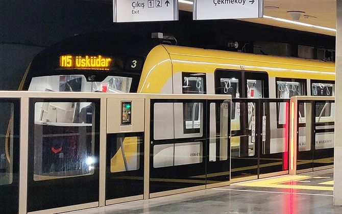
- M5 Üsküdar–Çekmeköy/Samandıra (26.5 km / 16.5 miles, 20 stations): Driverless line opened in 2017. Extended to Samandıra (Ümraniye) in March 2024.
- M8 Bostancı–Parseller (14.3 km / 8.9 miles, 13 stations): North–south line opened in January 2023. Connects Bostancı with Parseller (Ümraniye district).
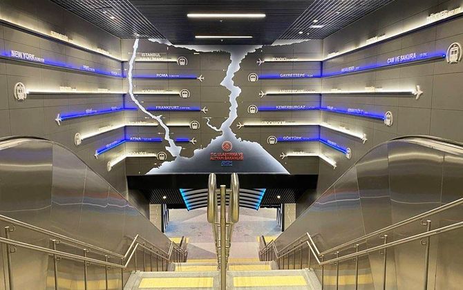
- M11 Gayrettepe–Istanbul Airport–Halkalı (51.5 km / 32 miles planned, 16 stations active): Sections opened between January 2023 and March 2024. Currently operates from Gayrettepe to Istanbul Airport and Arnavutköy. A future extension will reach Halkalı to the west.
In total, the system has 159 stations in service. Most are underground and marked with the red-and-white “M” logo.
Prices, Tickets, and Passes
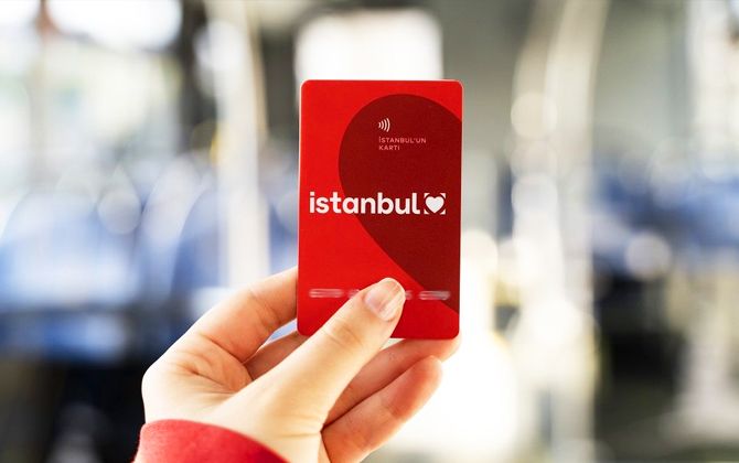
Travel on the Istanbul Metro is paid with the rechargeable Istanbulkart, a contactless RFID card. The initial card deposit is about 165 TL (~$4.3), after which you can top it up with credit.
A single ride with an Istanbulkart costs 35 TL (~$0.9).
Reduced fares are available for students and seniors. One-time paper tickets and prepaid multi-ride tickets can also be purchased at station vending machines.
| Ticket/Pass Type | Price (TRY) | Price (USD) |
|---|---|---|
| Istanbulkart (initial purchase) | 165 TL | $4.3 |
| Single ride (adult, with Istanbulkart) | 35 TL | $0.9 |
| 1-trip electronic ticket (paper) | 50 TL | $1.3 |
| 5-trip electronic ticket (paper) | 205 TL | $5.3 |
| 10-trip electronic ticket (paper) | 400 TL | $10.4 |
| 180-ride “Blue Card” (6 months) | 2,748 TL | $71.3 |
Disposable paper tickets (1–10 rides) are also available. Frequent users can purchase the Blue Card, which offers 180 rides over six months for 2,748 TL (~$71). Tourist Passes with unlimited rides for a set number of days are also sold.
Istanbulkart
The Istanbulkart is a personal, reloadable smart card required for metro travel. It is sold at metro station kiosks, vending machines, banks, and some shops. The deposit (~165 TL / ~$4.3) is refunded if you return the card in good condition. Credit can be added by cash or card. When boarding, hold the Istanbulkart to the turnstile reader; the fare (35 TL / ~$0.9) is deducted automatically. The system applies transfer discounts if you switch lines or modes within the valid window.
Electronic Tickets
Occasional visitors can use disposable electronic tickets with 1, 2, 3, 4, 5, or 10 trips preloaded. For example, a 5-trip ticket costs 205 TL (~$5.3) and a 10-trip ticket costs 400 TL (~$10.4). Each entry deducts one ride, and the ticket is discarded once all rides are used.
Monthly Pass
Istanbul does not offer an unlimited monthly pass. Instead, heavy users can buy the Blue Card. For adults, 180 rides valid for six months cost 2,748 TL (~$71). Discounted versions are available for students and seniors. For most travelers, paying per ride with an Istanbulkart is the simplest option. Transfers between lines, buses, and trams are free within 2 hours on the same card.
Schedule and Frequency
Most metro lines run daily from about 06:00 to midnight. During weekday peak hours (around 07:00–09:00 and 17:00–19:00), trains arrive every 4–6 minutes on the busiest lines. In the evening and off-peak times, intervals are usually 6–8 minutes or a bit longer.
For example, the M9 line operates from about 06:00 to 24:00 with trains every 9 minutes at peak hours. On Friday and Saturday nights, as well as public holidays, several lines (M1A, M1B, M2, M4, M5, M6, M7) run 24 hours with service every 30 minutes.
Exact schedules and frequencies are displayed at stations. Weekday and weekend timetables may vary slightly by line.
Connections
The Istanbul Metro is well integrated with other transport modes:
- Marmaray (suburban rail): Major interchange at Yenikapı (M1/M2) connects to Marmaray, which runs beneath the Bosphorus. The line also connects with M4 at Ayrılık Çeşmesi and Bostancı (Asian side) and with M5 at Üsküdar. Marmaray uses the same Istanbulkart fares and provides cross-continental travel.
- Trams and Funiculars: Several metro stations connect to tram or funicular lines. Yenikapı links to the T1 Kabataş–Bağcılar tram. Taksim (M2) connects via the F1 funicular to Kabataş (tram and ferry terminal). The F4 funicular links Boğaziçi Üniversitesi (M6) to Aşiyan on the Bosphorus. Transfers are marked on maps (e.g., “F1/T1”).
- Buses (IETT): Most metro stations have nearby city bus stops. Yenikapı serves over a dozen routes (30D, 31, 31Y, 33E, 36Y, 50Y, 69A, 70FY, 70KY, 72YT, 76A, 77, 88A, 146T, 336Y, BN1, MR35). Taksim (M2) links to 40+ routes, including buses to Beşiktaş, Bakırköy, Kadıköy, and Sabiha Airport (Havabüs). Üsküdar (M5) is both a ferry hub and a major bus terminal on the Asian side. All IETT buses accept Istanbulkart. Dolmuş minibuses and airport shuttles also serve many metro stations.
- Metrobus BRT: The Metrobus (bus rapid transit) runs east–west along the E-5 highway. It interchanges with metro lines at several points (e.g., Söğütlüçeşme M4, Kirazlı M1B). Sometimes a short walk is needed between stations. Metrobus also accepts Istanbulkart.
- Airport Buses: In addition to the metro, private operators (Havabus, Havaist) run airport buses from Taksim, Kadıköy, Bakırköy, and other central locations. For example, Havabus runs from Taksim to Sabiha Gökçen, stopping at Üsküdar and Kartal.
Overall, most metro stations act as multi-modal hubs. Transfers are free with the same Istanbulkart, making connections seamless between metro, tram, ferry, bus, and funicular.
Airport Connections
- Istanbul Airport (IST): On the European side, the M11 line provides a direct link. The Gayrettepe–Istanbul Airport section opened in January 2023. Trains run every 10–15 minutes and take about 30 minutes from Gayrettepe (central business district) to the airport. The line will eventually extend west to Halkalı. This is the fastest public transit option to the new airport.
- Sabiha Gökçen Airport (SAW): On the Asian side, the M4 Kadıköy–Sabiha Gökçen line was extended to the airport on 2 October 2022. The airport station is the eastern terminus of M4. From Kadıköy or Bostancı, travel takes about 40 minutes.
The former Atatürk Airport was served by M1A, but commercial flights ended in 2019. The M1A still terminates at “Atatürk” station, serving the congress center and surrounding area.
Private airport coaches (Havabus, Havaist) remain available, operating from hubs like Taksim, Sultanahmet, and Kadıköy. Fares are about 50–100 TL (~$1.3–$2.6). However, the metro now offers a faster and more frequent all-day service.
Historical Overview
Istanbul’s rail transit history is long and diverse. The city’s first underground line was the Tünel funicular, opened in 1875. It is the world’s second-oldest subterranean railway. Modern metro development came much later. In 1988, Metro İstanbul A.Ş. was established, and on 11 March 1989 the first stage of the M1 line (Yenikapı–Kocatepe) opened. This proved that subways could operate successfully under Istanbul’s crowded streets and historic layers.
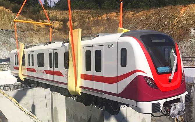
Expansion gained pace in the 2000s. In 2000, the M2 line began running from Taksim to Şişli/Levent, providing rapid north–south travel. The Asian side received its first full metro in 2012 with the opening of M4 (Kadıköy–Kartal). Key milestones since then include the launch of driverless operation on M5 (Üsküdar–Çekmeköy) in 2017 and parts of M7 in 2020. The full 20 km (12.4 miles) M7 route (Mecidiyeköy–Mahmutbey) opened on 2 January 2023. In March 2024, M9 was extended to Ataköy, linking the Olympic Stadium area to the west.
Today, the metro covers all major boroughs on both the European and Asian sides. Growth has been rapid, with ridership reaching 3 million trips on peak days. Hundreds of kilometers of new lines and extensions are under construction, with many projects planned through the late 2020s.
Informative Insights and Highlights
- Historic firsts: The Tünel funicular (1875) is the world’s second-oldest underground urban railway. The modern metro began in 1989 and has expanded rapidly since then.
- Network size: As of 2024, the metro spans 243.3 km (151 miles), making it one of the 25 longest systems in the world and the fourth-longest in Europe. Counting all rail transit, including Marmaray and trams, the network exceeds 380 km (236 miles).
- Major stations: Yenikapı is Turkey’s largest rapid transit station. It has multiple island platforms serving M1A, M1B, M2, Marmaray, and ferry connections—all accessible underground.
- Driverless trains: M5 (opened 2017) was Turkey’s first fully driverless metro. M7 (opened 2020–23) became the first driverless line on the European side.
- 24/7 operation: Seven lines run all night on Fridays, Saturdays, and public holidays, with trains every 30 minutes. This supports both nightlife and early work commutes.
- Longest tunnel: The M11 line from Gayrettepe to Istanbul Airport runs 51.5 km (32 miles). It is the second-longest continuous metro tunnel in Europe, after Moscow.
- Seamless travel card: The Istanbulkart works on metro, trams, buses, Metrobus, and ferries. Transfers between modes are free within time limits, making trips like metro + ferry to the Princes’ Islands simple with one card.
Projected Expansions
Istanbul’s metro continues to grow, with several new lines and extensions planned:
M12 (60. Yıl Parkı–Kazım Karabekir): Planned on the Asian side. About 13 km (8 miles) long with 11 stations. Expected to open in the second half of 2026.
M14 (Altunizade–Bosna Bulvarı): Another Asian-side branch, 4.5 km (2.8 miles) with 4 stations. Under construction, opening planned for 2026.
M10 (Pendik–Sabiha Airport) and M13 (Emek–Yenidoğan): Both under construction on the Asian side. These will expand coverage in Pendik and Çekmeköy districts.
European-side extensions: The M7 line will extend south to Kabataş, linking with the F1 funicular and T1 tram. The M11 line will extend west to Halkalı, connecting with Marmaray. Both projects are expected in the mid-to-late 2020s.
Other projects: Plans include an M5 branch to Sultanbeyli, Metrobus extensions, and additional infill stations. Construction is progressing quickly as part of Istanbul’s large-scale infrastructure program. Updated maps should be checked often for new openings.
Fun Facts
- Old meets new: The Tünel funicular (1875) in Beyoğlu is older than the London Underground. Meanwhile, Istanbul’s modern metro grew from zero in 1989 to more than 240 km (149 miles) in just 35 years.
- Biggest station: Yenikapı (M1/M2/Marmaray) is Turkey’s largest transit hub with 5 tracks, 4 underground platforms, and a bus terminal above. It once handled 3 million passengers in a single day.
- Longest tunnel: The M11 line to Istanbul Airport runs 69 km (43 miles) entirely underground, making it the second-longest continuous metro tunnel in Europe.
- 24/7 weekend metro: Istanbul is one of the few cities with round-the-clock weekend service. You can even catch a train at 3 AM from Taksim or Kadıköy on a Saturday night.
- Unified fares: With one Istanbulkart you can use metro, trams, funiculars, buses, ferries, and even Marmaray commuter trains.
- Driverless pioneers: M5 (Üsküdar–Çekmeköy) was Turkey’s first driverless metro in 2017, followed by M7 (Yıldız–Mahmutbey) on the European side in 2020.
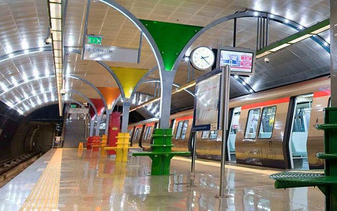
- Architectural nods: Many stations feature unique designs. Sultanahmet tram stop reflects Ottoman tilework, while newer stations showcase modern styles. Some are very deep due to geology—for example, İTÜ-Ayazağa (M2) has one of the world’s longest escalators.
Nearby Attractions
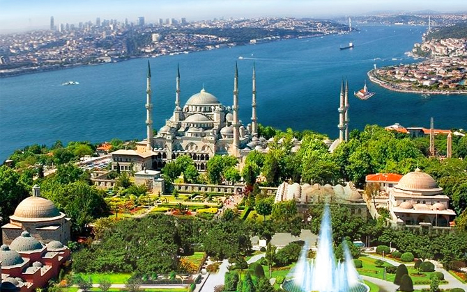
- Historic Sultanahmet (Old City): Hagia Sophia, the Blue Mosque, Topkapı Palace, and the Grand Bazaar are near Yenikapı. Take M1A/M1B or M2 to Yenikapı, then transfer to the T1 tram or walk a few blocks. Alternatively, ride Marmaray to Sirkeci and connect to the tram.
- Beyoğlu and Galata: From Şişhane (M2), it’s a short walk to Galata Tower and Istiklal Street. Taksim (M2) sits at the center of Beyoğlu, steps from Taksim Square, Istiklal Avenue, Gezi Park, and art galleries.
- Dolmabahçe Palace: At the Bosphorus end of Istiklal Street, the palace is a short downhill walk from Taksim (M2). You can also ride the F1 funicular between Kabataş (tram T1) and Taksim.
- Kadıköy and Moda: Kadıköy (M4) offers markets, cafes, and ferry access. The Moda neighborhood nearby has a car-free promenade. From Bostancı (M4), ferries depart to the Princes’ Islands (Büyükada, Heybeliada, etc.).
- Bosphorus and Beşiktaş: From Boğaziçi Üniversitesi (M6) or the F4 funicular, you can walk to Beşiktaş for its fish market, Dolmabahçe shoreline, and ferry docks to Eminönü, Kadıköy, and the Asian side.
- Modern districts: Business hubs around Levent and Maslak (M2/M6) feature malls like Zorlu Center and Istinye Park. The old Atatürk Airport station (M1A) now serves a large fairground. Western areas like Kirazlı Bağcılar (M1B) and Başakşehir (M3/M9) connect to new residential zones.
Wherever you go, Istanbul’s unified transit card and frequent service make it easy to cross continents, ride the Bosphorus, or explore historic neighborhoods—all in one seamless trip.