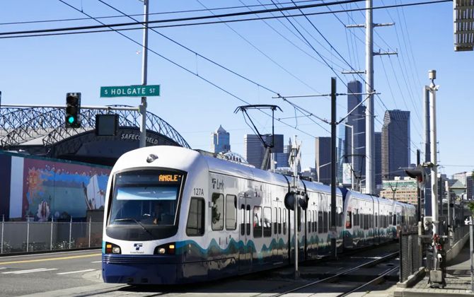
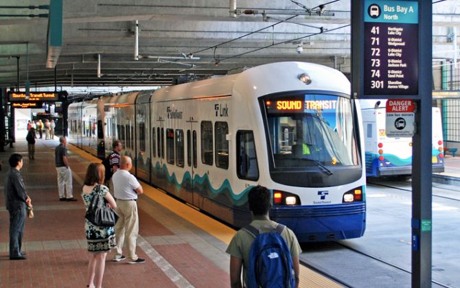
Seattle’s Stadtbahn, officially the Sound Transit Link light rail, is a modern rapid transit system serving the Seattle metropolitan area and the Puget Sound region. It is operated by Sound Transit and connects major destinations across King, Snohomish, and Pierce counties.
As of 2026, the network includes three lines: the 1 Line (formerly Central Link) running through Seattle, the Eastside 2 Line in Bellevue and Redmond, and the T Line in Tacoma (formerly Tacoma Link). Together, they serve 45 stations.
The Link light rail is Seattle’s metro-style system, combining underground, elevated, and street-level tracks. Trains run on electricity and offer frequent, all-day service. Weekday ridership is around 115,000 passengers (2026).
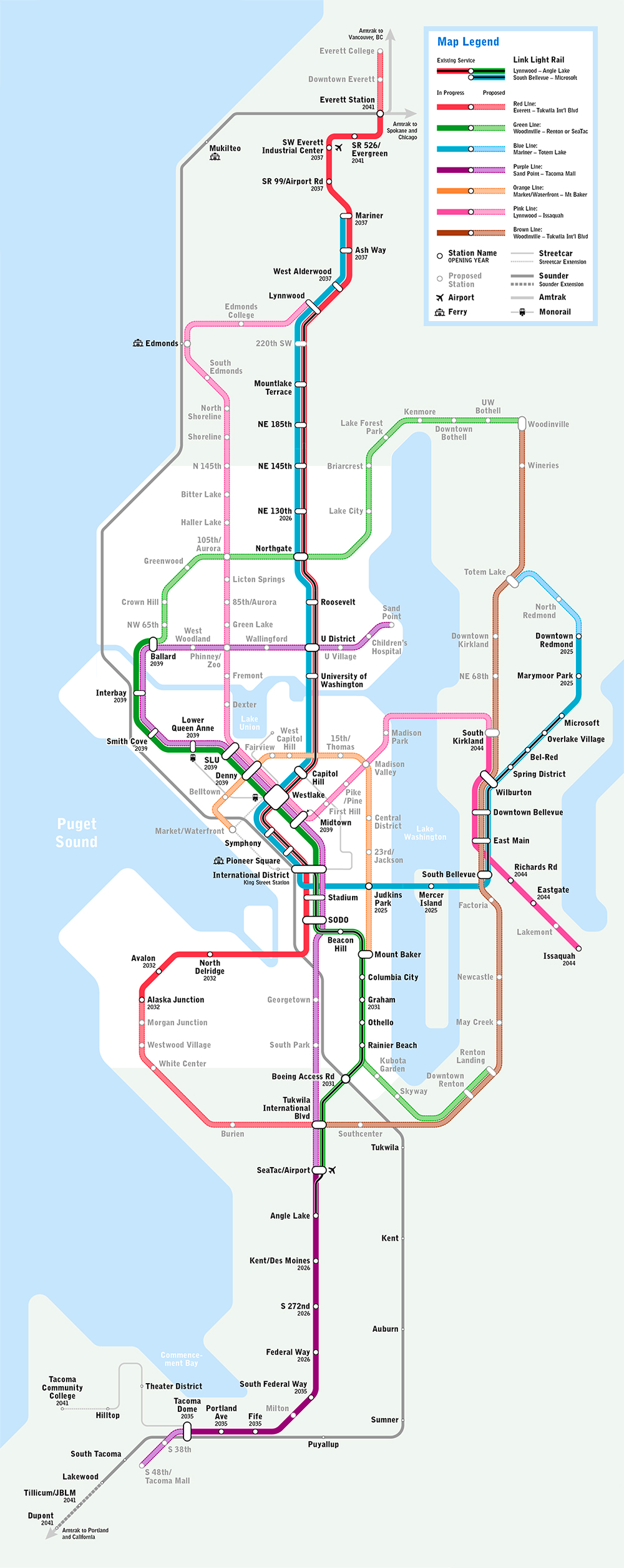
Seattle Link Light Rail Map
The Seattle Link light rail map (2026) shows a growing transit network with two main corridors:
The 1 Line (Central Link) runs north–south through Seattle, stretching from Lynnwood in the north to Angle Lake near Seattle–Tacoma International Airport in the south. It passes through downtown Seattle and several neighborhoods along the way.
The T Line (Tacoma Link) operates in Tacoma, about 48 km (30 miles) south of Seattle. It functions as a streetcar in downtown Tacoma and nearby districts.
Map of Seattle Stadtbahn showing different lines. Click on the map to enlarge it or download the Seattle Stadtbahn map in PDF format.
Lines and Stations
Central Link
The Central Link is the main line of the Seattle Stadtbahn, stretching from Lynnwood to Angle Lake south of Sea-Tac Airport. The full trip takes about one hour and connects park-and-rides, neighborhoods, downtown, and the airport. As of 2026, there are 23 stations.
- Lynnwood City Center
- Mountlake Terrace
- Shoreline South/148th
- Shoreline North/185th
- Northgate
- Roosevelt
- U District
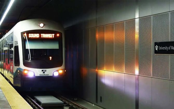
- University of Washington
- Westlake
- Symphony (formerly University Street)
- Pioneer Square
- International District/Chinatown
- Stadium
- SODO
- Beacon Hill
- Mount Baker
- Columbia City
- Othello
- Rainier Beach
- Tukwila International Boulevard
- SeaTac/Airport
- Angle Lake
Tacoma Link
The T Line is a 6.4 km (4 mile) streetcar in Tacoma, running from Tacoma Dome to Hilltop. It has 12 stations and provides quick local trips through downtown Tacoma, the Stadium District, and Hilltop. End-to-end travel time is about 10–12 minutes.
- Tacoma Dome
- South 25th Street
- Union Station
- Convention Center
- Commerce Street
- Theater District/Old City Hall
- Stadium District
- St. Joseph
- Tacoma General
- 6th Avenue
- Hilltop District
Fares, Tickets, ORCA Card
As of 2026, Sound Transit uses a flat fare system for all Link light rail lines. Riders pay the same fare for any one-way trip, regardless of distance. The current fares are:
- Adult (ages 19–64): $3.00 (≈280 ₽)
- Youth (18 and under): Free
- Senior (65+) or Disabled (RRFP): $1.00 (≈95 ₽)
- Low-Income (ORCA LIFT): $1.00 (≈95 ₽)
These fares apply to both the 1 Line and the T Line. Tacoma’s T Line originally had a $2 flat fare, but with the 2024 change, both lines now share the same system. Riders only need to “tap on” with an ORCA card at the start of a trip.
Day passes are available for unlimited rides across the region. An adult ORCA day pass costs $6.00 (≈560 ₽), while a reduced day pass for seniors and ORCA LIFT riders costs $2.00 (≈190 ₽). Youth ride free and do not need a pass.
Payment Options: Tickets can be purchased at vending machines at every station.
The preferred option is the ORCA card (“One Regional Card for All”), a reusable smart card valid across most Seattle-area transit.
Since 2022, youth under 19 ride free on all regional transit. They can use a free Youth ORCA card or simply board with ID if needed. This policy makes transit more accessible for students and families.
Schedule & Operating Hours
Link light rail operates daily with frequent service. The 1 Line schedule:
- Hours: 5:00 a.m.–1:00 a.m. Monday–Saturday; 6:00 a.m.–midnight on Sundays and major holidays.
- Frequency: Every 8 minutes at peak, every 10–15 minutes during off-peak, evenings, and weekends. Late at night, trains run about every 15 minutes.
During large events, Sound Transit may add trains or extend hours (for example, after stadium games). Maintenance can cause early closures or bus replacements, so signing up for service alerts is recommended.
For the T Line in Tacoma:
- Hours: Weekdays ~4:30–5:00 a.m. to 10:00 p.m.; Saturdays 7:00 a.m.–10:00 p.m.; Sundays 10:00 a.m.–6:00 p.m.
- Frequency: Every 12 minutes on weekdays and Saturdays (6:00 a.m.–8:00 p.m.); every 20 minutes early mornings, evenings, and Sundays.
As a shorter streetcar route, the T Line has longer headways than the 1 Line but still covers its 6.4 km (4 miles) quickly. Travel time end-to-end is about 10–12 minutes.
Connections
One of the key strengths of Seattle’s Stadtbahn (Link light rail) is its integration with other transit services. Each station is designed as a hub, making transfers easy and efficient. Here are the main connections:
Buses: Almost every Link station connects with local or regional buses. Major hubs like Lynnwood City Center, Northgate, Bellevue Transit Center (future East Link), Federal Way Transit Center (future 2026 extension), and Tacoma Dome Station have large bus bays. King County Metro and Community Transit routes feed into many 1 Line stations. For example, Northgate connects to buses serving suburban neighborhoods, while Mountlake Terrace and Shoreline stations feature park-and-ride and bus drop-offs. In downtown Seattle, stations like Westlake, Capitol Hill, and ID/Chinatown are within steps of multiple bus routes.
Sounder Commuter Rail & Amtrak: At King Street Station (near International District/Chinatown Station), riders can connect to Sounder trains to Tacoma and Everett, and Amtrak trains to Portland, Vancouver, and beyond. The walk from ID Station to King Street is just a few minutes. At Tacoma Dome Station, the Sounder South Line terminates. The T Line stops adjacent, allowing seamless transfers between commuter trains and Tacoma’s streetcar. Amtrak’s Tacoma station is also nearby, giving intercity passengers easy access to downtown via the T Line.
Seattle Center Monorail: At Westlake Station, you can transfer to the historic Seattle Monorail, which runs a 1.6 km (1 mile) route to Seattle Center and the Space Needle in just 2 minutes. The monorail terminal is inside Westlake Center mall, connected by escalator from the Link mezzanine. ORCA cards are accepted here.
Seattle Streetcars: Seattle operates two modern streetcar lines:
- South Lake Union Streetcar: Terminates at McGraw Square, near Westlake Station. Useful for reaching the South Lake Union neighborhood.
- First Hill Streetcar: Runs from International District/Chinatown Station through First Hill to Capitol Hill Station. It was designed to link with Link rail after plans for a First Hill light rail stop were canceled.
Ferries: Colman Dock, the main ferry terminal for Washington State Ferries to Bainbridge and Bremerton, is about a 10-minute walk from Pioneer Square Station. Passenger-only ferries like the King County Water Taxi to West Seattle also depart here. Riders arriving by ferry can easily transfer to Link for trips uptown or to the airport.
Park-and-Ride
By 2026, 13 Link stations have park-and-ride lots with over 12,700 spaces. Major facilities are at Lynnwood, Mountlake Terrace, Northgate, Tukwila, Angle Lake, and Federal Way. Parking is typically free for up to 24 hours, though Sound Transit may introduce modest fees at high-demand stations starting in 2026. Drop-off/pick-up zones are available at most stations.
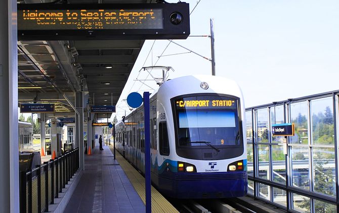
Connection to the Airport
A major advantage of Link light rail is its direct service to Seattle-Tacoma International Airport (SEA). SeaTac/Airport Station, opened in 2009, connects the terminal to downtown quickly and cheaply.
Location: The station is linked to the airport’s main terminal via a covered pedestrian skybridge from the 4th floor of the parking garage.
The ride from SeaTac/Airport Station to downtown Seattle (Westlake) takes about 38 minutes. Trains run every 6–15 minutes depending on the time of day. Travel time is consistent and unaffected by traffic, unlike driving which can take 20–60 minutes.
Cost: The fare is $3.00 (≈280 ₽) for adults, $1.00 (≈95 ₽) for seniors and ORCA LIFT riders, and free for youth under 19. Taxis or ride-shares cost $40–$60 for the same trip. Tickets can be purchased from vending machines at the station, or you can load an ORCA card for multiple trips.
Rules
- Pets are allowed on trains and buses provided they are on a lead or in a cage.
- Always have your ticket or ORCA card handy when travelling as inspectors may ask to see it. Failure to produce a valid ticket may result in a fine.
- Keep your belongings with you in a way that does not obstruct other passengers. Items can be placed in your lap or under seats.
- To maintain a peaceful environment, avoid encroaching on the personal space of other passengers.
- If you’re playing multimedia content on a device, use headphones so as not to disturb others.
- If you bring food or drink, ensure that it is sealed to prevent odours from disturbing others.
- For reasons of hygiene, passengers must be fully dressed and wear shoes while travelling.
- Lying down or putting your feet on the seats is prohibited and may result in a fine.
- Avoid distracting or disturbing light rail staff on trains and at stations.
- Any action that encourages vandalism or harassment of other passengers will be dealt with immediately by staff.
- Eating is prohibited in stations and on trains.
- Smoking (both traditional and electronic cigarettes) is not permitted in any Link Light Rail facility.
- Do not litter on trains or in stations.
- Consumption of alcoholic or hallucinogenic substances on the system’s facilities is prohibited.
- Potentially hazardous, flammable, explosive or corrosive materials are not permitted on trains or buses.
- Firearms are prohibited.
- Do not leave your belongings unattended at stations.
Future Expansions
Seattle’s light rail is growing fast. By 2044, the Sound Transit 3 plan envisions about 187 km (116 miles) of track and 80+ stations. Key projects:
- East Link / 2 Line (Seattle–Bellevue–Redmond): Eastside service between South Bellevue and Redmond opened in 2024–25. The full line, including the I-90 floating bridge into Seattle, is slated for early 2026. It will share tracks through downtown and north to Lynnwood, enabling a transfer-free ride from Lynnwood to Redmond.
- Federal Way Extension (1 Line South): Opening late 2026, adds Kent/Des Moines, Star Lake, and Federal Way Downtown. Length: 12.6 km (7.8 miles). Federal Way will be a major hub with parking and bus links; forecasts show ~20,000 daily riders by 2028.
- Tacoma Dome Link Extension (TDLE): Planned for 2035 to extend the 1 Line from Federal Way to Tacoma Dome, with new stations likely in South Federal Way, Fife, East Tacoma, and Tacoma Dome. This will pair with the T Line for downtown Tacoma circulation.
- West Seattle Extension (3 Line part A): Target ~2032. A branch from downtown to Alaska Junction with possible Delridge and Avalon stops. Aims to relieve the congested bridge corridor.
- Ballard Extension (3 Line part B): Target ~2037–2039. New second downtown tunnel serving Belltown and South Lake Union, then across the Ship Canal to Ballard (e.g., Seattle Center, Smith Cove, Ballard Market Street area).
- Everett Link Extension: Phased opening ~2037–2041. Roughly 26 km (16 miles) and six stations north of Lynnwood to Everett, with a potential branch to Paine Field/Boeing.
- Issaquah–Kirkland Line (4 Line): Long-term (~2044). An Eastside line via Bellevue, likely sharing segments with the 2 Line before branching.
- Infill Stations: NE 130th Street (2026 target) between Shoreline South/148th and Northgate; Graham Street (around 2030) between Columbia City and Othello.
- Capacity & Fleet: Additional Series 3 vehicles by 2029, new operations bases (Bellevue open since 2021; future bases in Federal Way and Everett), and station codes to aid wayfinding—preparing for an ~187 km (116-mile), 83-station system by 2044.
Timelines may shift with funding and construction, but many projects are in design or construction now. The mid-2020s bring near-annual openings, expanding rail to West Seattle, Ballard, Everett, and deeper into Tacoma and the Eastside.
Tourist Attractions
Link is an easy way to reach top sights without a car. Highlights:
- Pike Place Market & Downtown: Westlake or Symphony (formerly University Street). 5–10 minutes on foot to the Market, waterfront, Aquarium, hotels, and the Seattle Art Museum.
- Seattle Center (Space Needle & Museums): From Westlake, transfer upstairs to the Seattle Center Monorail (about 1.6 km / 1 mile, 2 minutes). ORCA is accepted. Alternatively, walk ~30 minutes or take a short bus ride.
- Chinatown–International District: International District/Chinatown Station lands you amid historic eateries, the Wing Luke Museum, and Uwajimaya. King Street Station is steps away.
- Pioneer Square: Pioneer Square Station for 19th-century architecture, galleries, bars, and the Underground Tour. Colman Dock ferries are ~10 minutes on foot for trips to Bainbridge or Bremerton.
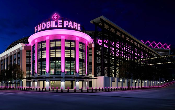
- Stadiums: Stadium Station for T-Mobile Park (Mariners). Lumen Field (Seahawks, Sounders FC) is one stop north at International District or a short walk. Extra trains often run on game days.
- University of Washington: UW Station sits by Husky Stadium. Cherry blossoms in spring (the Quad), plus the Burke Museum and Henry Art Gallery are on campus.
- Capitol Hill: Capitol Hill Station at Broadway & John for cafés, nightlife, and shops. Volunteer Park and the Seattle Asian Art Museum are about 1.6 km (1 mile) north.
- Northgate & North Seattle: Northgate Station for the open-air mall and Kraken Community Iceplex. Bus connections from here reach Woodland Park Zoo.
- Tacoma (via T Line): From Tacoma Dome, ride the T Line to Union Station for the Museum of Glass, Tacoma Art Museum, and Washington State History Museum; to Stadium District for Wright Park and scenic Stadium High School; and to Hilltop for local cafés and medical centers.
History
Seattle’s light rail took over a century to realize, with many failed starts before success.
- Early 1900s: Seattle ran streetcars and cable cars. A 1911 subway plan failed. Streetcars ended by 1941.
- 1960s–70s: Voters rejected the “Forward Thrust” subway plans. Federal funds went to Atlanta’s MARTA instead.
- 1980s–1990s: The downtown bus tunnel (1990) was built rail-ready. Sound Transit was formed in 1993.
- 1996: Voters approved “Sound Move,” funding starter light rail and Tacoma Link.
- 2003: Tacoma Link opened as a 2.6 km (1.6 mile) downtown streetcar.
- 2009: Central Link launched between Westlake and SeaTac/Airport (22.5 km / 14 miles, 13 stations).
- 2016: U-Link (downtown–UW) and Angle Lake extensions opened.
- 2021: Northgate Link extended service 6.9 km (4.3 miles) north to Roosevelt and Northgate.
- 2016: Voters approved ST3, a $54B plan to expand rail to Everett, Tacoma, West Seattle, Ballard, Issaquah.
- 2020s: Lines rebranded (1, 2, T). Youth fares set to $0. Lynnwood Link opened Aug 2024. Eastside 2 Line segment opened Apr–May 2026. Tacoma’s Hilltop extension opened Sept 2023. Federal Way extension set for Dec 2026. Ridership ~115,000 weekday trips by mid-2025.
Despite decades of delays, voter support and persistence finally delivered a regional system central to Seattle’s daily life.
Fun Facts
- World-first floating-bridge rail: The 2 Line will be the first railway to run over a floating bridge (I-90 across Lake Washington) using special track joints to handle movement.
- Shared transit tunnel history: From 2009 to 2019, Link trains shared the Downtown Seattle Transit Tunnel with buses—rare in the U.S. The tunnel is now rail-only.
- 100% renewable power: Since 2020, Link’s electricity comes from carbon-neutral sources (wind and hydropower).
- ORCA name, real meaning: The ORCA fare card stands for “One Regional Card for All”—valid across most regional buses, trains, streetcars, and some ferries.
- Art in stations: Sound Transit’s STart program commissions site-specific art—Beacon Hill mosaics, Angle Lake’s landmark “Cloud” sculpture, and more.
- Deep stations, steep grades: UW Station sits roughly 30 m (≈100 ft) underground. The downtown-to-Capitol Hill tunnel climbs one of the steepest grades in U.S. light rail.
- Escalator overhauls: Aging downtown-tunnel escalators from the 1980s are being fully replaced for reliability.
- Two technologies: The high-floor 1 Line and low-floor T Line use different vehicles and platforms; they meet at Tacoma Dome via future high-floor 1 Line service.
- Ridership growth: Daily riders rose from ~16,000 in 2010 to 80,000+ by 2019, and ~115,000 by 2026 as new segments opened.
- Wayfinding codes: Stations use three-digit codes introduced in 2024 (replacing earlier pictograms) to simplify navigation for multilingual riders.