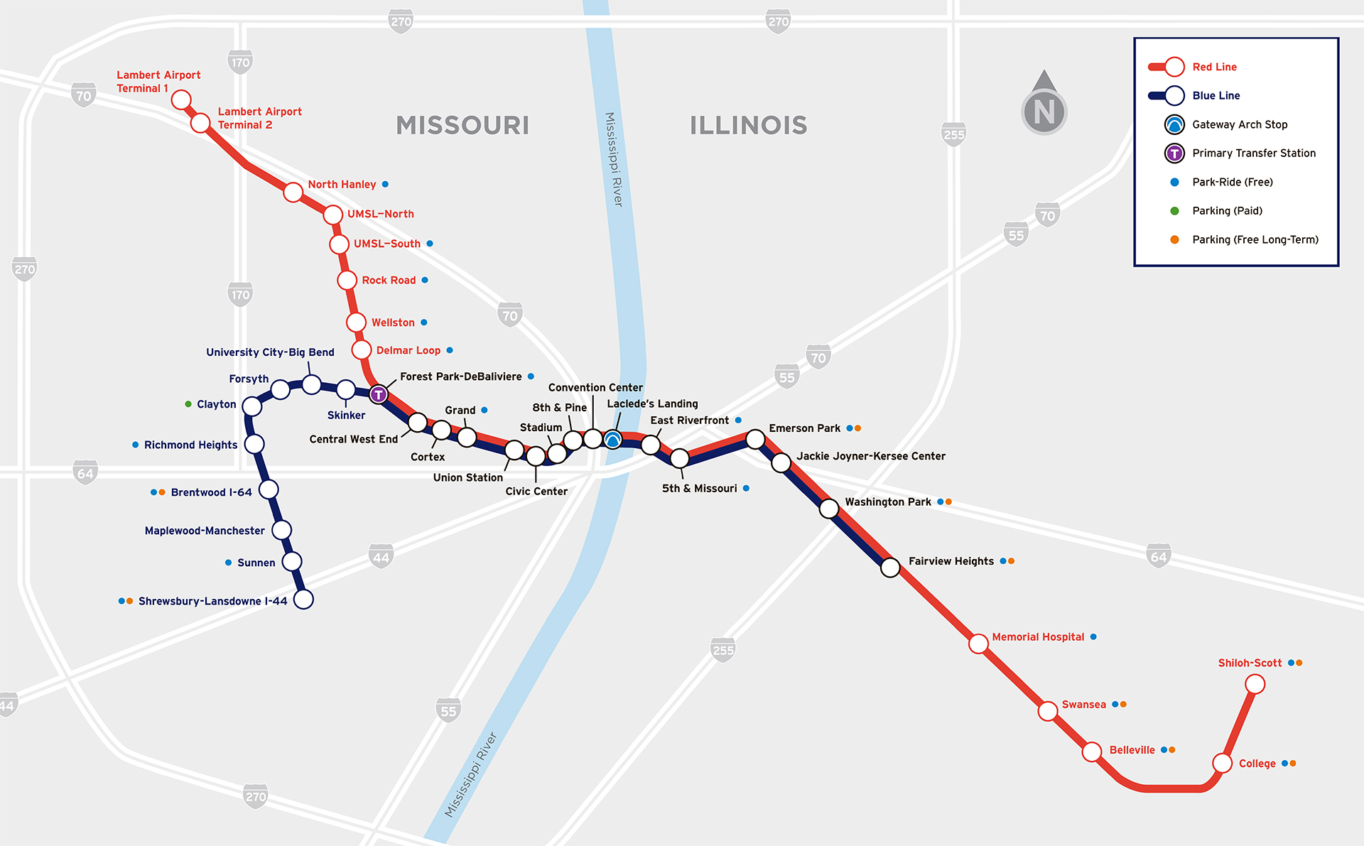
The St. Louis MetroLink is the region’s light rail system, covering about 46 miles (74 km) of track with 38 stations across Missouri and Illinois. It runs two main lines — the Red Line and the Blue Line — connecting St. Louis City, St. Louis County, and St. Clair County (IL). The lines link downtown with suburbs, the airport, and major attractions.
Trains operate daily from around, providing late-night service for commuters and travelers. Since opening in 1993, MetroLink has become a key part of local transit, with more than 6.7 million rides in FY2024.
The St. Louis MetroLink is the region’s light rail system, covering about 46 miles (74 km) of track and serving 38 stations in Missouri and Illinois. It operates two main lines — the Red Line and the Blue Line — that connect St. Louis City, St. Louis County, and St. Clair County (IL). Together, they link downtown with suburbs, the airport, and popular attractions.
St. Louis Metro Map
The system is known for its modern trains and fast service. The 2026 route map includes all current stations and updated service patterns. Whether you’re commuting, catching a flight, going to a game, or exploring the city.
Map of Saint Louis Metro showing different lines. Click on the map to enlarge it or download the Saint Louis Metro map in PDF format.
Saint Louis MetroLink Lines and Stations
St. Louis MetroLink has two lines: the Red Line and the Blue Line. Together, they cover the 46-mile (74 km) network. Both share tracks through downtown St. Louis and into Illinois, stopping at all stations between Forest Park–DeBaliviere and Fairview Heights. In this busy corridor, both lines serve the same stations, offering more frequent service. At Forest Park–DeBaliviere, the lines split: the Red Line heads northwest to the airport, while the Blue Line runs west into St. Louis County.
Line 1
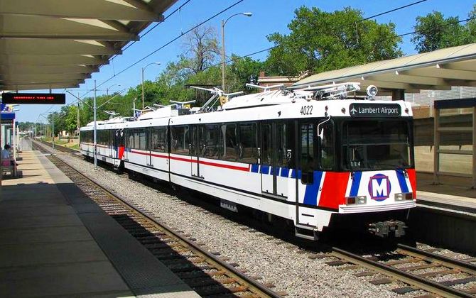
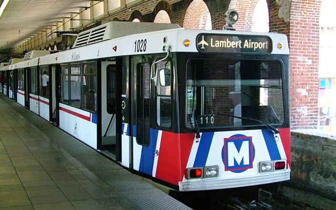
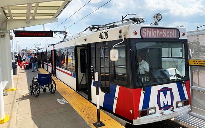
Line 1 is the Red Line, the longer and older route. It runs east–west from Lambert–St. Louis International Airport (Terminal 1) in northwest St. Louis County to Shiloh–Scott Station near Scott Air Force Base in Illinois. The Red Line is about 38 miles (61 km) long and has 29 stations across three counties and two states.
Key stops include both airport terminals, North Hanley (a major park-and-ride), Delmar Loop, Central West End, and all downtown stations. After downtown, the Red Line crosses the Mississippi River via the historic Eads Bridge and continues through East St. Louis and Belleville. Important Illinois stations include East Riverfront, 5th & Missouri, Belleville, and College (at Southwestern Illinois College). The line ends at Shiloh–Scott, next to Scott Air Force Base.
A full Red Line trip takes about 1 hour 15 minutes. Trains carry red signs on the front and sides. Passengers can switch between the Red and Blue Lines at Forest Park station with easy cross-platform transfers.
Line 2
Line 2 is the Blue Line, opened in 2006. It runs from Shrewsbury–Lansdowne I-44 Station in southwest St. Louis County to Fairview Heights in Illinois, covering about 25 stations.
Starting at Shrewsbury (a large park-and-ride), the line passes through Maplewood–Manchester, Brentwood, Richmond Heights (near the Saint Louis Galleria), and reaches Clayton, the county’s government and business hub. From there, it continues past Forsyth, University City–Big Bend, and Skinker stations, serving the western edge of Washington University. At Forest Park–DeBaliviere, it merges with the Red Line. East of Forest Park, Blue Line trains share all stations through downtown and into Illinois, ending at Fairview Heights.
Important stops include Union Station, Civic Center, Stadium, and 8th & Pine. The Blue Line does not continue to College or Shiloh–Scott. A full trip takes about 50 minutes. Blue Line trains carry blue signs and usually operate as two-car sets. Much of the route uses old rail and streetcar corridors, giving the Blue Line its own right-of-way and reliable service.
Schedules and Frequencies
MetroLink runs daily from early morning until after midnight. On weekdays, first trains leave around 4:00–4:30 a.m., last trains near midnight. Weekend service is similar, with Sunday starting later.
- Daytime: Red and Blue Lines every 20 minutes.
- Central corridor: combined service every ~10 minutes.
- Evenings/early mornings: every 20–30 minutes.
- Extra trains often added after big events.
Travel times: Red Line end-to-end ≈ 1h 15m; Blue Line ≈ 50–55m. Downtown trips (Civic Center–Laclede’s Landing) just a few minutes.
Last trains leave downtown around midnight: eastbound to Illinois ~12:20 a.m., westbound to the airport at a similar time. Riders should plan accordingly.
Fares and Passes
MetroLink uses a simple fare system shared with MetroBus, so transfers between bus and rail are easy.
- Single Ride: $2.50 (≈ €2.30), valid for 2 hours, no bus transfer included.
- 2-Hour Pass: $3.00 (≈ €2.75), unlimited bus + rail within 2 hours.
- Airport Fare: $4.00 (≈ €3.65) for a 2-hour pass from Lambert Airport.
- Day Pass (Adventure Pass): $5.00 (≈ €4.55), unlimited rides until end of service.
- Weekly Pass: $27.00 (≈ €24.50).
- Monthly Pass: $78.00 (≈ €71.00).
- Semester Pass: $175 (≈ €159), available at certain colleges.
- Reduced Fares:
- Children 5–12: half price.
- Children 4 and under: free with adult.
- Seniors 65+, disabled riders, Medicare cardholders: 50% off (e.g., $1.25 ≈ €1.15 one-way).
Tickets and passes are available at station vending machines and in the Transit app.
Connections with Other Systems
One of MetroLink’s strengths is its integration with other transit in the St. Louis region. MetroLink is run by Metro Transit (Bi-State Development), which also operates MetroBus and Metro Call-A-Ride paratransit. MetroBus has 59 routes serving both Missouri and Illinois.
Many MetroLink stations double as transfer hubs. For example, Civic Center Transit Center, next to the Civic Center MetroLink Station, is the main downtown hub with more than a dozen bus routes. Most suburban MetroLink stations include Park-Ride lots and bus connections. A $3.00 (≈ €2.75) 2-hour ticket covers both bus and rail, making transfers simple.
In Illinois, MetroLink works with the St. Clair County Transit District (SCCTD) and Madison County Transit (MCT). These agencies provide funding, shuttle links, and bus routes to MetroLink stations.
MetroLink also connects with regional and intercity travel. At Civic Center Station in downtown St. Louis, passengers can transfer to the Gateway Transportation Center. This hub includes Amtrak service at Gateway Station, plus Greyhound and Burlington Trailways buses.
Overall, MetroLink is well integrated with local buses, Amtrak, Greyhound, and airports.
Airport Connections
MetroLink directly serves St. Louis Lambert International Airport. The Red Line has two stations on airport grounds: one at Terminal 1 and one at Terminal 2. Both are a short walk from baggage claim.
From Terminal 1, the Red Line runs through downtown and into Illinois. Service is frequent: every 20 minutes off-peak and more often during rush hours. The trip from the airport to downtown takes about 30–35 minutes.
The base fare is $2.50 (≈ €2.30). However, tickets sold at airport vending machines require a $4.00 (≈ €3.65) 2-hour pass, which includes transfers. Many travelers use MetroLink as a low-cost alternative to parking or taxis.
MidAmerica St. Louis Airport (BLV) is not yet on the rail line, but construction is underway on a 5.2-mile (8.4 km) Red Line extension from Shiloh–Scott to the airport. Completion is planned for early 2026. Until then, the SCCTD shuttle bus connects the Shiloh–Scott MetroLink Station with the BLV terminal. Shuttle times are coordinated with train arrivals.
System Regulations
- Eating and drinking are not allowed on the metro.
- Smoking, including electronic cigarettes, is strictly prohibited in carriages and on platforms.
- Seats should be reserved for elderly and disabled passengers.
- It is forbidden to carry firearms on the metro.
- Pets are not allowed, except for service animals accompanying disabled passengers.
Tips
- Tickets: Validate paper tickets at red machines if not pre-stamped. Activate mobile tickets before boarding and keep your phone charged.
- Right Train: Check displays for Red vs. Blue Line. Transfers are easy at Forest Park.
- Park & Bike: Free Park-Ride lots at many stations. Bikes allowed; racks and lockers available.
- Peak Crowds: Rush hours and post-events are busiest. Travel earlier or later for space.
- Day Pass: A $5 (≈ €4.55) pass gives unlimited rides — perfect for sightseeing.
Future Plans and Extensions
MetroLink’s future includes both expansion and modernization:
- MidAmerica Airport Extension (2026): A 5.2-mile (8.4 km) Red Line extension is under construction from Shiloh–Scott to MidAmerica Airport. It includes a new airport station and is set to open in spring 2026. The project, partly funded by a $98 million Illinois state grant, also extends the MetroBikeLink trail.
- North–South MetroLink (“Green Line”): Plans are underway for a 5.6-mile (9 km) route along Jefferson Avenue from Natural Bridge Ave. to Chippewa St. It would intersect the current system near Civic Center, serving underserved neighborhoods. Cost is estimated at $1–1.5 billion, with funding sought from federal grants. Service could begin in the early 2030s.
- Infill Stations: New stations may be added in Midtown (Jefferson Ave. transfer) and near SLU. The Cortex Station, opened in 2018, is an example of such an infill project.
- Westport and North County Extensions: Long-term ideas include extending MetroLink to Westport Plaza/Maryland Heights or north from North Hanley to Florissant. These projects remain unfunded.
- System Upgrades: Metro is adding fare gates by 2026 and introducing a new fare collection system. Old trains from the 1990s may be refurbished or replaced in coming years.
- Service Improvements: Advocates hope for later night service on weekends and more frequent trains if funding allows. Restoring peak service to every 10 minutes per line is a long-term goal.
- Regional Integration: Metro aims for a unified fare system with agencies like MCT, allowing one card or app across the metro area.
With these projects, MetroLink will soon connect MidAmerica Airport, expand into new city neighborhoods, modernize its technology, and improve service for riders across the region.
Historical Highlights
MetroLink has served St. Louis for over 30 years, growing from a single corridor to a regional network. Key moments include:
- 1987–1990: Construction began using old rail lines, downtown tunnels, and the Eads Bridge. Cost: about $465 million.
- 1993: Opening of the first 13.9-mile (22.4 km) line with 16 stations. Over 180,000 rode opening weekend.
- 1994–1998: Extended to Lambert Airport (Terminals 1 & 2) and East Riverfront station.
- 2001–2003: Illinois extension added 20.9 miles (33.6 km) to College and Shiloh–Scott. Cost: $425 million. System rebranded as “Metro.”
- 2006: Cross County Extension (Blue Line) added 8 miles (12.9 km) and nine stations through Clayton to Shrewsbury. Cost: $676 million.
- 2009: Budget cuts reduced service, later restored after a 2010 sales tax (Proposition A).
- 2014–2018: Station upgrades and the new Cortex Station — first infill station in 20 years.
- 2022: Flash floods caused $40+ million in damage; full service restored by November.
- 2023–2026: Fare gates added under the Secure Platform Plan. Construction began on the MidAmerica Airport extension; planning advanced for the Green Line.
Notable Facts
Here are concise highlights about the St. Louis MetroLink system:
Bi-State Operation: One of the few U.S. light rail systems serving two states. Trains cross the Mississippi River on the Eads Bridge, linking Missouri and Illinois under the Bi-State Development compact.
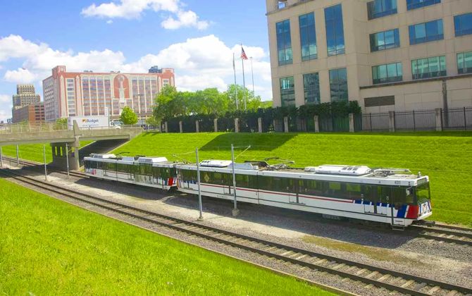
System Profile (2024): 38 stations (27 in Missouri, 11 in Illinois) over 46 route miles (74 km). Fleet of 72 electric light-rail vehicles on standard-gauge track with overhead catenary. Trains usually run in two-car sets.
Ridership & Use: ~6.75 million boardings in FY2024. Pre-pandemic averages were higher (e.g., ~43,000 weekday riders in FY2018; Central West End was the busiest at ~4,900). Around 84% of riders use Metro to get to work and ~20% to school.
Economic Impact: Since 2011, more than $11 billion in development has been announced or built within a half-mile (0.8 km) of stations, including projects in Central West End, Cortex, and parts of Metro East.
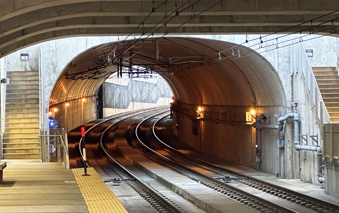
Speed & Infrastructure: Though light rail, MetroLink operates much like a light metro. It runs mostly on exclusive right-of-way with top speeds around 55 mph (89 km/h). All stations have level, high-platform boarding. Trains use 19th-century tunnels downtown and the historic Eads Bridge — a blend of old infrastructure and modern transit.
Awards: Metro (Bi-State) won APTA’s “Best Large Transit System in North America” in 1997, just a few years after opening.
Station Variety: Downtown includes subway stations (8th & Pine, Convention Center) for a big-city feel. Lambert Airport Terminal 1 is elevated; Civic Center features an integrated bus hub and security facilities. Many stops include public art.
Security Upgrade: A $52 million Secure Platform Plan is adding 8-foot (2.4 m) fencing, fare gates, and new surveillance by 2026 — a major shift from open proof-of-payment to gated entries.
Bus Integration: Unified fares cover bus and rail. Key Transit Centers include North Hanley, Civic Center, Delmar Loop, and Shrewsbury for timed transfers.
Bridges & Tunnels: Uses the Eads Bridge (opened 1874; first steel arch bridge in the U.S.) and repurposed downtown tunnels, including the historic St. Louis Freight Tunnel with brick arches.
Environment: Electric trains have zero tailpipe emissions and help reduce congestion. The MetroBikeLink trail in Illinois supports bike-and-ride commutes.
Future Line Names: Today’s Red and Blue could be joined by a planned North–South “Green Line.” A conceptual “Purple Line” toward Westport has appeared in long-range ideas.
Points of Interest Accessible via the St. Louis Metro
MetroLink connects many top destinations. Nearest stations are listed for each:
- Gateway Arch & Riverfront: Laclede’s Landing or 8th & Pine (5–10 minute walk). Avoid downtown parking and walk straight to the Arch grounds and riverboats.
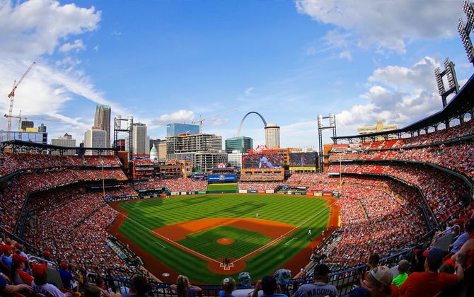
- Busch Stadium (Cardinals): Stadium Station is adjacent to the ballpark and Ballpark Village — a two-minute walk.
- Enterprise Center (Blues): Civic Center Station is next door (under 5 minutes on foot). Also serves many concerts and events.
- CITYPARK (STL CITY SC): Union Station is ~0.3 miles (0.5 km), ~5–6 minutes walking. Civic Center is another option (~10 minutes). Extra trains often run on match days.
- The Dome at America’s Center: Convention Center Station is a 2–3 minute walk; also ideal for conventions at America’s Center.
- Union Station & Aquarium: Union Station stop serves the historic complex with the St. Louis Aquarium, the 200-ft (61 m) Wheel, food, and attractions.
- City Museum: Convention Center Station is about 0.5 miles (0.8 km), ~10 minutes by foot. Union Station or 8th & Pine are similar distances.
- Forest Park Attractions: Forest Park–DeBaliviere is the main gateway to the Zoo, Art Museum, History Museum, Science Center, and The Muny. Walk ~10 minutes to the History Museum, ~20 minutes to the Zoo, or use seasonal shuttles/MetroBus. Central West End also serves the park’s east side and the Science Center via a short ride or ~15-minute walk.
- Delmar Loop: Delmar Loop Station/Transit Center serves restaurants, venues (The Pageant, Delmar Hall), shops, and Blueberry Hill. A heritage Loop Trolley operates seasonally.
- Washington University (Danforth Campus): Skinker (northeast corner) and University City–Big Bend (southwest corner) on the Blue Line. Students can use the university’s U-Pass program.
- Saint Louis University & Midtown: Grand Station connects to SLU (10–15 minute walk or quick #70 Grand bus). The Fabulous Fox Theatre and Powell Hall are along Grand.
- Scott Air Force Base: Shiloh–Scott Station is next to a base gate (proper ID required). One of the few U.S. military bases with direct rail access.
- Downtown Belleville, IL: Belleville Station with a short bus ride or ~1 mile (1.6 km) walk to the historic Main Street and square.
- Casino Queen (East St. Louis): East Riverfront Station sits beside the casino and hotel with skyline views.
- More Destinations: Clayton (Clayton Station), Brentwood I-64 (shopping), Maplewood–Manchester (downtown Maplewood), Richmond Heights (Saint Louis Galleria), and University of Missouri–St. Louis (UMSL North & South) are all on the network. Bring a bike on board to reach nearby trails like MetroBikeLink or Grant’s Trail.
If you have a St. Louis destination in mind, MetroLink likely gets you close — often within a short walk or a quick bus hop.