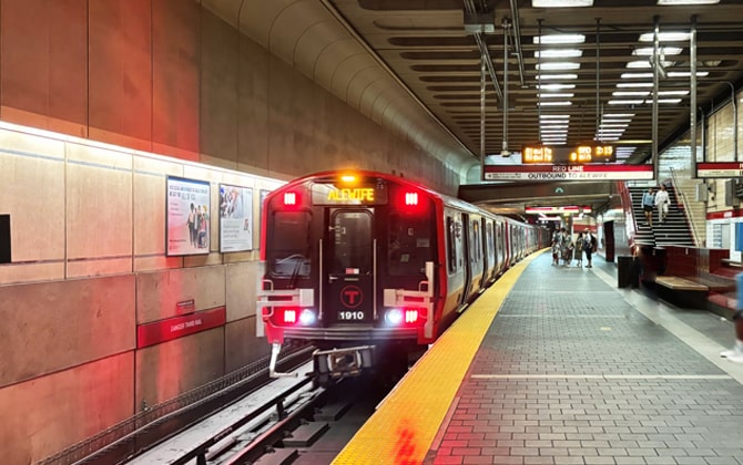
Boston’s subway, known as “The T,” opened in 1897. It’s the oldest in the United States. It’s a vital part of the city’s transit. Operated by the Massachusetts Bay Transportation Authority (MBTA), it runs five color-coded lines: Red, Orange, Blue, Green (light rail) and Silver (bus rapid transit). These serve 153 stations across Boston and nearby cities. The network spans about 111 km (69 mi) of track. It links key neighborhoods, business districts and suburbs. The MBTA also runs buses, commuter rail and ferries— all integrated into one system. Locals simply say “take the T.”
The line colors reflect history or geography. The Green Line ran streetcars through the Emerald Necklace parks. The Blue Line follows Boston Harbor’s waters. The Orange Line traced old Orange Street. The Red Line leads to Harvard (whose color is crimson). The Silver Line uses silver-branded buses. Despite its age, the system keeps modernizing. New trains hit the Orange and Red Lines recently. Accessibility upgrades are ongoing. The Green Line Extension to Somerville and Medford opened in 2022. Riders find both historic stations and modern facilities. Together, they offer a fast way to travel around Boston.
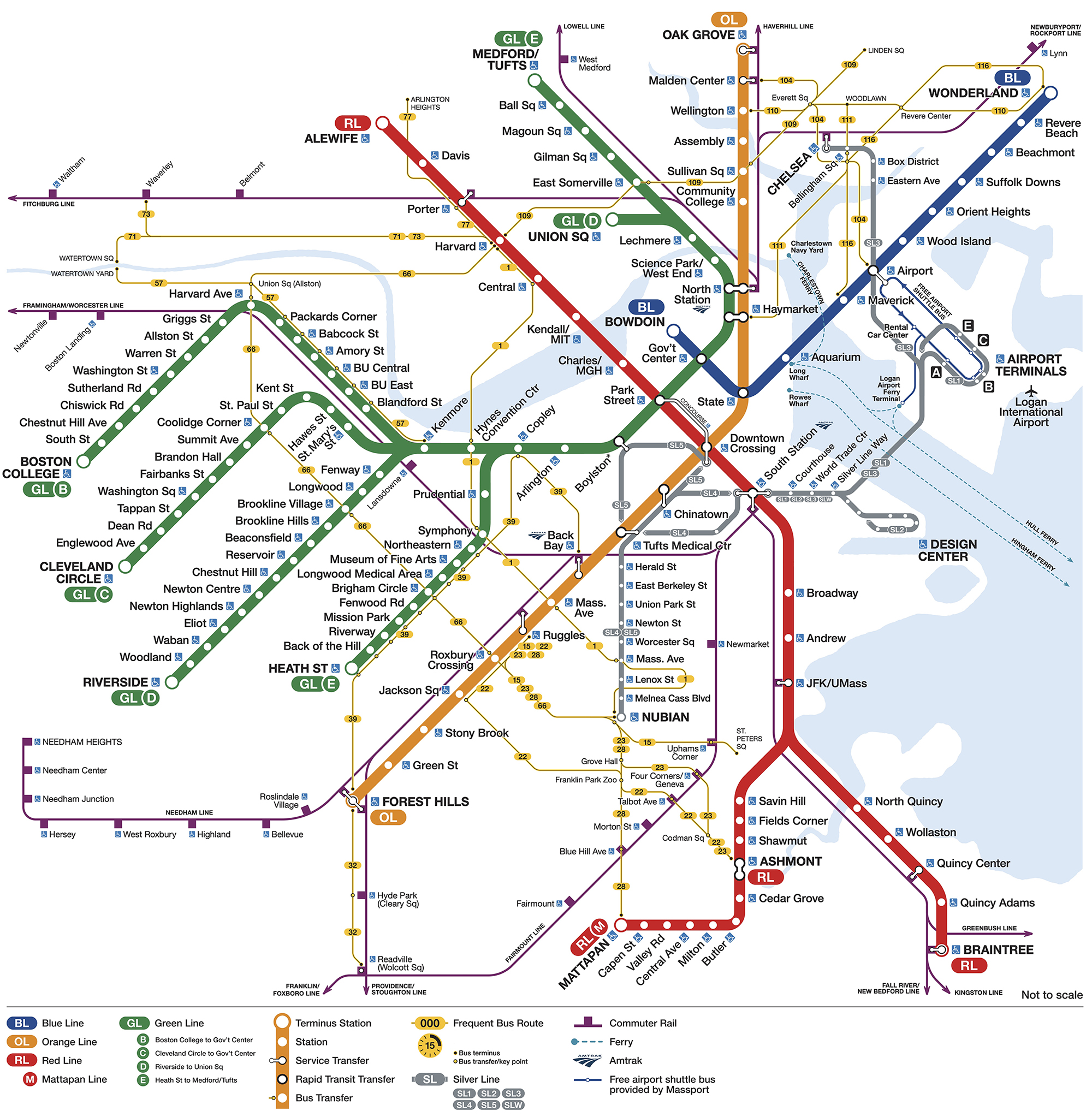
Boston Subway Map
Boston Subway Map shows all subway and rapid transit lines—Red, Orange, Blue, Green and Silver—plus connections to commuter rail, main bus routes and ferries. The map highlights line intersections and the neighborhoods each line serves. Coverage extends beyond Boston into Cambridge, Somerville, Brookline, Newton, Revere, Quincy and more. The 2026 edition adds the Green Line Extension branches to Union Square and Medford/Tufts.
Boston MBTA Subway Map showing different lines. Click on the map to enlarge it or download the Boston MBTA Subway map in PDF format.
Lines & Stations Overview
Boston’s T has four rail lines—Green, Orange, Blue and Red—and the Silver Line bus routes. Below is an overview of each line and its main stations. (Line names match their map colors.)
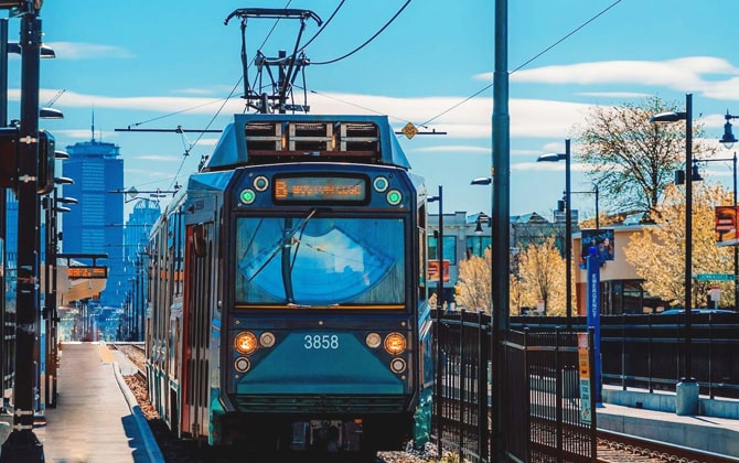
Green Line Stations
The Green Line is a light rail system with four branches (B, C, D and E). All trains share a downtown tunnel—from Lechmere and Government Center through Park Street to Boylston—and then split outward.
- B branch (Boston College): 23 stops from Boston College in Brighton to Government Center. Key stops: BU West, Packards Corner, Fenway/Kenmore Square (Fenway Park).
- C branch (Cleveland Circle): 22 stops from Cleveland Circle to Government Center. Notable: Coolidge Corner, St. Mary’s Street, Cleveland Circle (Chestnut Hill Reservoir).
- D branch (Riverside–Union Square): Over 20 stations from Riverside (Newton) through Kenmore to Union Square, Somerville. Major: Fenway, Longwood Medical Area, Brookline Village.
- E branch (Heath Street–Medford/Tufts): About 25 stops from Heath Street through Longwood Medical Area and Copley to Medford/Tufts. Highlights: Museum of Fine Arts, Northeastern University, East Somerville.
All branches converge at Government Center, Park Street, Boylston, Arlington and Copley. Most underground stations and many surface stops have raised platforms for accessibility.
Orange Line Stations
The Orange Line runs north to south from Oak Grove in Malden to Forest Hills in Jamaica Plain. It has 20 fully accessible stations.
- Oak Grove: Terminus in Malden, park-and-ride
- Malden Center: Commuter Rail connection
- Wellington: Park-and-ride in Medford
- Assembly: Assembly Row, Somerville
- North Station: Transfer to Green Line, Commuter Rail; near TD Garden
- Haymarket: Near Faneuil Hall and the North End
- State: Transfer to Blue Line, Financial District
- Downtown Crossing: Transfer to Red Line
- Back Bay: Copley Square, Amtrak and Commuter Rail
- Forest Hills: Southern terminus with Commuter Rail link
The Orange Line uses modern six-car trains for a smooth ride.
Blue Line Stations
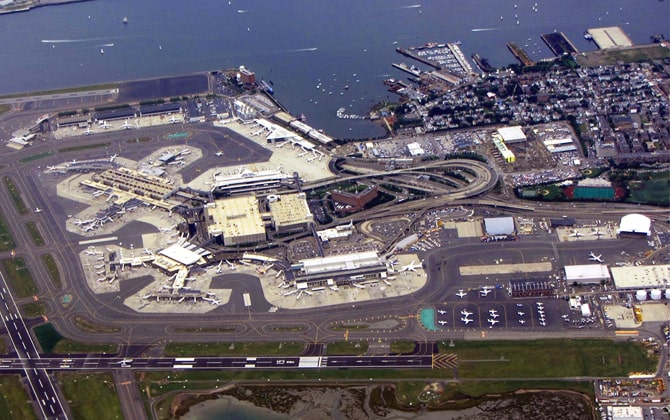
The Blue Line links downtown Boston to East Boston and Revere. It has 12 stations and serves Logan Airport.
- Bowdoin: Downtown terminus (closed nights and weekends)
- Government Center: Transfer to Green Line
- State: Transfer to Orange Line
- Aquarium: New England Aquarium, Waterfront
- Airport: Logan Airport (free shuttle); ride time ~15 min from State to Airport
- Revere Beach: America’s first public beach
- Wonderland: Revere terminus with parking
All stations except Bowdoin are accessible. Trains switch from third-rail power underground to overhead wires outdoors.
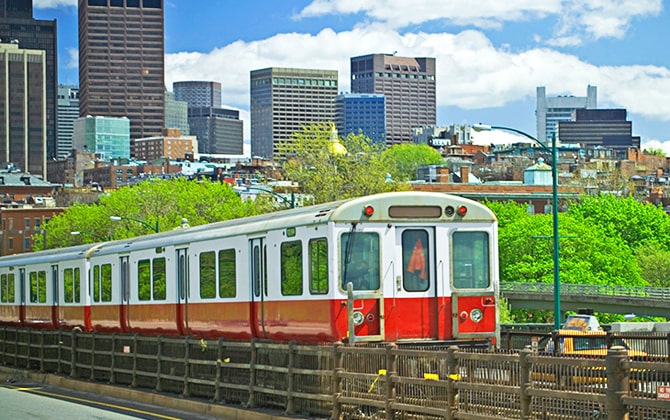
Red Line Stations
The Red Line runs northwest to south from Alewife (Cambridge) to Ashmont and Braintree (south). It has 22 stations.
- Alewife: Northern terminus, park-and-ride
- Harvard: Harvard Square
- Park Street: Transfer to Green Line
- South Station: Amtrak, Commuter Rail, Silver Line
- JFK/UMass: Split to Ashmont and Braintree branches
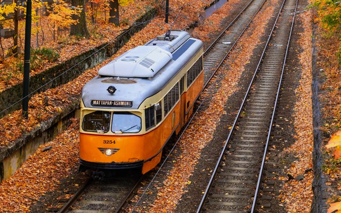
- Ashmont branch: 4 stops to Ashmont; connect to Mattapan Trolley
- Braintree branch: 5 stops to Braintree; park-and-ride and Commuter Rail
All Red Line stations and trains are accessible. Travel times: Harvard to Park Street ~12 min; Park Street to Ashmont or Braintree ~20–25 min.
Silver Line Stations (Bus Rapid Transit)
The Silver Line is bus rapid transit with dedicated lanes or tunnels. Fare: USD $2.40.
- SL1 (Logan Airport–South Station): Tunnel to Courthouse, then direct to airport terminals (inbound rides to Boston are free)
- SL2 (Design Center–South Station): Seaport Industrial Park and cruise terminal
- SL3 (Chelsea–South Station): Chelsea and East Boston; stops at Logan Airport Station
- SL4/SL5 (Nubian–Downtown/South Station): Runs on Washington Street; connects Roxbury, the South End and downtown
All Silver Line vehicles have low-floor boarding and are wheelchair accessible. Tunnel routes (SL1–SL3) use Boston Subway fares; SL4/SL5 use local bus fares. Transfers are free within two hours.
Boston Subway Operating Hours & Timings
The MBTA subway runs roughly from 5:00 AM to 12:30 AM on weekdays and Saturdays, and from 6:00 AM to 12:30 AM on Sundays. It shuts down overnight for maintenance. Check MBTA for exact first/last train times at your station.
Weekdays: First trains depart terminals around 5:00 AM. Red: 5:10 AM from Alewife. Orange: 5:15 AM from Oak Grove. Blue: 5:30 AM from Wonderland. Green: 5:45 AM from branch ends. Last trains leave downtown near 12:30 AM.
Saturdays: Similar start (5:15–5:30 AM) and end (~12:30 AM). Frequency dips late at night.
Sundays & Holidays: Start around 6:00 AM (Blue at 6:25 AM). Last trains near 12:30 AM. Some holidays follow Sunday Boston Subway hours.
Between ~12:50 AM and 5:00 AM, use taxis, rideshares or late-night buses—subway service is closed.
Schedules & Timetables (2026)
Red Line Schedule
Frequency: 4–6 min peak (2–3 min downtown). 8–12 min midday/evening. 10–15 min after 9 PM. Weekends 7–12 min Sat, ~12 min Sun.
First/Last: Weekdays: 5:10 AM Alewife; 5:15 AM Ashmont/Braintree. Last leaves terminals ~12:25–12:30 AM. All trains finish by 1:00 AM.
Travel Times: Alewife→Ashmont ~35 min; Alewife→Braintree ~40 min; Harvard→Park Street ~12 min; Park Street→Quincy Center ~20 min.
Blue Line Schedule
Frequency: 5 min rush; 8–10 min midday; 10–12 min evenings. Saturdays ~9 min; Sundays 7–10 min.
First/Last: Weekdays: 5:30 AM Wonderland; 5:15 AM Bowdoin. Sat 5:37 AM Wonderland; Sun 6:25 AM. Last from Wonderland ~12:45 AM; from Government Center ~12:30 AM (arrives Wonderland ~12:50 AM).
Travel Times: Bowdoin→Wonderland ~20 min; State→Airport ~10 min.
Orange Line Schedule
Frequency: 5 min peak; 7–9 min midday/weekends; 9–11 min evenings.
First/Last: Weekdays/Sat: 5:15 AM from Forest Hills & Oak Grove. Sun: ~6:00 AM. Last trains ~12:30 AM; line closed by 1:00 AM.
Travel Times: Oak Grove→Forest Hills ~30 min; Forest Hills→Downtown Crossing ~15 min; North Station→Back Bay ~10 min.
Green Line Schedule
Frequency: Rush: 7–8 min per branch (1–3 min downtown). Off-peak: 8–12 min per branch. Nights: 10–15 min. Weekends: 9–11 min.
First/Last: B/C/D: ~5:30–5:45 AM weekdays; E: ~5:00 AM. Sat ~5:40 AM; Sun ~6:00 AM. Last trains leave Park Street/Government Center ~12:40–12:50 AM; arrive branch ends by ~1:15 AM.
Travel Times: Government Center→Boston College ~45 min; →Cleveland Circle ~35 min; →Riverside ~45 min; →Heath Street ~30 min; →Union Square ~10 min; →Medford/Tufts ~20 min.
MBTA Subway Fares & Prices
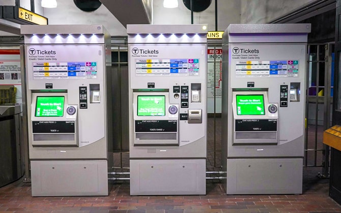
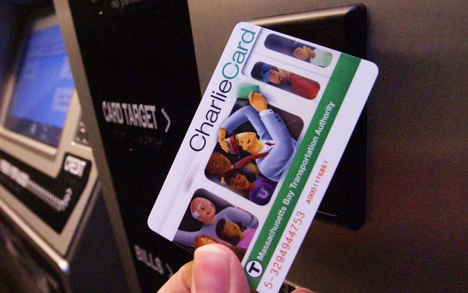
Types of Subway Tickets (Charlie Tickets, Charlie Cards)
The MBTA accepts reusable CharlieCards, paper CharlieTickets, contactless payments and cash. Prices are in USD.
- CharlieCard: Free plastic card. Tap at fare gates. Load pay-per-ride or time passes. One-way fare $2.40 (US$2.40). Free transfers within 2 hours.
- CharlieTicket: Paper ticket. Buy at vending machines. Holds stored value or passes. Expires 90 days after load. Fare $2.40 (US$2.40).
- Contactless: Tap credit card or phone at equipped gates or validators. Fare $2.40 (US$2.40).
- Cash: Pay onboard local buses or surface trolleys. Exact change only. Fare $2.40 (US$2.40).
- You can buy or reload at station machines, customer service booths or select stores.
One-Way Trip Fares
- Subway & Silver Line: $2.40 (US$2.40), includes up to two transfers within 2 hours.
- Local bus: $1.70 (US$1.70); pay $0.70 extra when transferring to subway.
- Express bus: Inner Express $4.25 (US$4.25); Outer Express $5.25 (US$5.25).
- Commuter Rail Zone 1A: $2.40 (US$2.40), same as subway.
- Ferries: Inner harbor $2.40 (US$2.40); outer services cost more.
- Reduced fares: Seniors/disabilities/students ride half-price: subway $1.10 (US$1.10), bus $0.85 (US$0.85). Children 11 and under ride free with an adult.
Unlimited Trip Passes (“LinkPass”)
- 1-Day LinkPass: $11 (US$11). Unlimited rides for 24 hours from first tap.
- 7-Day LinkPass: $22.50 (US$22.50). Unlimited for 7 consecutive days.
- Monthly LinkPass: $90 (US$90). Unlimited for a calendar month.
1-Day pays off after ~5 rides. 7-Day after ~9 rides. Monthly after ~38 rides. Covers subway, buses, Silver Line, Zone 1A and inner-harbor ferries.
Other Passes
The MBTA also offers mode-specific passes (e.g., bus-only monthly for $55 (US$55) and Commuter Rail passes for higher zones). Commuter Rail passes include subway access. Student and senior passes are discounted (monthly $30 (US$30)).
How to use a pass: Tap CharlieCard at the gate or insert CharlieTicket. 1-Day and 7-Day activate on first use. Monthly are valid from the 1st to the last day of the month.
Best Subway Ticket & LinkPass Options for Visitors
Visitors can save by choosing the right fare product based on trip length and ride count. Here are our recommendations:
Best Subway Pass for 1-Day Visits in Boston
The 1-Day LinkPass costs $11 (US$11) and offers unlimited rides for 24 hours from first tap. A single ride costs $2.40 (US$2.40), so five rides would cost $12 (US$12) without a pass.
- Ideal for tourists visiting 5 + sites in one day.
- Covers subway, buses, Silver Line and inner-harbor ferries.
- Includes airport trips (e.g., Silver Line or Blue Line to Logan).
- Buy at station machines on CharlieCard or CharlieTicket.
Best Subway Pass for 2 or More Days in Boston (9+ Trips)
The 7-Day LinkPass costs $22.50 (US$22.50) and covers 7 consecutive days from first use. You break even after 9 rides.
- Great for stays of 3–7 days or 2-day trips with 9 + rides.
- Covers all subway lines, local buses, Silver Line, Zone 1A commuter rail and inner-harbor ferries.
- Two 1-Day passes cost $22 (US$22)—only $0.50 less than the weekly pass.
- Monthly pass ($90 / US$90) may be cheaper for stays over 10 days.
Discount Commuter Rail Weekend & Holiday Passes
For weekend or holiday trips beyond Boston, use the $10 (US$10) Commuter Rail pass.
- Weekend Pass: $10 (US$10) unlimited travel on all commuter rail lines Sat–Sun.
- Visit Salem (Zone 3, ~$8 / US$8 one-way) and Gloucester (Zone 6, ~$11 / US$11 one-way) for one fee.
- Holiday Weekend Pass covers three-day weekends for $10 (US$10).
- Holiday Day Pass covers single midweek holidays for $10 (US$10).
- Buy via mTicket app, station offices or onboard.
MBTA Subway Regulations & Guidelines
Proper Use of Subway Facilities
- Follow entrance and exit signs. Let riders off before you board.
- Stand clear of doors. Move into the car and keep aisles free of bags and strollers.
- Yield priority seats to seniors and people with disabilities. Use elevators only if you need them.
- No open food or drink. Sealed bottles or travel mugs are allowed. No alcohol.
- No smoking or vaping. Fines apply.
- Use headphones for audio. Keep phone calls quiet.
- Stand right on escalators; walk on the left.
- Use trash bins. Do not enter staff-only areas or tracks.
- Non-commercial photos are OK. Avoid flash in tunnels and large equipment.
Pet Transport Policy
Service animals ride free, always on leash, without carriers.
Non-service pets:
- Off-peak hours: Leashed pets are allowed if they don’t block aisles. You may be asked to ride in the last car.
- Peak hours (approx. 7–10 AM, 4–7 PM): Pets must stay in a lap-sized carrier.
Do not place pets on seats or block doors. Staff may ask you to wait for a less crowded train. Carry a copy of the MBTA pet policy if possible.
Subway Safety & Security Guidelines
- Stay back from the edge: Stand behind the yellow or tactile strip until the train stops. Mind the gap when boarding.
- Hold on: If you’re standing, grip a pole or strap to avoid falls when the train moves or stops suddenly.
- Respect the operator: Don’t distract bus drivers or motormen—only use intercoms or call boxes in real emergencies.
- Emergency contacts: Press the onboard intercom button or use platform call boxes. Dial 617-222-1212 or 911 if needed.
- Never enter tracks: The third rail carries 600 V DC. If you drop something, alert MBTA staff—they can retrieve it safely.
- Bike rules: Bikes ride free off-peak—hold them securely and don’t block doors. During rush hours, use a foldable bike or wait for a less crowded train.
- Protect your belongings: Keep bags zipped and phones stowed. After dark, wait in well-lit areas or the front car near the operator.
- Follow instructions: Heed MBTA announcements and staff directions. Random bag checks may occur for security.
How to Use Boston Subway (Step-by-Step Guide)
- Plan your trip: Check an MBTA map or app. Find the nearest station and note your line and direction.
- Buy or load fare: Use station vending machines to get a CharlieCard or Ticket. Add pay-per-ride value or select a pass.
- Enter through fare gates: Tap your card or contactless device, or insert your Ticket. Follow on-screen prompts.
- Choose the right platform: Look for train endpoints (e.g., “Alewife” vs “Braintree”) or use “Inbound”/“Outbound” signs.
- Board safely: Let riders exit first, step in fully, then move inside the car and hold on.
- Transfer within fare control: Follow “Transfer” signs—no extra tap within 2 hours of your first ride.
- Exit the station: Follow Exit signs to street level. Most stations have free-exit turnstiles or push-through gates.
- Ask for help: MBTA staff and fellow riders are usually happy to guide you. Watch for service alerts.
With these tips, you’ll navigate the T smoothly and safely.
Traveling from Logan Airport Using Boston Subway
1. Silver Line (SL1) – Free Inbound from Logan
Board at any Logan terminal lower‐level arrivals. SL1 buses run every 10–15 min, with racks for luggage. Ride to South Station is free inbound and takes ~20–30 min via the tunnel. Stops: Airport Station (Blue Line transfer), Courthouse, World Trade Center, South Station. Transfers to Red Line are free.
2. MBTA Blue Line – Airport Station
Take the free Massport shuttle (routes 22, 33, 55) for ~5–10 min to Airport Station. Buy fare at the station: $2.40 (US$2.40). Inbound trains run every 5–10 min and reach State/Government Center in ~5–6 min. Transfer to Orange or Green Line as needed.
3. Logan Express Back Bay (Bus)
Massport runs a free shuttle from arrivals to Back Bay (Copley/Hynes). Return trip costs $3 (US$3). Buses depart every 20–30 min until 22:00.
4. Taxis & Rideshare
Taxis from Logan to downtown cost ~$25–$35 (US$25–35) + $2.75 (US$2.75) tunnel toll + tip (~15–20 %). Uber/Lyft range $20–$30 (US$20–30). Pickup at “App Ride” zones outside each terminal.
5. Water Shuttle
Take a free shuttle to Logan Harbor Dock, then the MBTA Harbor Ferry to Long Wharf/Seaport. Fare is $3.70 (US$3.70) with a CharlieTicket or pass. Ferries run every 20–30 min; trip is ~10 min. From Long Wharf, walk to Aquarium station or Faneuil Hall.
Tip: SL1 is simplest for South Station/Seaport. Blue Line is faster for connections at Government Center or State. After 00:30, use taxis or rideshare. Outbound SL1 costs $2.40 (US$2.40).
Other Transportation Options in Boston
Taxi Information & Availability
Taxi stands at South Station, North Station, Logan and major hotels. Meter starts at $2.60 (US$2.60) + $0.40 per 1/7 mile + $0.40/min waiting. Logan–downtown runs ~$25–$35 (US$25–35) + $2.75 (US$2.75) toll + tip.
Downtown cabs are plentiful; suburbs and late nights may require an app (e.g., Curb) or street hail (lit rooftop sign). Taxis use tunnels/HOV lanes, offering faster door-to-door service when the T doesn’t go your way.
All drivers display a medallion and license. Most accept cards; tip ~15 %. Request a receipt if you need to track a lost item.
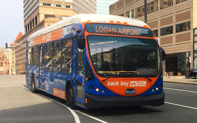
Logan Express Bus to Back Bay
Airport to Back Bay: Free (US$0.00) shuttle at any Logan terminal. Look for the blue “Back Bay” bus. Stops at Hynes Convention Center (800 Boylston St) and Back Bay Station (Dartmouth St). Runs every 30 minutes from about 6 AM to 10 PM. Trip time: 20–30 minutes.
Back Bay to Airport: $3.00 (US$3.00). Departures every 30 minutes from about 5 AM to 9 PM. Tickets online, via mobile or onboard. Includes a “Ticket to Skip” for priority TSA lane.
Handles luggage easily. Avoids subway transfers. Travel time rivals taxis.
Tramway (Trams) in Boston
The MBTA’s tram network consists of:
- Green Line: Light rail with underground and street sections on branches B, C, D and E. Shares lanes with cars on Commonwealth Ave, Beacon St and Huntington Ave.
- Mattapan Trolley: Heritage PCC streetcars from Ashmont to Mattapan. Transfer at Ashmont. Subway fare applies.
No separate public tram lines exist. Tourist “trolley” buses offer private sightseeing only. For a classic tram ride, take the Green Line E to Heath Street or the Mattapan Trolley.
Boston Subway Station Parking Information
Many end-of-line and some intermediate stations offer parking:
- Red Line: Alewife; Braintree; Quincy Adams; Wollaston; Ashmont.
- Orange Line: Oak Grove; Malden Center; Wellington; Forest Hills.
- Blue Line: Wonderland; Beachmont; Orient Heights.
- Green Line: Riverside; Boston College; Cleveland Circle.
- Mattapan Line: Mattapan.
Typical weekday rates: $7.00–$10.00 per day. Example: Alewife $9.00 (US$9.00) weekdays, $3.00 (US$3.00) weekends; Wonderland $7.00 (US$7.00). Pay via PayByPhone app (enter lot code and plate) or station kiosks. No ticket display required. Most lots allow up to 7 days parking.
Accessible spaces are available; disability plates often park free. Lots fill early on weekdays. Some areas have free street parking on weekends—check signs. Verify current rates and capacity on the MBTA website.
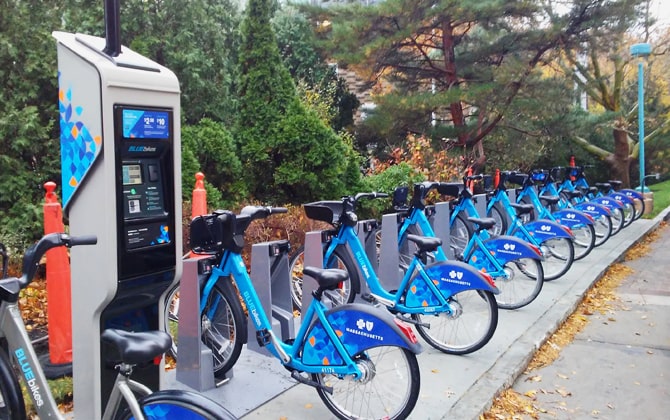
Bicycling Options – BLUEbikes Program
Boston loves bikes. The Bluebikes bike-share program makes quick trips easy and fun. Bluebikes operates in Boston, Cambridge, Somerville, Brookline, and Everett.
How Bluebikes Works
The system has over 480 docking stations and 4,500+ bikes across metro Boston. Grab a bike from any station, ride it, then return it to any station in the network. The bikes are sturdy three-speed city bikes. Some stations have electric-assist e-bikes for an extra fee.
Finding Bikes
Stations sit every few blocks in the city center. Check the Bluebikes app or website map to find them. Popular spots include South Station, Copley Square, Harvard Square, and along the Esplanade. Each station has a kiosk and bike docks.
Access & Pricing
Buy passes at kiosks or through the mobile app:
- Single Ride: $2.95 (~$2.95) for trips up to 30 minutes. Perfect for quick point-to-point trips.
- 24-Hour Pass: $10 (~$10) for unlimited rides within 24 hours. Each ride can last up to 2 hours. Great for tourists exploring the city.
- Monthly Membership: $30.50 (~$30.50) per month for unlimited 45-minute rides. Good for extended visits.
- Annual Membership: $133.50 (~$133.50) per year (about $11/month). Best for locals. Includes perks like free e-bike unlocks.
Go over the time limit and you’ll pay extra fees. The system encourages docking and taking a fresh bike for longer journeys.
Using Bluebikes
Find a station using the app. Buy your pass in the app or at the kiosk (credit cards accepted). Get an unlock code or scan the QR code on the bike. Enter the 5-digit code or scan to unlock. Pull the bike out firmly, adjust the seat, and ride!
Helmets aren’t provided but are strongly recommended. When finished, find a station near your destination. The app shows available docks. Push the bike firmly into an empty dock until you hear a click and see a green light. Make sure it’s secure before leaving.
If the station is full, the kiosk can give you extra time to find another station.
Where to Ride
Boston has many bike lanes and paths. The Charles River offers a beautiful multi-mile bike path. Protected bike lanes run on Mass Ave, Commonwealth Ave, and other major streets.
Use Bluebikes to commute or sightsee – ride from Beacon Hill to the Seaport or MIT to the Museum of Fine Arts. Follow traffic laws: ride with traffic, stop at red lights, and stay alert. Boston drivers expect bikes, especially downtown and in Cambridge.
Bikes on the T
Personal bikes are allowed on the subway outside rush hours. Don’t take Bluebikes on the T – just dock and grab another bike at your destination.
Bluebikes complements the MBTA perfectly. Sometimes it’s faster than the subway. Going from Copley Square to the North End takes two T transfers but only 15 minutes by bike. When MBTA service breaks down, Bluebikes sometimes offers free ride codes.
Cambridge, Somerville, and Brookline are very bike-friendly and covered by Bluebikes. A day pass lets you bike from Harvard to Fenway and beyond. Bluebikes offers a flexible, healthy, eco-friendly way to explore Boston when weather cooperates.
Future Boston Subway Expansion Plans
Boston has several transit projects in planning stages. The MBTA focuses on maintenance and reliability, but expansion plans are moving forward.
Green Line Extension Completed (2022) & Possible Extension to Route 16
The Green Line Extension opened in 2022. It extended service beyond Lechmere into Somerville and Medford, adding Union Square branch and Medford/Tufts branch with 6 new stations.
A proposed extension would reach Mystic Valley Parkway/Route 16 in Medford – about 0.6 miles (1 km) beyond Medford/Tufts. This was part of the original plan but deferred due to cost. It’s not funded as of 2026, but local officials support it.
Somerville’s Union Square branch could extend west to Porter Square someday, connecting with the Red Line. That’s still conceptual.
Red-Blue Connector
This long-planned project would link the Blue and Red Lines at Charles/MGH. It would extend Blue Line tracks about 0.4 miles (0.6 km) west from Bowdoin under Cambridge Street.
Currently, Red and Blue are the only lines that don’t connect. Riders must walk or use Green/Orange to transfer. Design is funded through 30% completion, but construction funding doesn’t exist yet.
The project might begin by late this decade if funding comes through. Optimistic opening would be early 2030s. It would create a new Blue Line station at Charles/MGH and close Bowdoin station.
Commuter Rail Upgrades
South Coast Rail Phase 1 opened in late 2023. It extended service to Fall River and New Bedford – about 50 miles (80 km) south of Boston. These cities hadn’t seen rail service in decades.
Phase 2 will route these lines directly via Stoughton for faster trips. The MBTA is also testing battery-electric trains in 2026 and plans to electrify lines like Providence/Stoughton and Fairmount.
Orange Line and Other Extensions
Ideas exist to extend Orange Line north to Reading or south to Roslindale/West Roxbury. These aren’t active projects due to cost and maintenance priorities.
Blue Line extension to Lynn has been discussed for decades. A draft environmental plan exists. But it remains unfunded and on the back burner despite North Shore advocacy.
Silver Line Expansion
Proposals include Silver Line expansion to Everett and Somerville. MassDOT is studying “Bus Rapid Transit Silver Line Gateway” through Everett to connect to Charlestown and the Orange Line.
Another idea extends Silver Line from Dudley/Nubian toward Mattapan via Dorchester. These remain in early planning stages.
Upgraded Fleets and Signal Systems
New Red and Orange Line trains are entering service, increasing capacity and reducing breakdowns. Signal system upgrades will allow more frequent, reliable service once completed.
The Green Line is getting new Type 10 supercars and power system upgrades. These improvements will help the system carry more people.
Accessibility Improvements
The T aims for every station to be accessible by 2030. Projects are adding elevators to stations like Symphony and State Street. Platform extensions at Downtown Crossing and State will improve transfers.
Long-Term Visions
Visionary plans include a North-South Rail Link connecting North and South Stations by tunnel. The Urban Ring would create circumferential transit around the city. These remain academic discussions.
Future Green Line extensions beyond current branches are possible but have no concrete plans.
The next likely expansion is the Red-Blue Connector, given broad support and relatively short tunnel needed. The MBTA’s Capital Investment Plan lists funded projects for the next 5-10 years.
Boston’s subway grew in spurts over the 20th century. While expansion has slowed, the city recognizes growth needs for demand and climate goals. By the 2030s, you might ride from Blue to Red without transfers.
Notable Places of Interest Accessible via Boston Subway
Boston’s T serves most key attractions and neighborhoods. Here’s how to reach notable places by subway:
Boston Common & Public Garden
Take Green or Red Line to Park Street (Boston Common) or Green Line to Arlington (Public Garden). Park Street opens directly onto the Common and starts the Freedom Trail.
Freedom Trail Sites
The 2.5-mile (4 km) Freedom Trail connects via multiple stops:
- Park Street – Massachusetts State House and trail start
- State or Downtown Crossing – Old South Meeting House
- Government Center – Faneuil Hall/Quincy Market (short walk)
- Haymarket or North Station – North End’s Paul Revere House and Old North Church
- Community College – Bunker Hill Monument (15-min walk or bus 93)
- Aquarium – Historic ships at Boston Harbor
Faneuil Hall & Quincy Market
State Station (Blue/Orange) is closest – about 5 minutes walking. Government Center and Haymarket are also nearby. This historic marketplace offers dining and shopping.
North End (Little Italy)
Haymarket (Green/Orange) sits right by North End’s entrance on Hanover Street. North Station is 5-10 minutes to Old North Church area. Enjoy cannoli and pasta in this historic neighborhood.
New England Aquarium & Waterfront
Aquarium Station (Blue Line) sits directly next to the Aquarium. Also walkable from State or Government Center. Access the HarborWalk with water views from here.
TD Garden (Sports Arena)
North Station (Green/Orange or Commuter Rail) connects directly to TD Garden. Home to Boston Celtics and Bruins, plus concerts. On game days, trains fill with fans.
Museum of Fine Arts (MFA)
Museum of Fine Arts stop (Green Line E) puts you at MFA’s rear entrance. Ruggles (Orange Line) is 5-7 minutes to the main entrance. Isabella Stewart Gardner Museum is nearby.
Fenway Park
Take Green Line to Kenmore (B, C, or D branch). Walk 5 minutes down Brookline Ave to the ballpark. Fenway station (D branch) is an 8-minute walk and sometimes less crowded. Follow the Red Sox jerseys on game days!
Harvard University & Harvard Square
Harvard station (Red Line) drops you in Harvard Square, steps from Harvard Yard. Street performers, bookstores, and campus tours surround you. Harvard’s museums are 10-15 minutes walking.
MIT
Kendall/MIT (Red Line) sits in Kendall Square, 5 minutes from MIT’s campus center. You can also walk from Central Station. The Charles River side of MIT is near Kendall.
Boston University
BU stretches along Commonwealth Ave, served by Green Line B branch. Boston University East, Central, and West stops serve different campus areas. Kenmore reaches BU’s east end near the bookstore.
Boston College
Boston College station terminates Green Line B branch at BC’s lower campus. It’s a long but convenient ride from downtown (~45 minutes).
Northeastern University
Green Line E at Northeastern or Museum of Fine Arts stops serve campus. Orange Line Mass Ave or Ruggles are also close to campus areas.
Longwood Medical Area
Green Line E has Longwood Medical Area and Brigham Circle stops serving Harvard Medical School, Brigham & Women’s, and Children’s Hospital. Orange Line Ruggles or Green Line Fenway with bus connections also work.
Seaport District
Silver Line SL1 or SL2 serves this booming area with Convention Center and Institute of Contemporary Art. Courthouse and World Trade Center stations drop you in Seaport’s heart. From South Station, it’s a 10-15 minute walk.
Charlestown & USS Constitution
Community College (Orange Line) is 10 minutes walking to Charlestown Navy Yard and USS Constitution. The F4 Charlestown Ferry from Long Wharf costs $2.40 (~$2.40) and is fun. Bunker Hill Monument is 15 minutes from Community College.
Museum of Science
Science Park (Green Line E) opens at the museum entrance. Also walkable from North Station (10 minutes over Gilmore Bridge).
Cambridge Squares
Central (Red Line) reaches Central Square, known for nightlife and restaurants. Inman Square is a short walk or bus ride away.
Assembly Row
Assembly station (Orange Line) opens into Assembly Row shopping district with outlets, restaurants, and nearby IKEA.
Encore Boston Harbor Casino
Take Orange Line to Wellington, then free casino shuttle. Or Assembly with short ride-share. Summer boats run from Seaport.
Beaches
Revere Beach (Blue Line) – get off at Revere Beach or Wonderland for historic beach with broad promenade. Carson Beach is near Andrew (Red Line) plus 15-minute walk. Commuter rail reaches coastal towns like Manchester-by-the-Sea and Gloucester for day trips.
Virtually every Boston attraction connects to the T, usually with a short walk. Use MBTA’s trip planner or Google Maps to find the nearest station. Boston’s walkability means even stations not at your destination’s door offer pleasant walks through interesting neighborhoods.
Don’t forget Back Bay (Newbury Street shopping via Green Line Arlington/Copley or Orange Line Back Bay), Chinatown (Orange Line Chinatown or Green Line Boylston), and South End (Back Bay or Orange Line Mass Ave plus walking). With a CharlieCard and this knowledge, you can explore all of Boston easily!